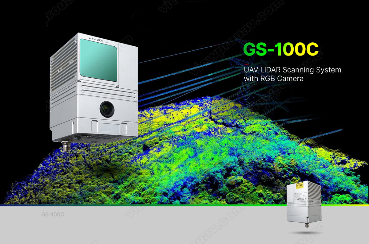
ViewPro GS-100C UAV Laser Lidar Scanning System with 24MP Camera for Drone 3D Mapping and Surveying
ViewPro GS-100C UAV Laser Lidar Scanning System with 24MP Camera for Drone 3D Mapping and Surveying
ViewPro
Couldn't load pickup availability
ViewPro GS-100C UAV Laser Lidar Scanning System Overview
The ViewPro GS-100C UAV Laser Lidar Scanning System is a powerful solution for high-precision 3D mapping and surveying applications. Featuring a 905nm Class 1 laser scanner with an impressive measuring range of 190m at 10% reflectivity and an integrated 24MP camera, the GS-100C delivers exceptional performance for aerial mapping and data collection. Its compact design, combined with precise GNSS and POS technologies, ensures superior accuracy, even in challenging conditions. This system is compatible with multicopter platforms and supports flight speeds of up to 10 m/s, making it an ideal choice for efficient large-scale surveying projects.
ViewPro GS-100C Key Features
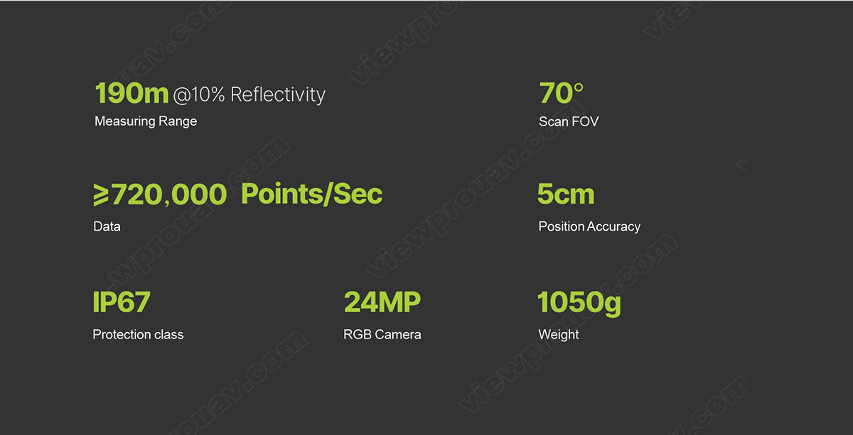
- High-Performance Laser Scanner: 190m measuring range with triple echo technology and up to 720,000 points per second for detailed terrain mapping.
- Integrated 24MP Camera: Equipped with a 70° FOV and 15mm focus length for capturing high-resolution images.
- Superior Accuracy: POS data accuracy includes pitch/roll at 0.015°, heading at 0.040°, and position precision of ≤0.05m.
- Wide GNSS Compatibility: Supports GPS, GLONASS, BDS, and GALILEO for reliable global positioning.
- Compact and Lightweight: Weighs just 1,050g with a portable design (15.5 x 9.2 x 9.3 cm).
- Efficient Data Storage: Includes 64GB internal storage with support for up to 128GB via TF card.
ViewPro GS-100C Specifications
| Component | Parameter |
|---|---|
| Laser Scanner | |
| Measuring Range | 190m @ 10% reflectivity |
| Laser Class | 905nm Class 1 (IEC 60825-1:2014) |
| Laser Line Number | Equivalent to 64-beam |
| FOV | 70° circular view |
| Range Accuracy | 2 cm (1σ @ 20m) |
| Data Output | Triple echo, 720,000 points/sec |
| Camera | |
| Resolution | 24MP |
| FOV | 70° |
| Focus Length | 15mm |
| POS (Position and Orientation System) | |
| Update Frequency | 200Hz |
| Pitch/Roll Accuracy | 0.015° |
| Heading Accuracy | 0.040° |
| Position Accuracy | ≤0.05m |
| GNSS Signal Type | GPS L1/L2/L5, GLONASS L1/L2, BDS B1/B2/B3, GALILEO E1/E5a/E5b |
| System Parameters | |
| Overall Accuracy | ≤10cm @ 110m |
| Weight | 1,050g |
| Working Temperature | -20°C to +55°C |
| Dimensions | 15.5 x 9.2 x 9.3 cm |
| Storage | Internal 64GB, Max support 128GB TF card |
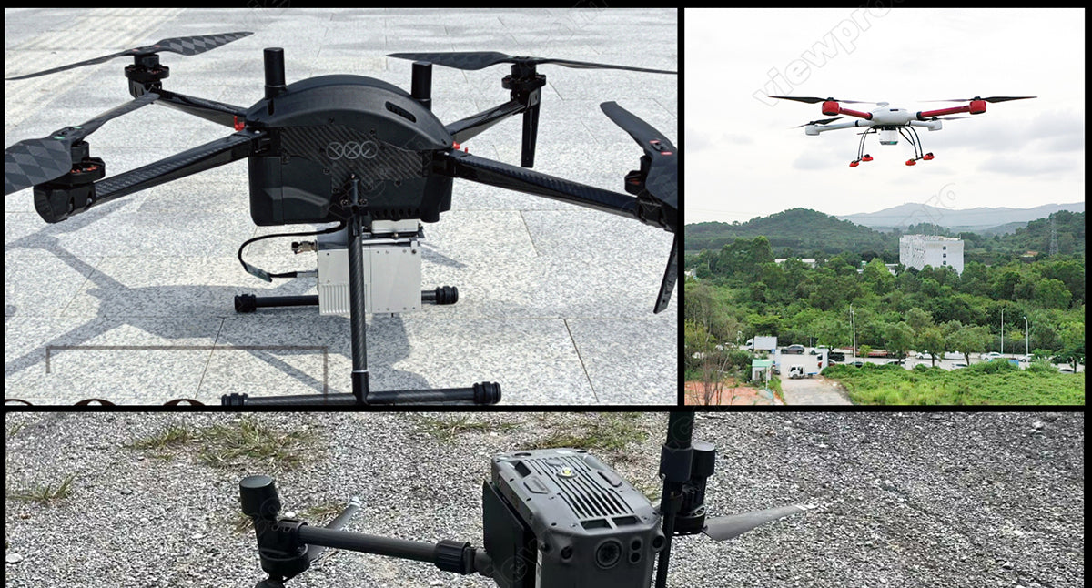
| Carrying Platform | Multicopter (10m/s flight speed) |
Operation Efficiency
| Flight Altitude (m) | Accuracy | Single Flight Coverage (km²) |
|---|---|---|
| 50 | ≤5cm | 0.88 |
| 70 | ≤7cm | 1.28 |
| 110 | ≤10cm | 1.92 |
ViewPro GS-100C Applications
The GS-100C is a versatile solution designed for:
- Aerial Mapping & Surveying: Create detailed 3D models of large-scale landscapes with high precision.
- Infrastructure Inspection: Accurately map roads, bridges, and buildings for maintenance and planning.
- Forestry & Agriculture: Monitor vegetation growth and calculate biomass for environmental management.
- Geological Exploration: Analyze terrain for mining, quarrying, and natural resource assessment.
- Urban Planning: Produce detailed city models for urban development and planning projects.
Package Contents
- GS-100C Lidar Scanner System x 1
- 24MP High-Resolution Camera x 1
- Integrated POS Module x 1
- 64GB Internal Storage (Upgradeable to 128GB) x 1
- Protective Case x 1
The ViewPro GS-100C combines cutting-edge laser scanning and high-resolution imaging to deliver a robust and reliable UAV mapping system. Whether for professional surveying, urban planning, or environmental monitoring, this system ensures unmatched precision and efficiency for your aerial operations.
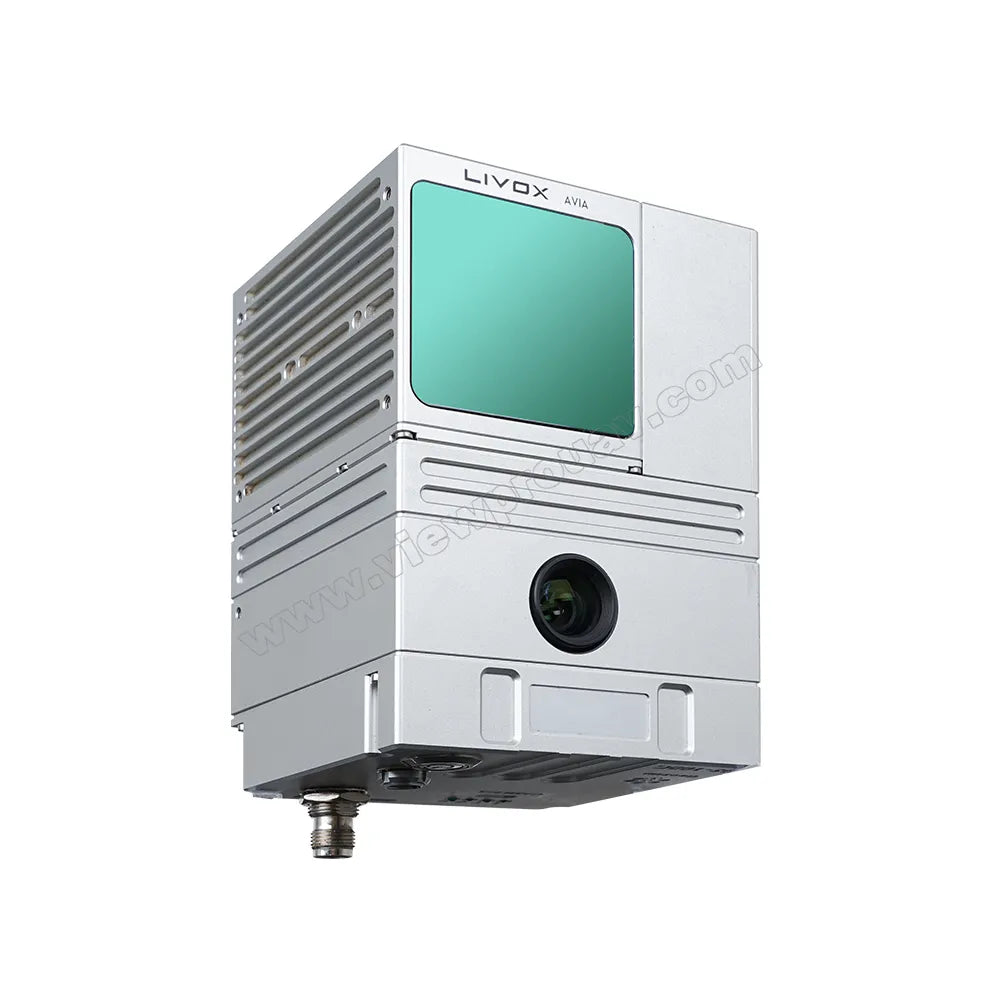
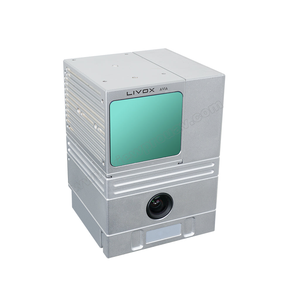
ViewPro GS-100C UAV Scanner product image features a high-resolution RGB camera and advanced LiDAR scanning technology for precise 3D mapping and data collection.
190m @1% Reflectivity, 700mm Measuring Range, Scan FOV: 27°, 2.72 million Points per Second, Scanning Data Position Accuracy: IP67, 24MP RGB Camera, Weight: 1050g, Protection Class: Unknown, Natural MP PCouleur July Queen
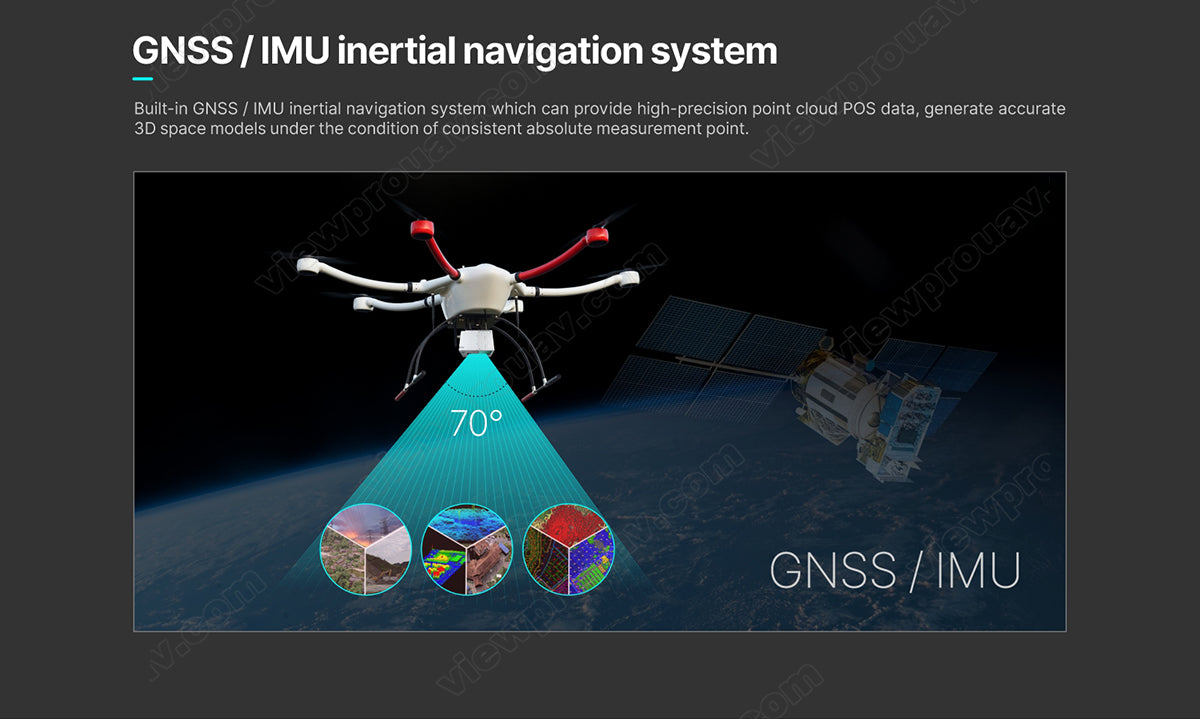
The ViewPro GS-100C UAV Scanner features a built-in Global Navigation Satellite System (GNSS) and Inertial Measurement Unit (IMU) for inertial navigation. This system provides high-precision point cloud data, generating accurate 3D space models with consistent absolute measurement points.
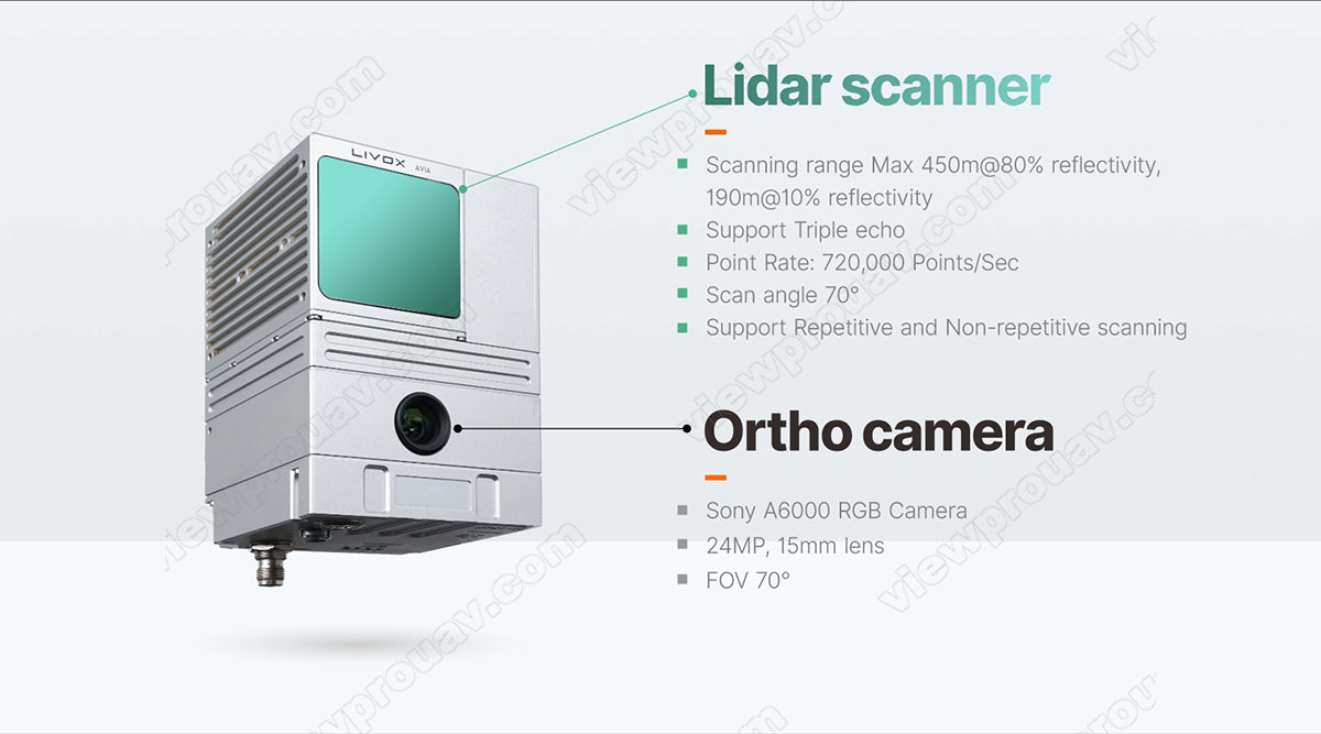
Lidar scanner scanning range maximum 450 meters at 80% reflectivity and 190 meters at 10% reflectivity. Supports triple echo point rate of 720,000 points per second. Scan angle supports up to 70 degrees. Camera module features a Sony A6000 RGB camera with 24 megapixels and 1.5 millimeter lens providing a field of view of 70 degrees. Compatible with CCU pfeu LiveX Ghns ZVC. Supports both repetitive and non-repetitive scanning modes.
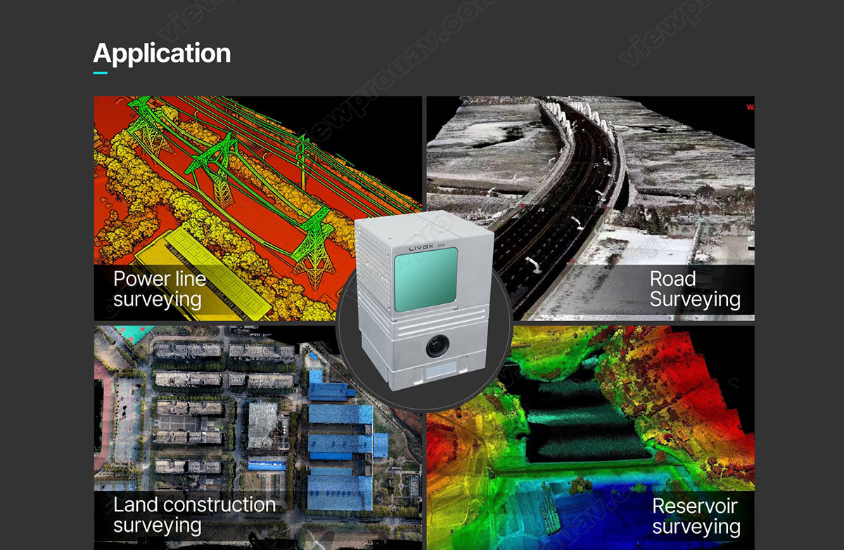
ViewPro GS-100C UAV Scanner for application in power line, road, surveying, land construction, reservoir surveying and other remote sensing applications.
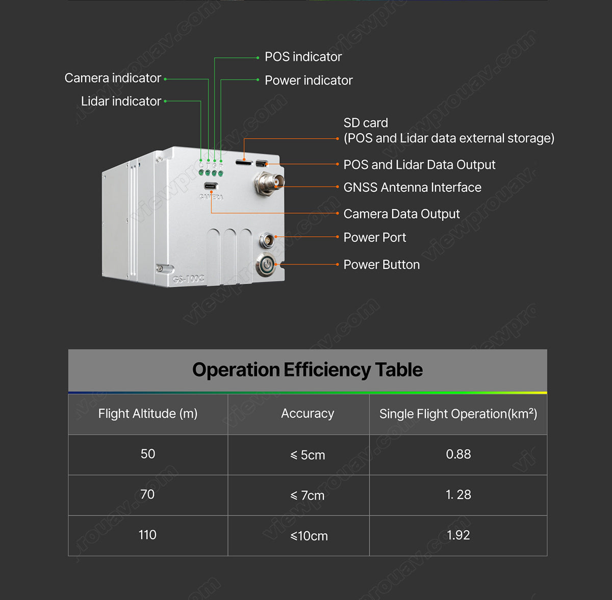
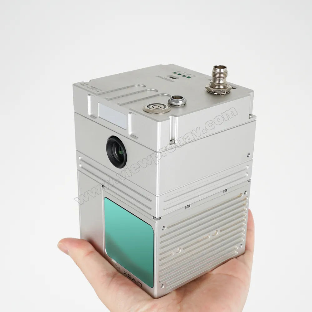
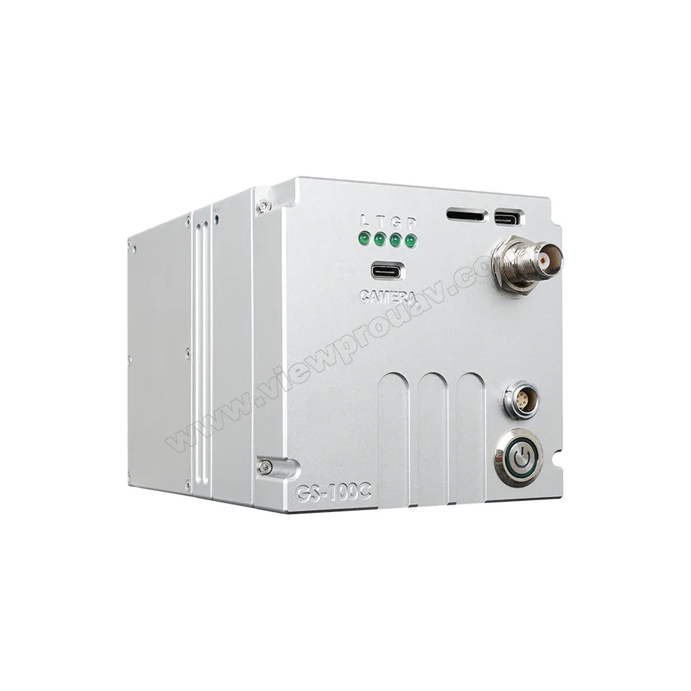
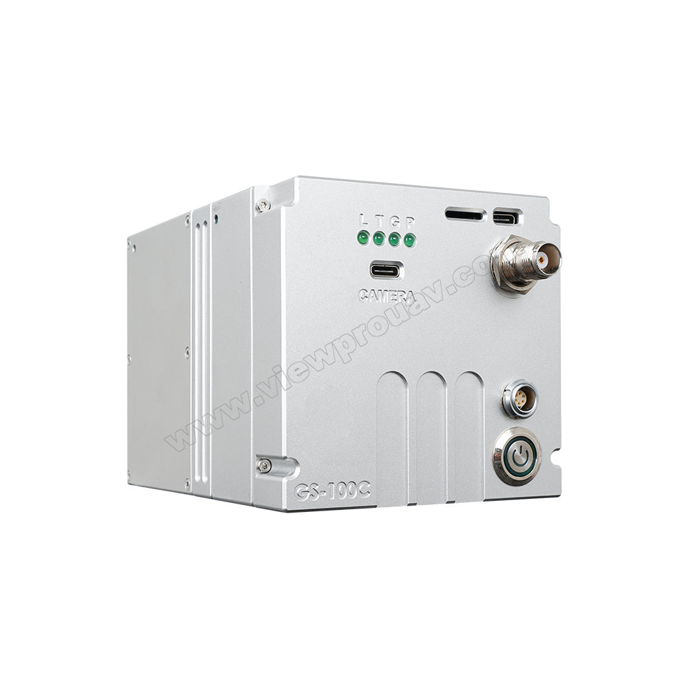
POS Indicator: Camera Indicator Power Indicator Lidar Indicator SD Card (External Storage for POS and Lidar Data); Output of GNSS, Lidar, and Camera Data; Power Port with Power Button. Efficiency Table: Flight Altitude (m), Accuracy, Single-Flight Operation (km) - 50 m, 0.88 accuracy, 70 < Zcm, 1.28 accuracy, 110 < 10 cm, 1.92 accuracy.
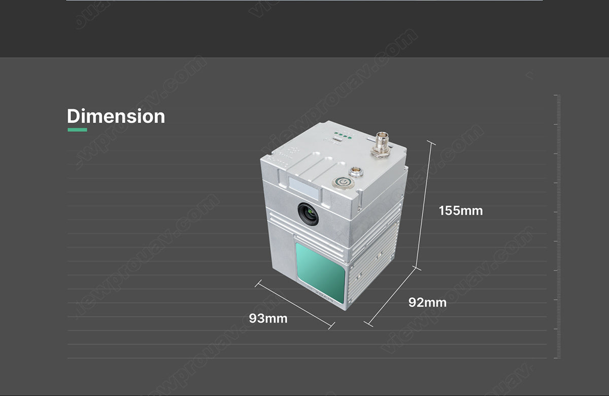
Uploading to NA, this UAV scanner dimensions are precisely measured at 155mm x 92mm x 93mm for accurate and efficient data processing.


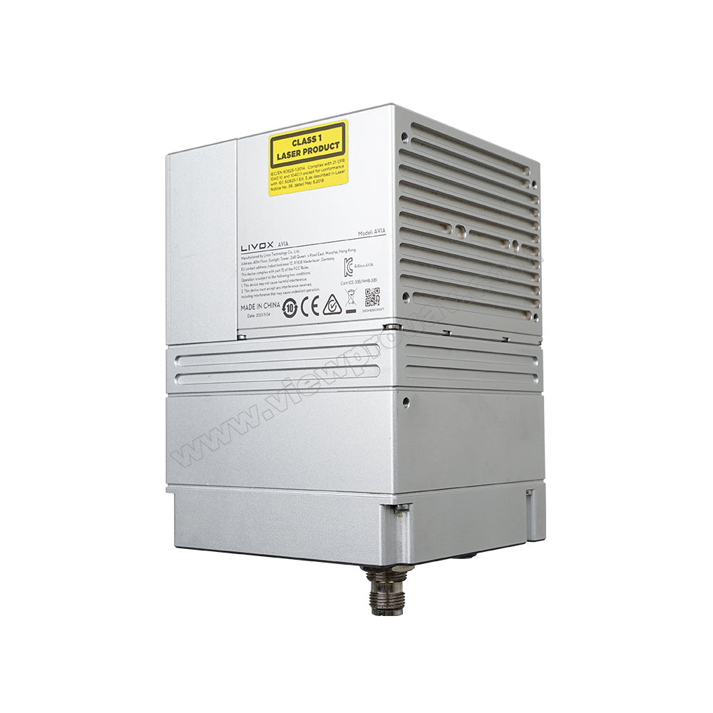
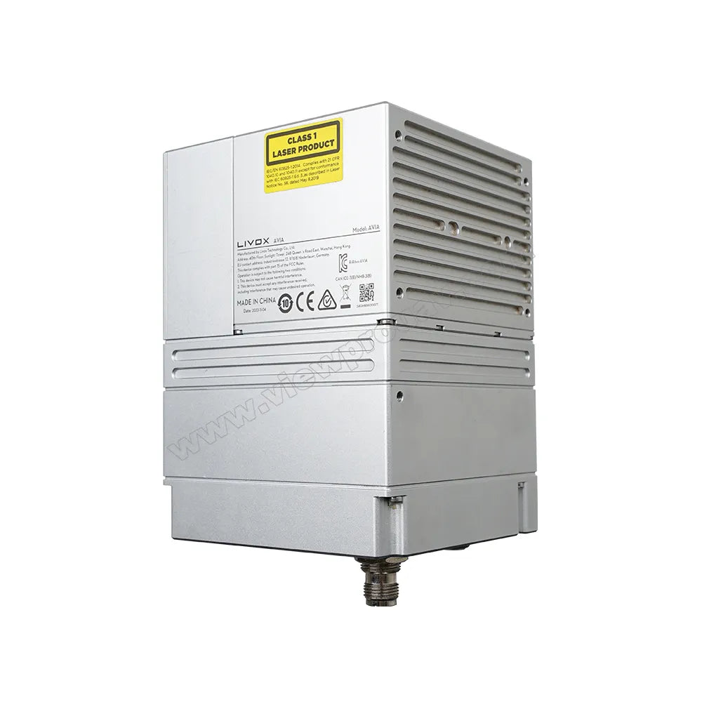
Made in China, the ViewPro GS-100C is a high-quality laser scanner featuring six class 1 lasers. It includes a product scanner, laser line width, control deck, and world-wide warranty, making it an ideal tool for precision measurement and inspection.


Related Collections