VK VDT-2 Agricultural Mapping Module – Dual-Frequency Multi-System High-Precision Farmland Mapper
VK VDT-2 Agricultural Mapping Module – Dual-Frequency Multi-System High-Precision Farmland Mapper
VK
Couldn't load pickup availability
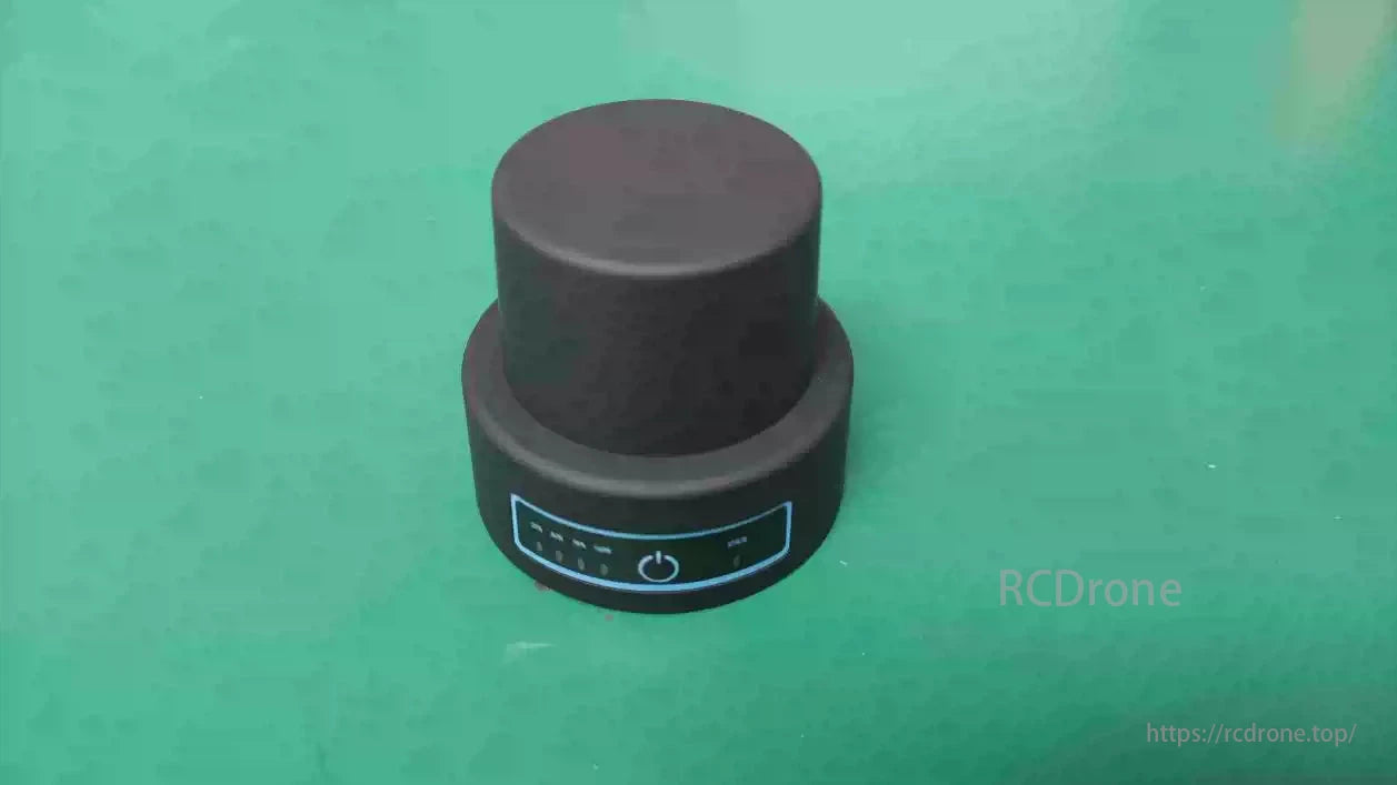
The VK VDT-2 is a lightweight, high-precision handheld mapper designed for farmland surveying and agricultural drone applications. With dual-frequency satellite reception, multi-GNSS compatibility, and Bluetooth wireless transmission, it offers centimeter-level accuracy for efficient boundary data collection and seamless integration with agricultural UAV systems. Its IP67 protection, compact size, and long battery life make it ideal for fieldwork in diverse environmental conditions.
Key Features
-
Supports BeiDou, GPS, GLONASS, Galileo, QZSS
-
Compact size and only 65g weight for handheld use
-
Bluetooth 4.0 wireless connectivity
-
Compatible with VK agricultural drone platforms
-
IP67 waterproof and dustproof
-
Long battery life up to 6 hours
-
Simple data upload and real-time field display via VK’s mapping software
Technical Parameters
| Parameter | Specification |
|---|---|
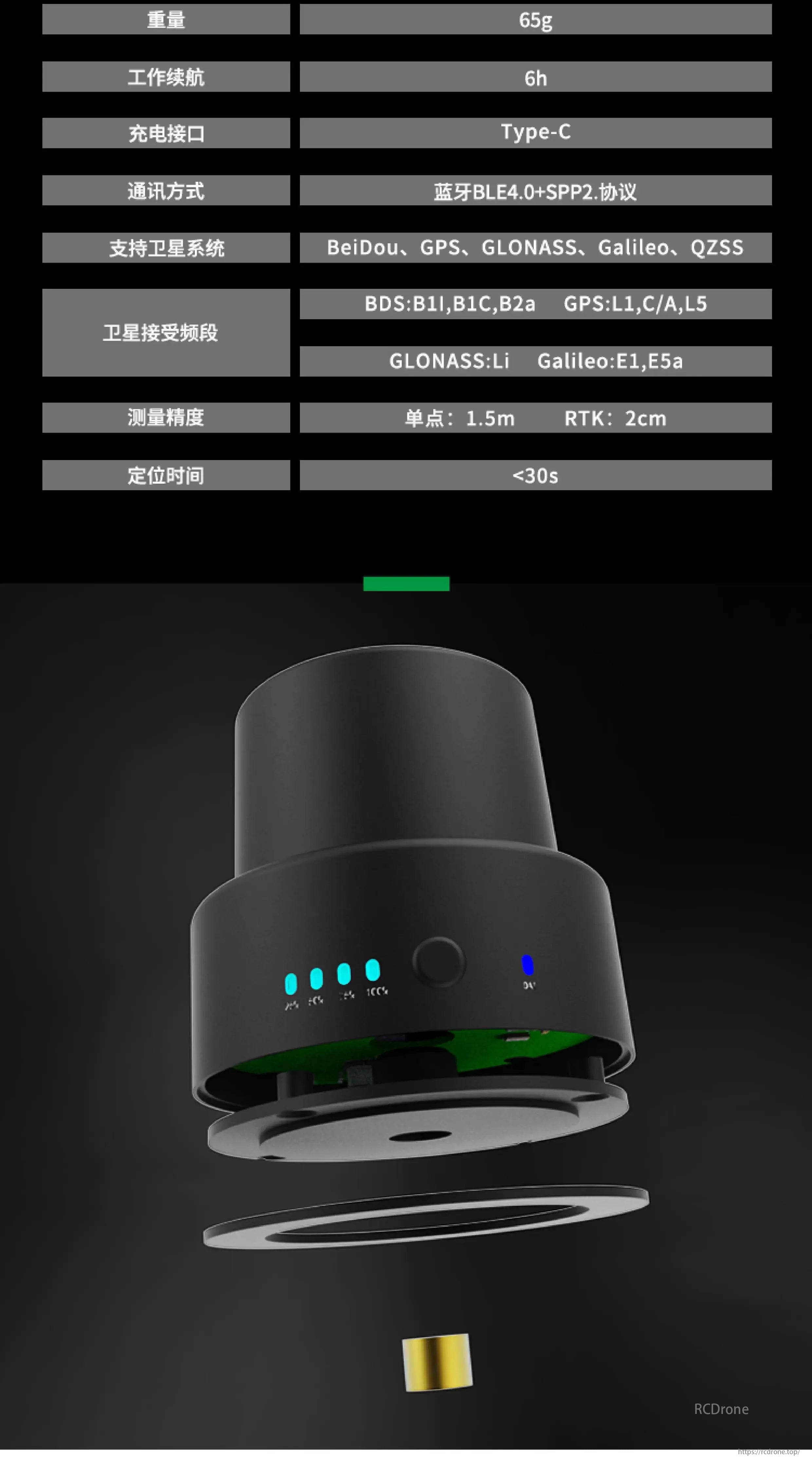
| Weight | 65g |
| Battery Life | 6h |
| Charging Interface | Type-C |
| Communication | Bluetooth BLE4.0 + SPP2.0 Protocol |
| GNSS Support | BeiDou, GPS, GLONASS, Galileo, QZSS |
| Signal Bands | BDS: B1I, B1C, B2a GPS: L1, C/A, L5 GLONASS: L1 Galileo: E1, E5a |
| Measurement Accuracy | Standalone: 1.5m RTK: 2cm |
| Positioning Time | <30s |
Application Workflow
-
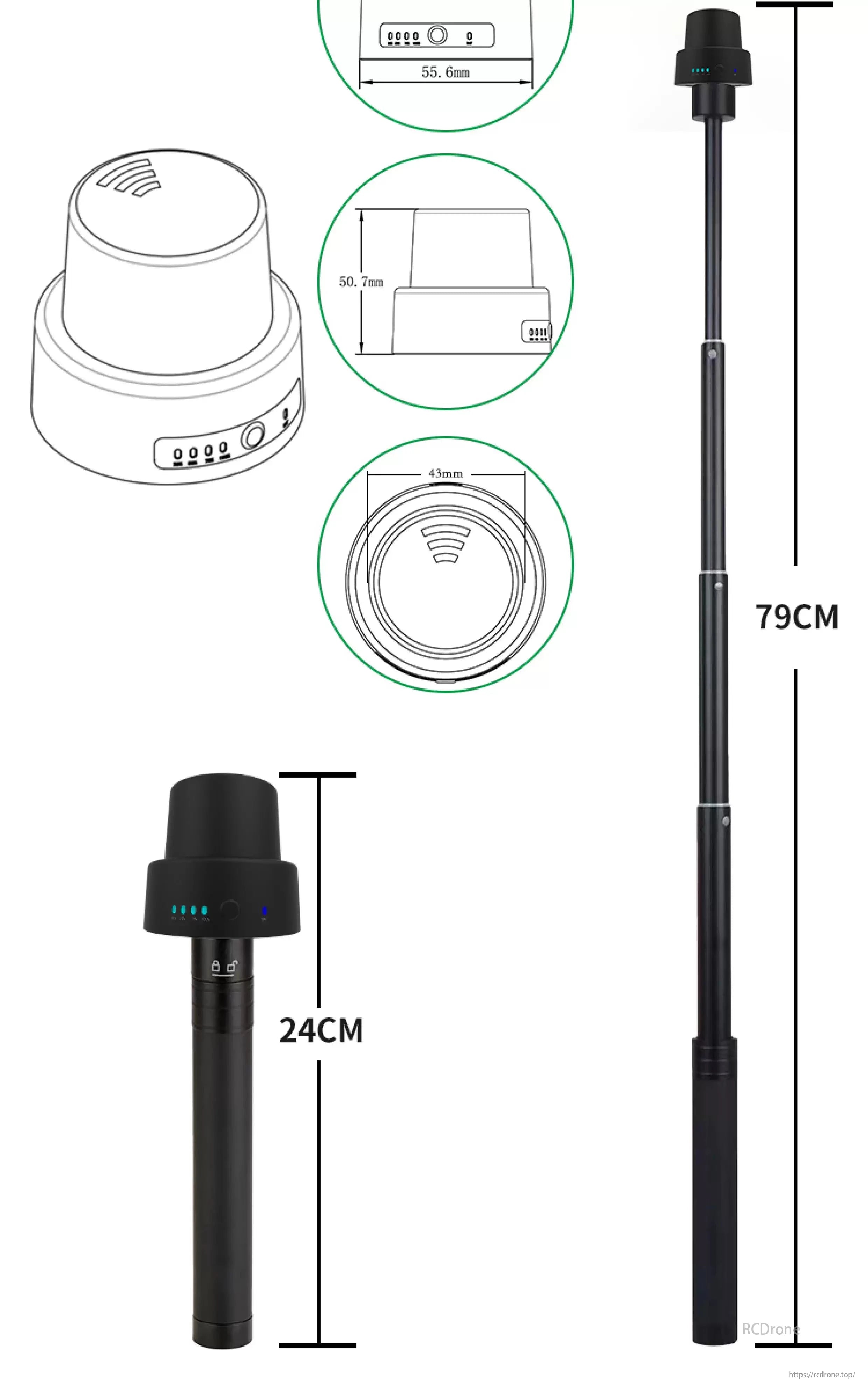
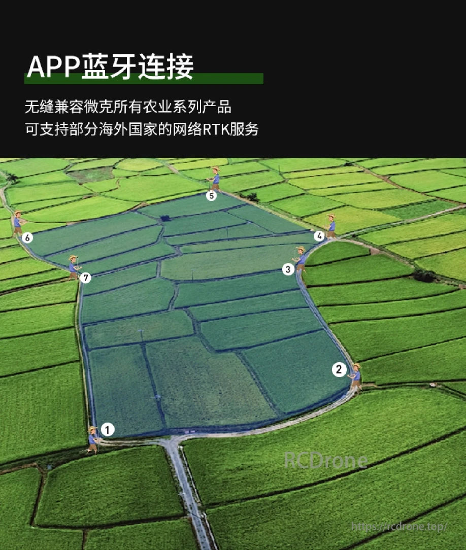
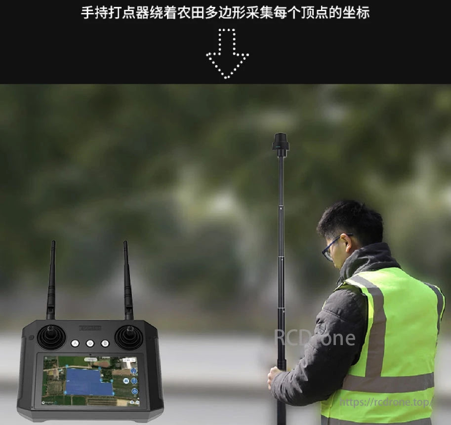
Field Surveying: Carry the VDT-2 with the telescopic rod and walk along field boundaries.
-
Real-Time Mapping: Automatically record GPS coordinates of each corner using the paired VK controller or mobile device.
-
Data Sync: Seamlessly upload mapped boundaries to the cloud or mission planning software.
-
Integration: Compatible with RTK-enabled drones for automated spraying, seeding, or data collection.
The VK VDT-2 RTK mapper is purpose-built for professionals in agriculture, enabling smart, efficient, and scalable farmland surveying.
Details
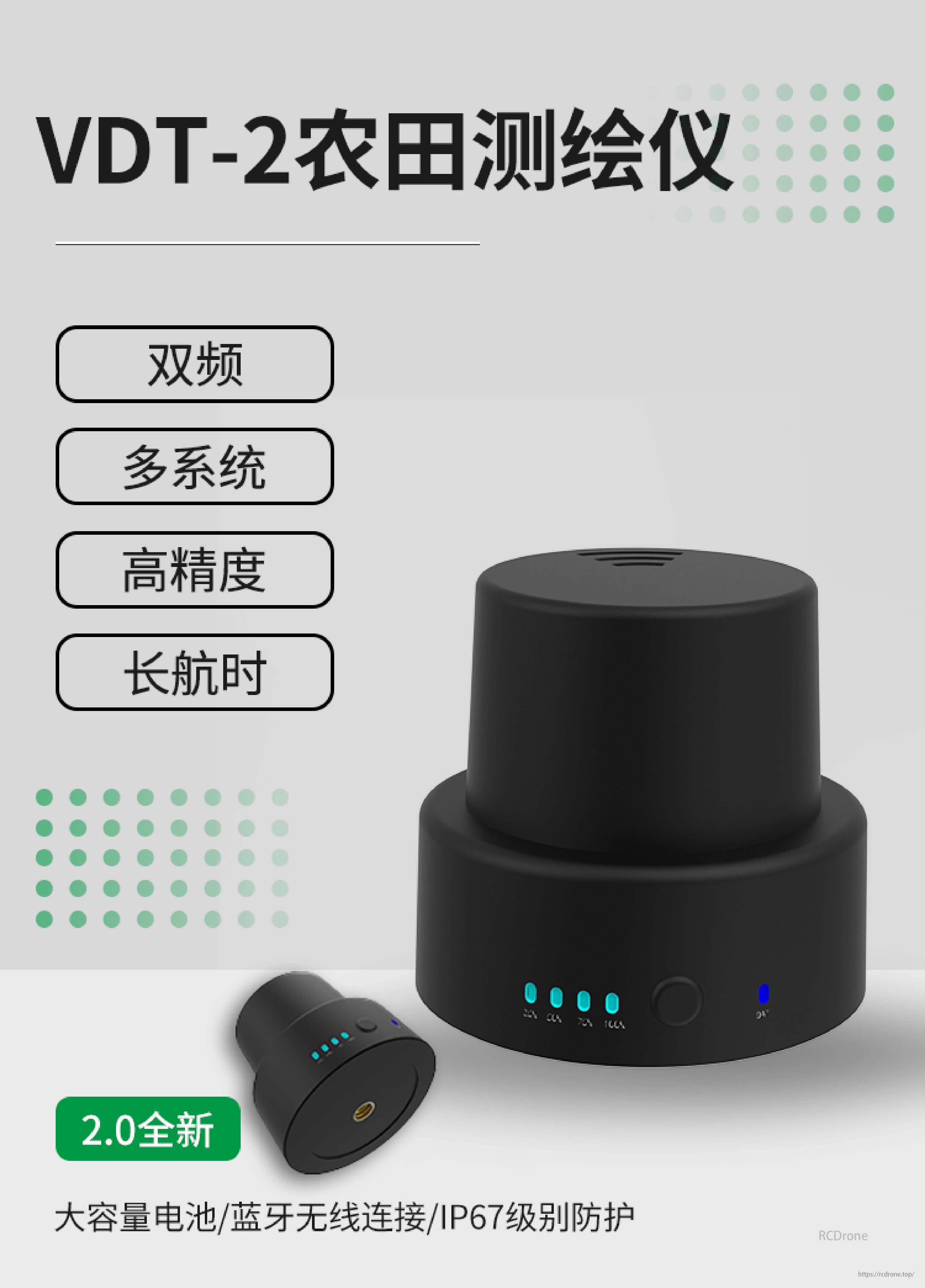
VDT-2 Farmland Mapper: Dual-frequency, multi-system, high-precision, long-endurance. 2.0 version with large battery, Bluetooth, IP67 protection.
VK VDT-2 Farmland Mapper: 65g, 6h battery, Type-C charging, BLE4.0+SPP2, supports BeiDou, GPS, GLONASS, Galileo, QZSS. Precision: 1.5m single, 2cm RTK. Positioning time under 30 seconds.
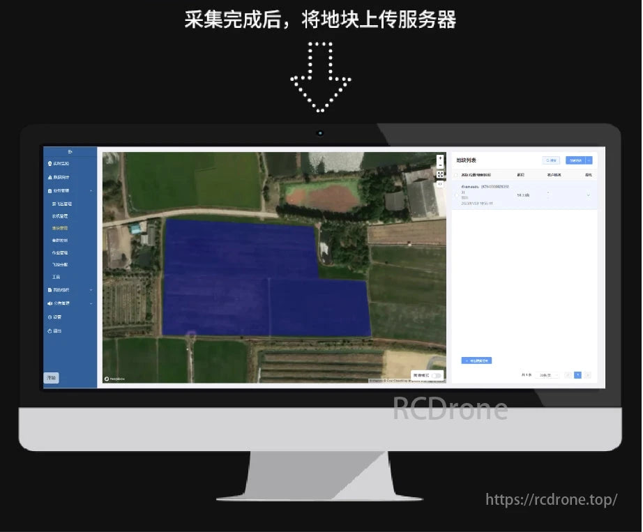
Farmland Mapper interface displays field data, options for analysis, and settings. Data upload process indicated.
Related Collections