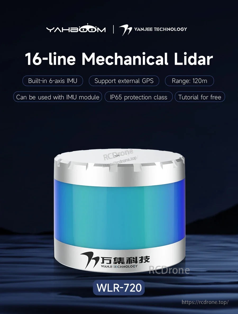
Yahboom VANJEE WLR-720 16-Line Mechanical LiDAR Sensor 120m TOF Range, Ethernet, 6-Axis IMU, ROS SDK
Yahboom VANJEE WLR-720 16-Line Mechanical LiDAR Sensor 120m TOF Range, Ethernet, 6-Axis IMU, ROS SDK
Yahboom
Couldn't load pickup availability
Overview
WLR-720 is a 16-line Mechanical LiDAR (Yahboom / VANJEE / WANJEE Technology) based on the TOF (Time of Flight) ranging principle, designed for 360° panoramic scanning and environmental 3D perception. It supports up to 120 m scanning radius, provides high-quality raw point cloud data within a 30° vertical field of view, and integrates a built-in 6-axis IMU for outputting angular velocity and acceleration data via PC software/host computer. Typical applications include navigation and positioning for low-speed vehicles and robots, outdoor high-precision map drawing, and obstacle detection.
Key Features
- 16-line mechanical scanning; vertical FOV: 30° (vertical angle: -16° to +14°); 360° horizontal scanning FOV.
- Ranging range up to 120 m (TOF ranging); supports single echo / double echo.
- Adjustable scanning frequency: 5 Hz / 10 Hz / 20 Hz.
- Built-in 6-axis IMU (chip model: ASM330LHH, automotive grade); supports external IMU inertial navigation and external GPS module.
- Ethernet communication; transmission method: UDP/IP.
- Laser wavelength: 905 nm; Class 1 (eye safety).
- Provides Windows PC software and ROS-SDK; compatible with ROS (Robot Operating System).
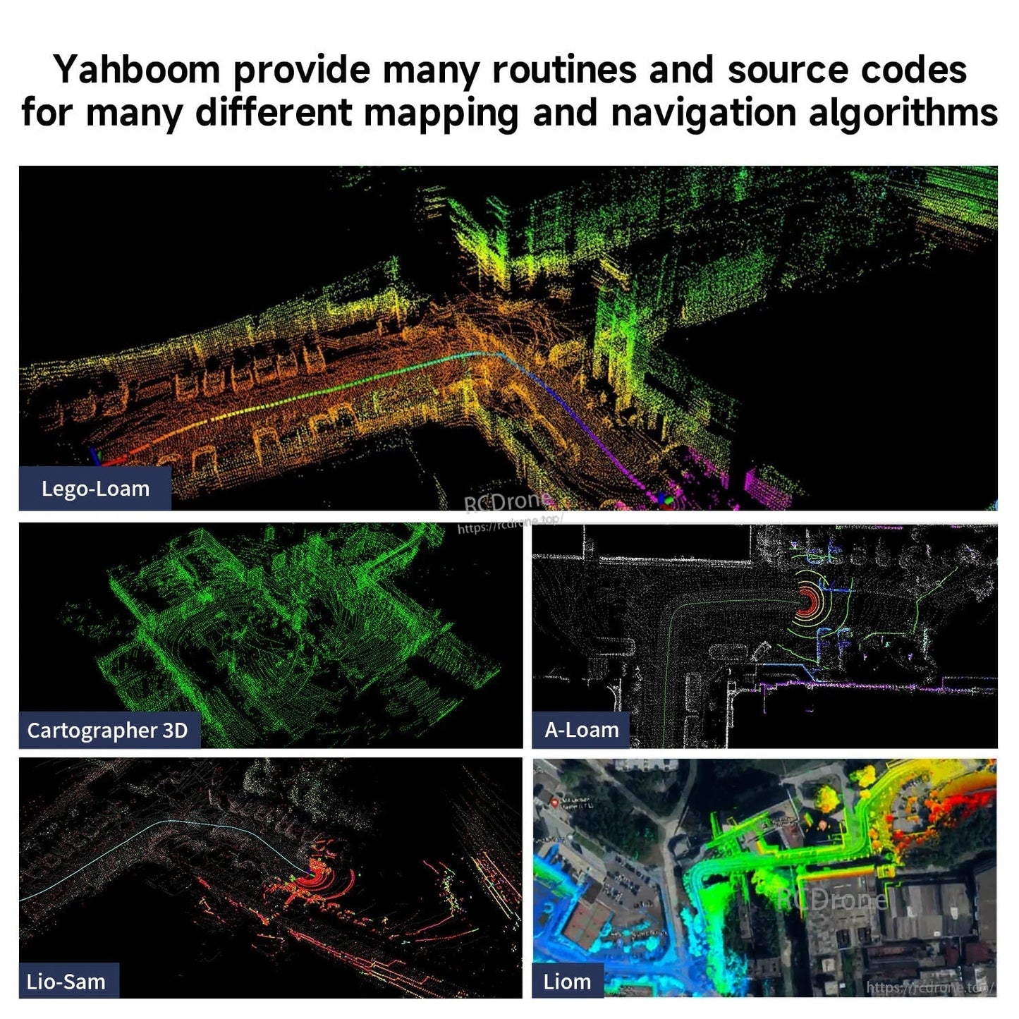
- Provides routines for 3D mapping/navigation algorithms: Lego-Loam, Cartographer 3D, Lio-Sam, A-Loam, Liom, and Autoware.ai.
- Designed with a closed protective cover to reduce external interference; built-in heating module and heat dissipation treatment; described as having excellent light resistance.
- Protection rating is stated as IP65 in feature materials; a parameter table lists IP67 (see Specifications).
Specifications
| Model | WLR-720 |
| Type | 16-line mechanical lidar |
| Ranging principle | TOF (Time of Flight) |
| Line count | 16 line |
| Distance measurement range | 0.5 m to 120 m (0.5 m to 50 m @ 10% reflectance, Channel 1-4 and 13-16; 0.5 m to 70 m @ 10% reflectance, Channel 5-12) |
| Distance measurement accuracy | +/- 3 cm (typical value) |
| Horizontal scanning FOV | 360 deg |
| Horizontal scanning resolution | 0.1 deg / 0.2 deg / 0.4 deg |
| Vertical scanning FOV | 30 deg (-16 deg to 14 deg) |
| Vertical scanning resolution | 2 deg |
| Scanning frequency | 5 Hz / 10 Hz / 20 Hz |
| Echo mode | Single echo / Double echo |
| Laser wavelength | 905 nm |
| Human eye safety level | Class 1 (eye safety) |
| Communication interface | Ethernet |
| Transmission method | UDP/IP |
| Working voltage | 12-32 V DC (power supply power > 20 W) |
| Power | 12 W |
| IMU | ASM330LHH (Automotive Grade), built-in 6-axis IMU |
| Time source | GPS |
| GPS synchronization accuracy | <= 10 ns |
| GPS clock drift | <= 10 ns/s |
| Protection class | IP65 (stated in feature materials); IP67 (listed in parameter table) |
| Size | Phi 105.7 mm x 81.5 mm |
| Net weight | 910 g |
| Operating temperature | -20 C to 60 C |
| Storage temperature | -40 C to 85 C |
If assistance is needed for selection or integration, contact [email protected] or visit https://rcdrone.top/.
Applications
- Navigation and positioning for low-speed vehicles and mobile robots
- Outdoor high-precision 3D mapping and point cloud data collection
- Obstacle detection and environmental perception for robotics and industrial automation
- ROS-based mapping/navigation development (ROS-SDK and provided routines)
Details
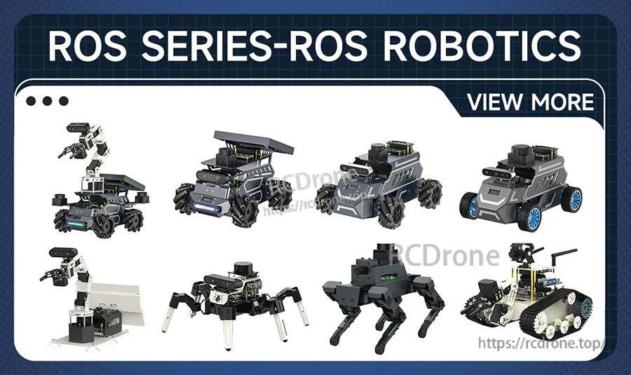
Compatible with popular ROS robot platforms for 3D perception, mapping, and navigation development.
WLR-720 delivers 360° scanning with a 120 m TOF range and an integrated 6-axis IMU for motion-aware perception.

Key capabilities at a glance: TOF ranging, Ethernet (UDP/IP), ROS SDK support, and an IP-rated protective housing.

Use the comparison table to confirm the WLR-720 configuration for your range, field-of-view, and interface needs.
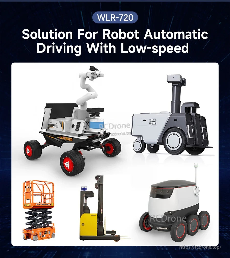
Designed for obstacle detection and navigation on low-speed vehicles such as delivery robots, forklifts, and mobile platforms.

ROS SDK and supporting tools help you bring point-cloud data into common robotics workflows faster.
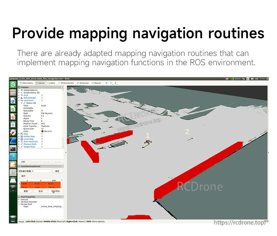
Ready-to-use navigation and mapping routines accelerate testing in a ROS environment.
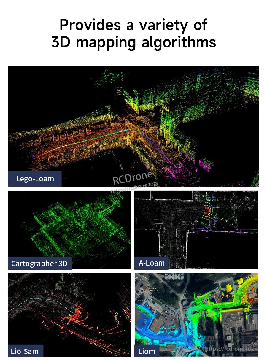
Supports multiple 3D mapping approaches such as Lego-Loam, Cartographer 3D, A-Loam, LIO-SAM, and more.

Autoware.ai adaptation enables building mapping and navigation pipelines for autonomous applications.
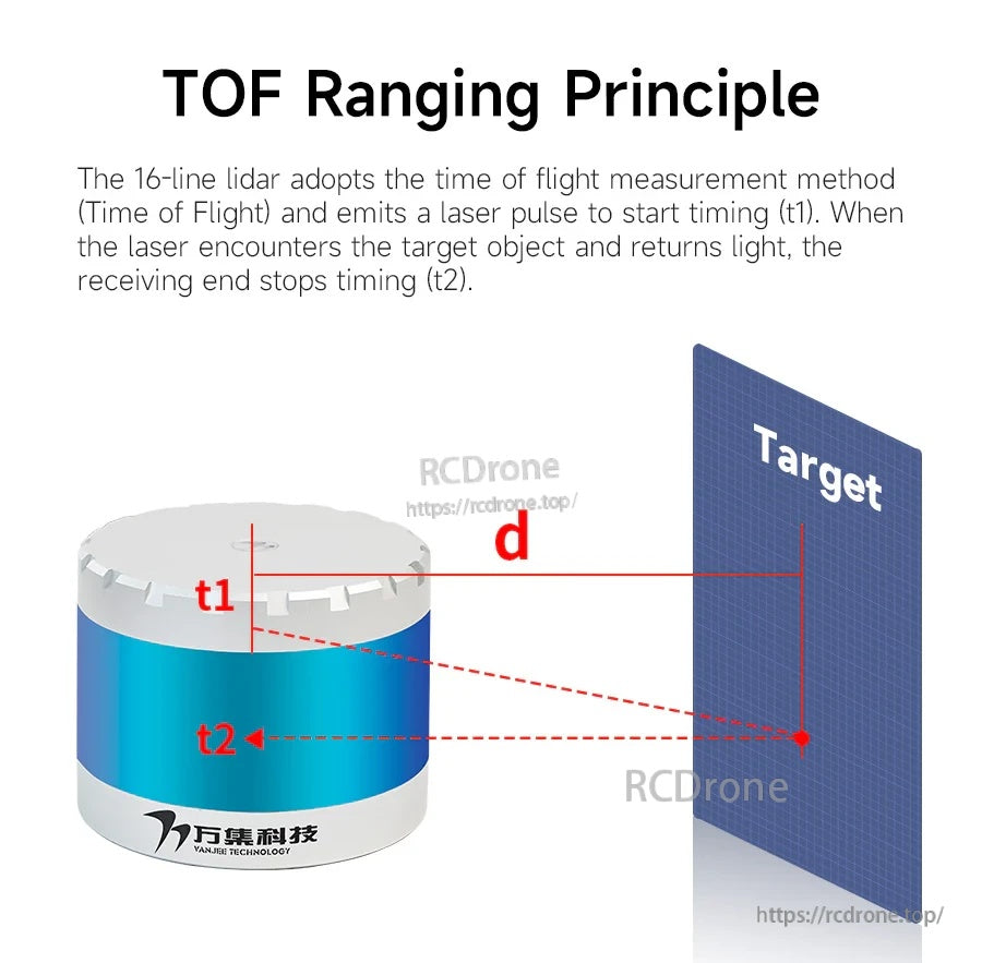
Time-of-Flight measurement uses laser pulse timing to calculate distance for accurate point cloud generation.
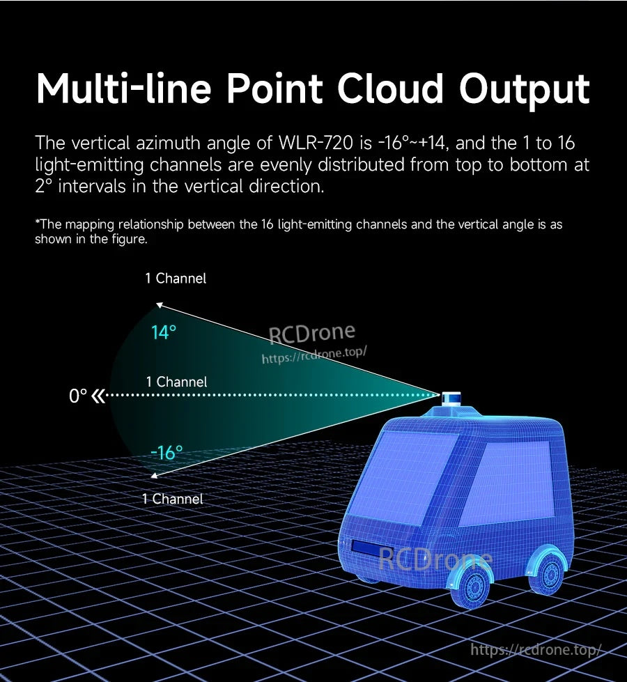
A 16-channel layout covers a -16° to +14° vertical field of view for more complete 3D scene capture.
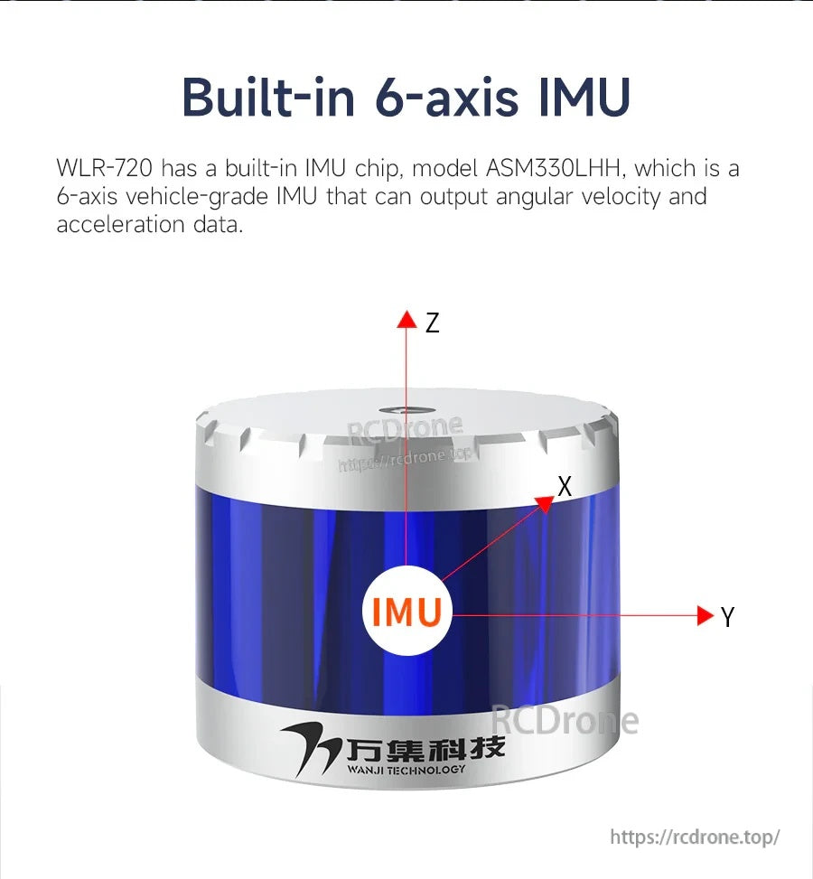
The built-in 6-axis IMU provides angular velocity and acceleration data for improved motion compensation.
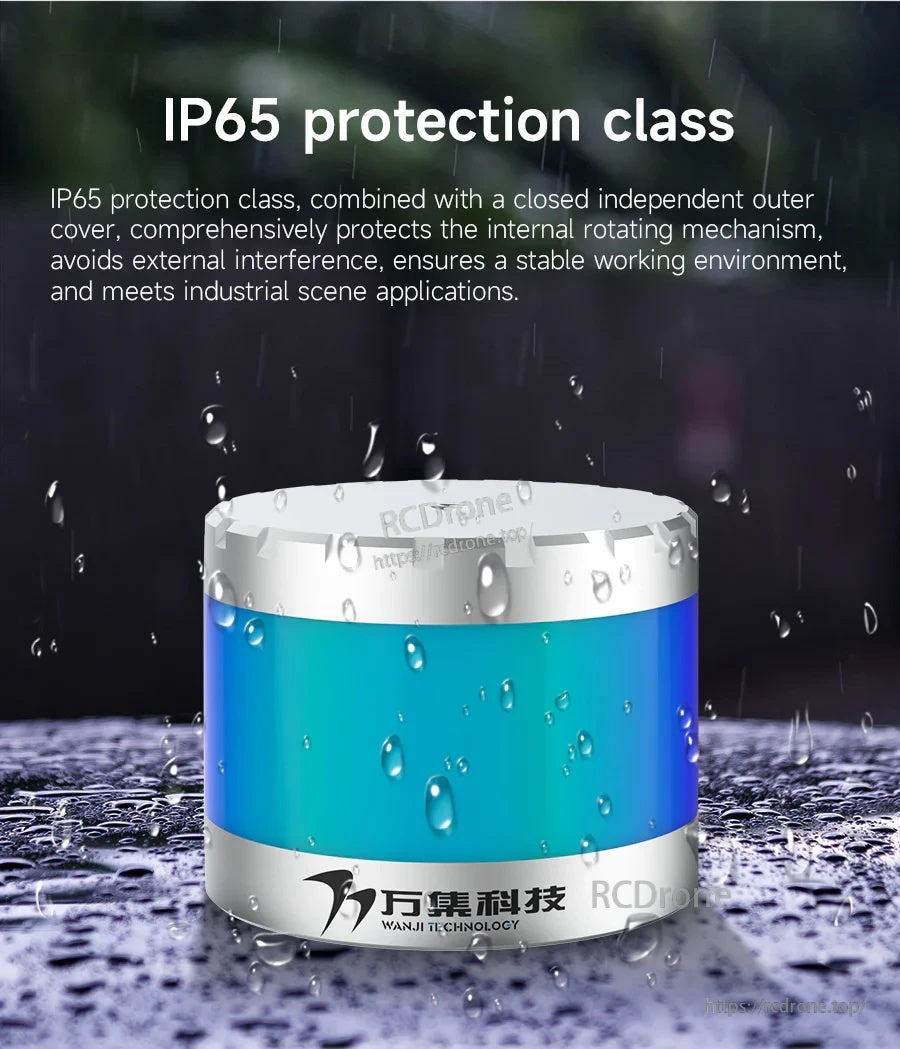
A sealed protective cover helps the LiDAR operate more reliably in dusty or wet industrial environments.
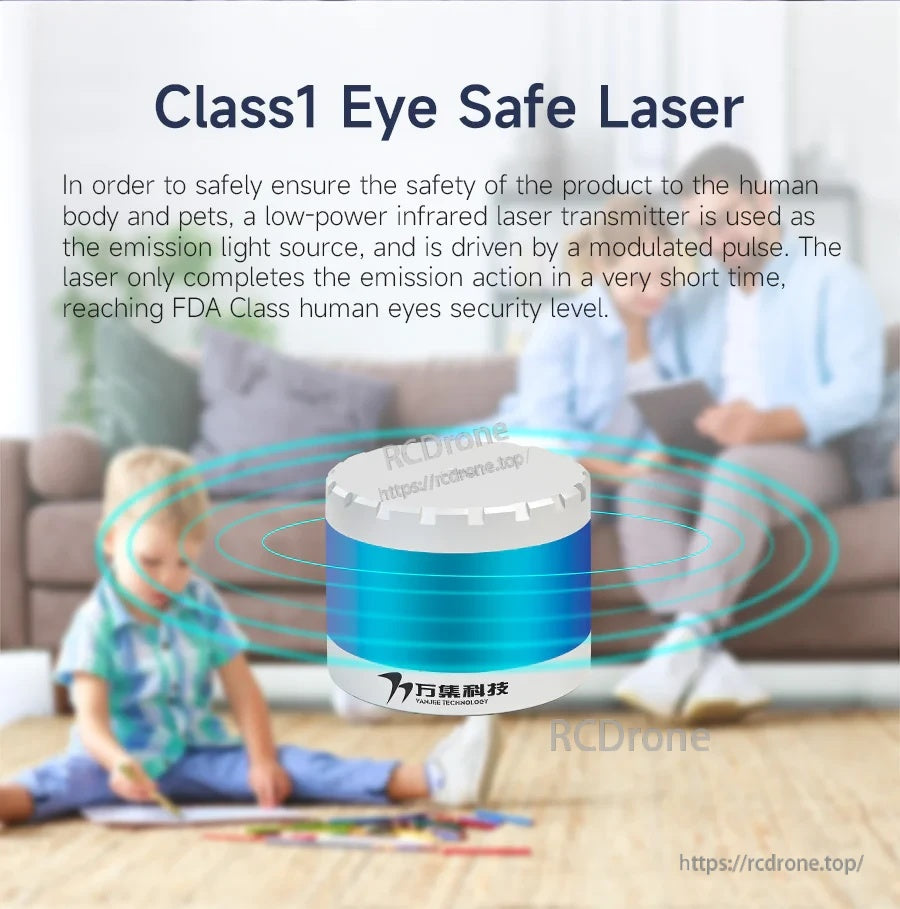
Class 1 laser design supports everyday deployment where eye-safety is required.
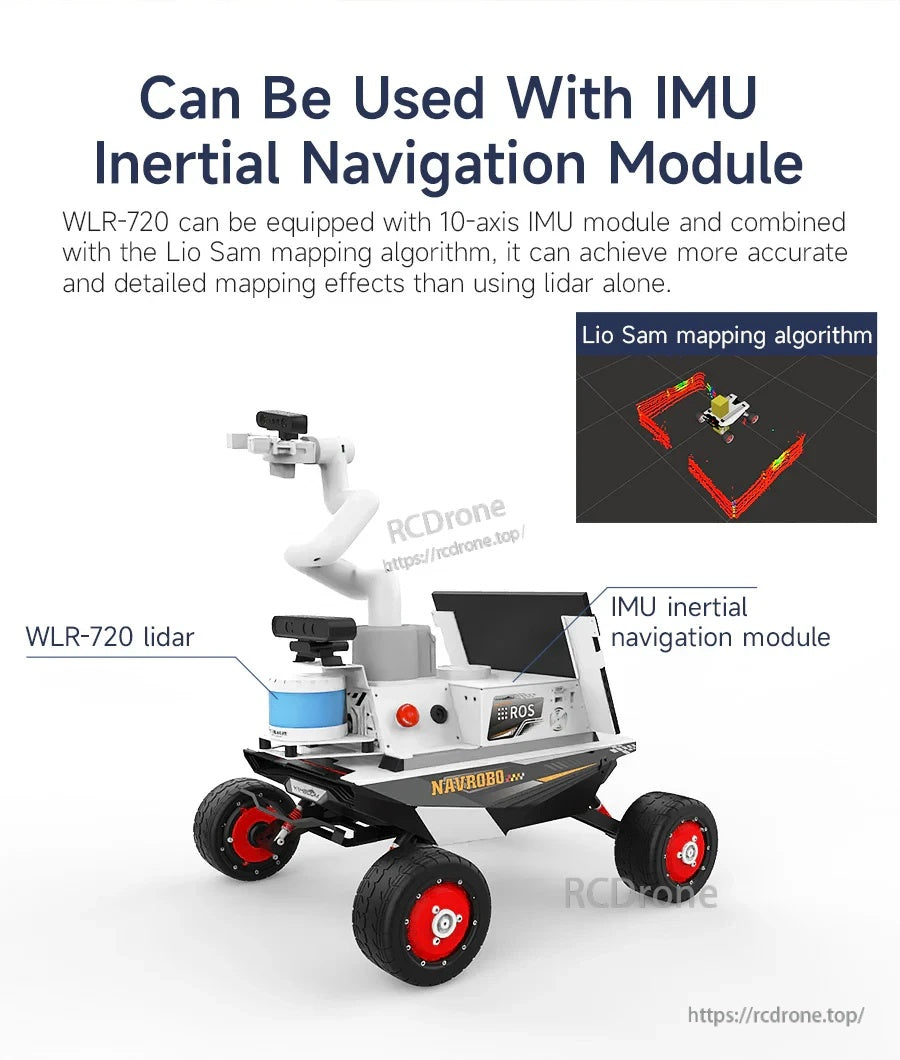
Optional external IMU integration supports tighter inertial navigation workflows (for example with LIO-SAM).
10-axis IMU inertial navigation modules can be added for projects that need higher-grade inertial inputs.
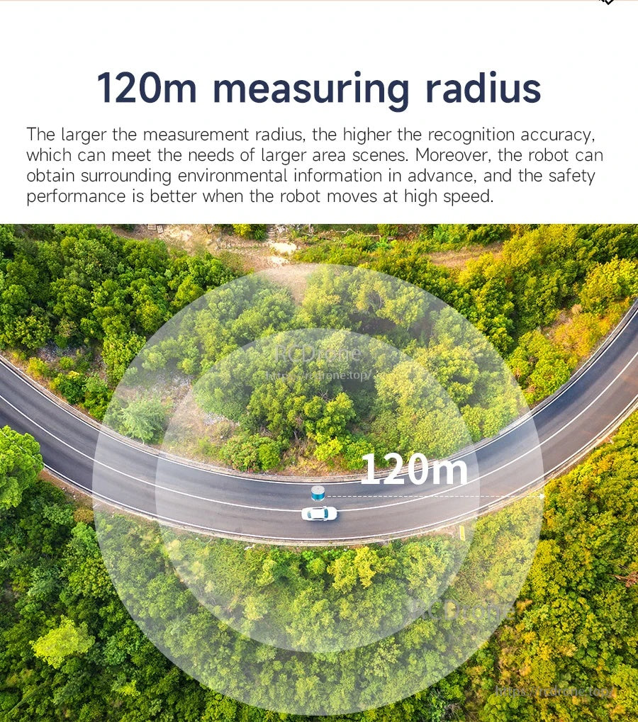
Up to a 120 m measuring radius helps extend obstacle detection and planning distance in outdoor scenes.
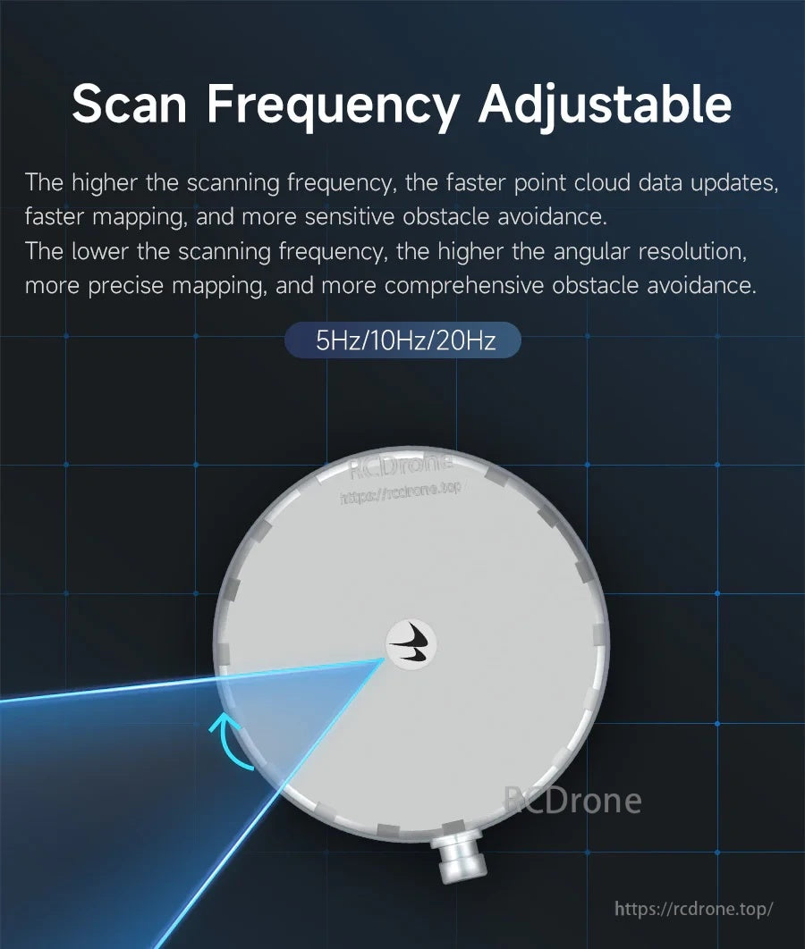
Choose 5 Hz, 10 Hz, or 20 Hz scan frequency to balance update rate, mapping detail, and computing load.

The WLR-720 LiDAR supports single-echo and dual-echo ranging with measuring point rates listed as 288,000 and 576,000 points per second.
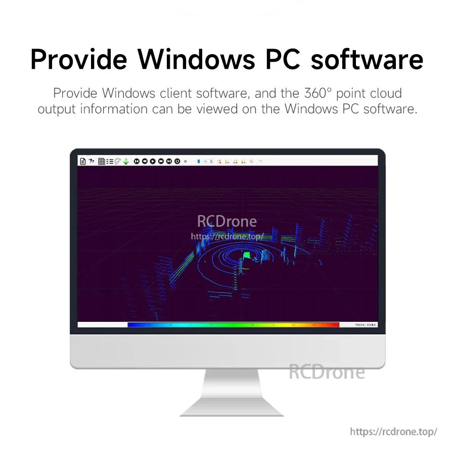
Windows PC client software lets you view the 360° point cloud output during setup and testing.

Adjustable shielding angle settings help block unwanted scan sectors, such as the left 30°, for cleaner point cloud data during robot operation.
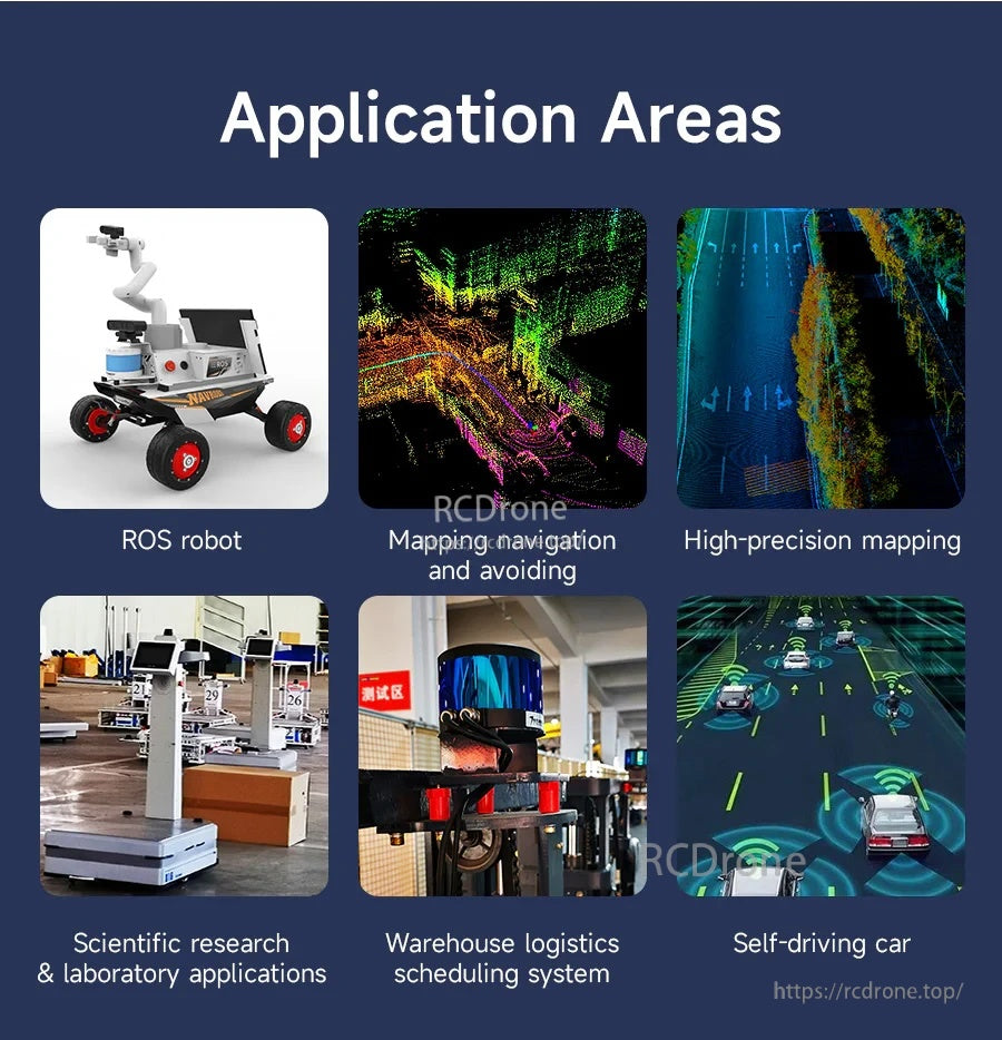
The WLR-720 LiDAR is commonly used for ROS robots, mapping and navigation, warehouse logistics automation, and autonomous driving research.

Yahboom WLR-720 learning resources include an online tutorial link and downloadable documents for popular SLAM algorithms like LOAM, Cartographer, A-LOAM, and LIO-SAM.
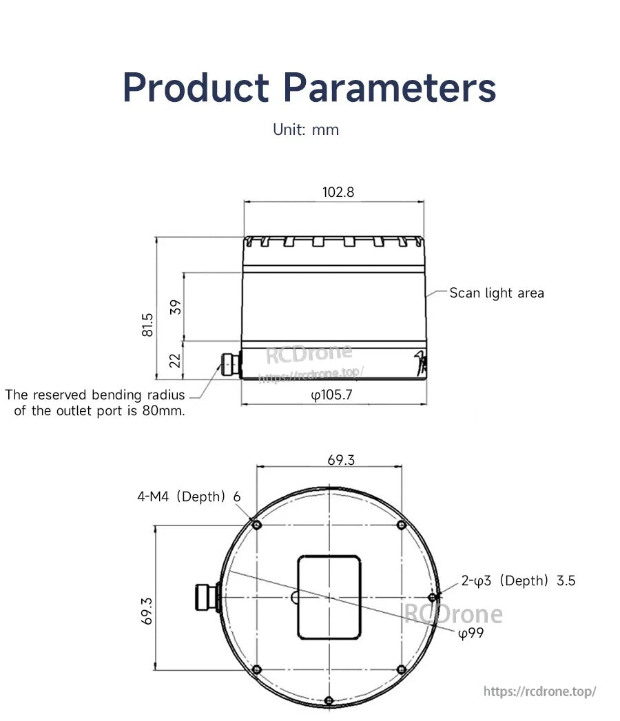
VANJEE WLR-720 LiDAR dimensions and mounting-hole layout help plan enclosure fitment and bracket placement.

The WLR-720 LiDAR lists TOF ranging from 0.5–120 m, a 360° horizontal field of view, Ethernet communication, and IP67-rated protection.
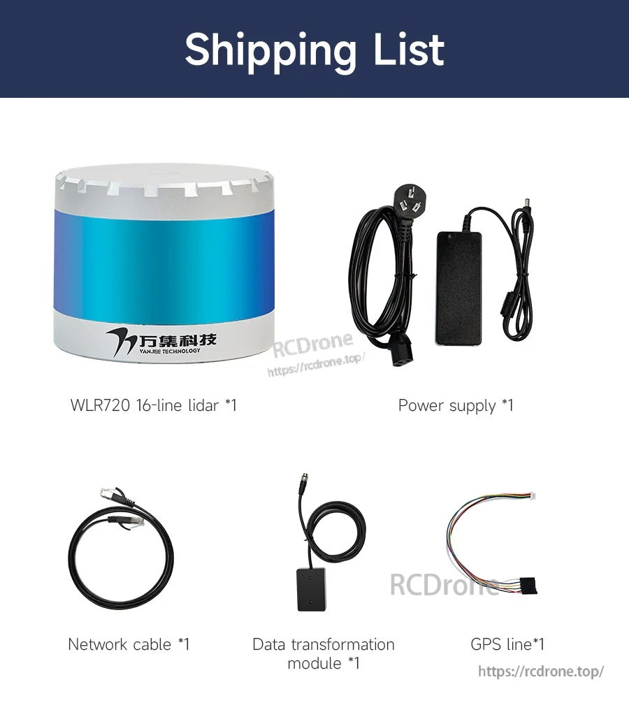
The kit includes the WLR-720 16-line LiDAR sensor plus a power supply, network cable, data transformation module, and GPS line for setup.
Related Collections