


Beitian BE-59D M10050 GNSS 위치 안테나 (해양/산업용), RS232 DB9 시리얼, 5V, IP67
Beitian BE-59D M10050 GNSS 위치 안테나 (해양/산업용), RS232 DB9 시리얼, 5V, IP67
Beitian
픽업 사용 가능 여부를 로드할 수 없습니다.


개요
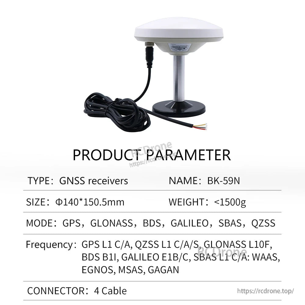
Beitian BE-59D는 해양, 농업 장비 및 산업 위치 지정 응용 프로그램을 위한 직렬 데이터 출력을 갖춘 GNSS 위치 지정 안테나/수신기입니다. M10050 칩을 사용하며, 여러 전송 속도와 NMEA/UBX 출력을 지원하여 컨트롤러, 컴퓨터 및 기타 직렬 호스트 장치와 통합할 수 있습니다.
주요 특징
- 다중 시스템 결합 위치 지정: GPS, BDS, GALILEO, SBAS, QZSS
- 직렬 출력 수준: RS-232 수준
- 프로토콜: NMEA, UBX
- 구성 가능한 업데이트 속도: 0.25Hz에서 18Hz (기본값 1Hz)
- FLASH 사용 시 (구성 변경 가능)
- IP67 방수 등급
- 자석 바닥 장착
- 모델 선택에 따라 다양한 연결 방법 가능 (DB9, USB, 4선)
사양
| 모델 | BE-59D |
| 칩 | M10050 |
| 작동 모드 / 주파수 | GPS L1 C/A, QZSS L1 C/A, SBAS L1 C/A; BDS B1I/B1C; GALILEO E1B/C; SBAS L1 C/A: WAAS, EGNOS, MSAS, GAGAN |
| 채널 | N/A |
| 수평 정확도 | 2.0m CEP |
| 속도 | 0.05m/s |
| 동적 방향 | 0.3 deg |
| PPS 시간 정확도 | RMS 30ns; 99% 60ns |
| 콜드 부팅 | 27초 |
| 웜 부팅 | 1초 |
| 전송 속도 (bps) | 4800bps에서 921600bps (기본값 115200bps) |
| 출력 수준 | RS-232 수준 |
| 출력 프로토콜 | NMEA, UBX |
| 업데이트 속도 | 0.25Hz에서 18Hz (기본값 1Hz) |
| 플래시 | 플래시 포함 |
| 전압 | DC 3.6V에서 5.5V (일반: 5.0V) |
| 전류 | 30mA / 5.0V |
| 크기 | Phi 140mm * 150.5mm |
| 무게 | <1500g |
| 케이블 길이 | 3m (도면: 3000 +/- 10 mm) |
| 고정된 | 자석 바닥 |
| 방수 등급 | IP67 |
NMEA-0183 메시지 내용 (예시)
| GGA | 시간, 위치, 위성 수 |
| GLL | 경도, 위도, UTC 시간 |
| GSA | GPS 수신기 작동 모드, 위치 지정에 사용된 위성, DOP 값, 타겟 상태 |
| GSV | GPS 위성 정보가 표시됨, 고도, 방위각, 신호 대 잡음 비율 |
| RMC | 시간, 날짜, 위치, 속도 |
| VTG | 지상 속도 정보 |
DB-9 여성 인터페이스 핀 설명
| 핀 9 | VCC | I | DC 3.6V에서 5.5V 공급 입력 (일반: 5.0V) |
| 핀 2 | TX | O | RS-232 직렬 데이터 출력 |
| 핀 3 | RX | I | RS-232 직렬 데이터 입력 |
| 핀 5 | GND | G | 접지 |
구조적 치수 (도면)
- 안테나 직경: 140 +/- 0.5 mm
- 표시된 높이: 59.5 +/- 0.5 mm
- 기본 직경: Φ 87 mm
- 스탠드에 표시된 높이: 75 mm 및 16 mm
- 나사 표시: M10
- 케이블 길이: 3000 +/- 10 mm
모델 옵션 (선택에 따라 다름)
Shopify 옵션은 DB9 RS232, DB9 + 케이블, DB9 + USB 및 4선 TTL 버전을 포함하여 다양한 인터페이스와 공급 수준을 가진 여러 변형(BE/BK 시리즈)을 나열합니다.필요한 모델을 선택하여 호스트 장치 인터페이스 및 전압 수준에 맞추십시오.
포함된 항목
- 선택된 수신기 x1
- 해당 나사 베이스 조립 x1
- 해당 연결 케이블 x1
응용 프로그램
- 해양 매핑
- 물류 추적
- 도크 트럭
지원
통합 질문(전송 속도, 출력 프로토콜 및 인터페이스 선택) 또는 맞춤 요청에 대해서는 [email protected] or에 문의하거나 https://rcdrone.top/.
세부정보
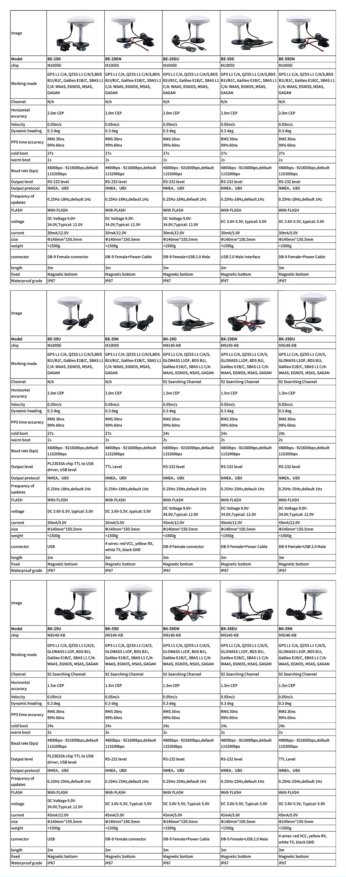
호스트 인터페이스 및 전원 수준(DB9 RS‑232, USB 또는 4‑선 TTL 옵션)에 맞는 변형을 선택하십시오.
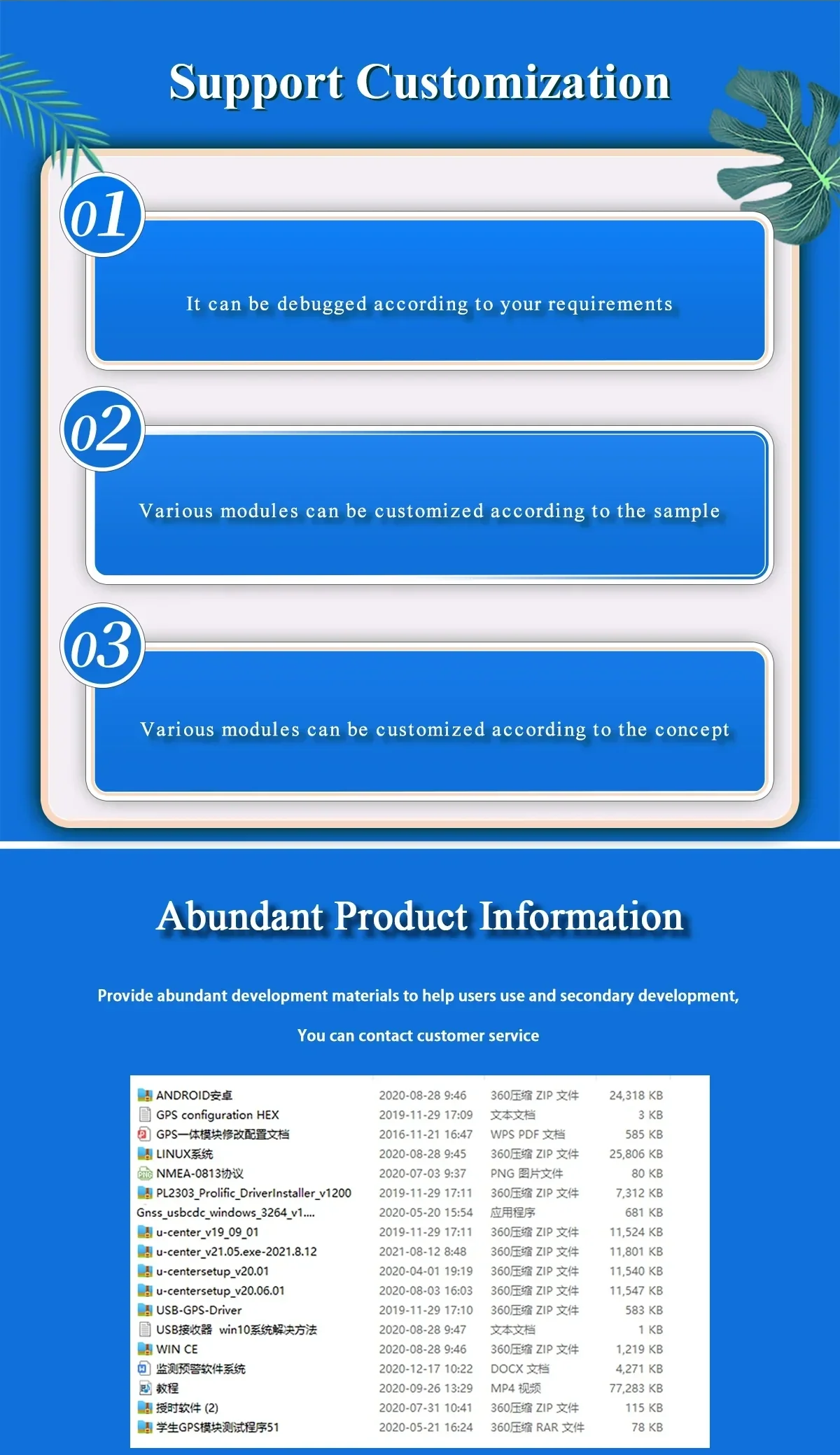
펌웨어 및 출력 설정은 통합 요구에 맞게 조정할 수 있으며, 전송 속도 및 NMEA/UBX 출력을 포함합니다.

다중 위성 수신(GPS/BDS/Galileo/SBAS/QZSS)은 해양, 농업 및 산업용 안정적인 위치 지정을 지원합니다.
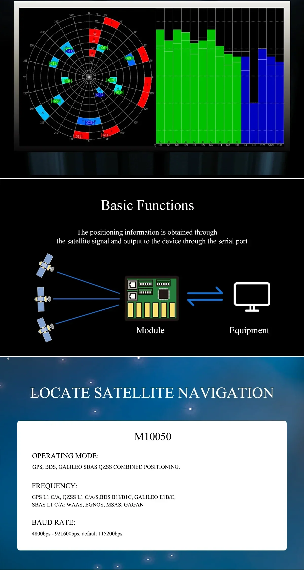
직접 연결을 위해 설계된 직렬 데이터 출력은 컨트롤러, PC 및 기타 직렬 호스트 장치에 연결됩니다.
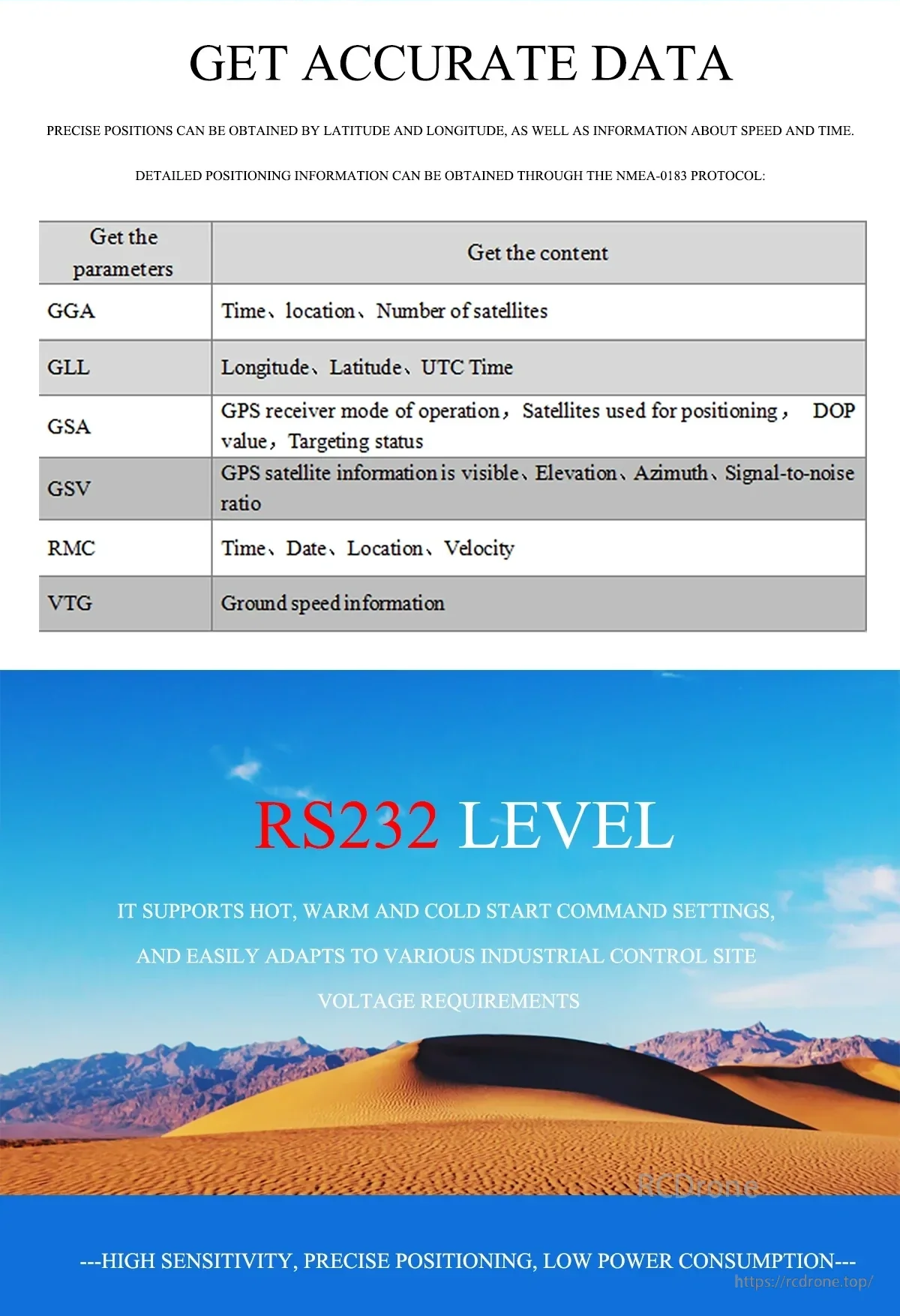
표준 NMEA-0183 문장(GGA, GSA, GSV, RMC, VTG 등)은 시간, 위치, 속도 및 위성 세부 정보를 제공합니다.
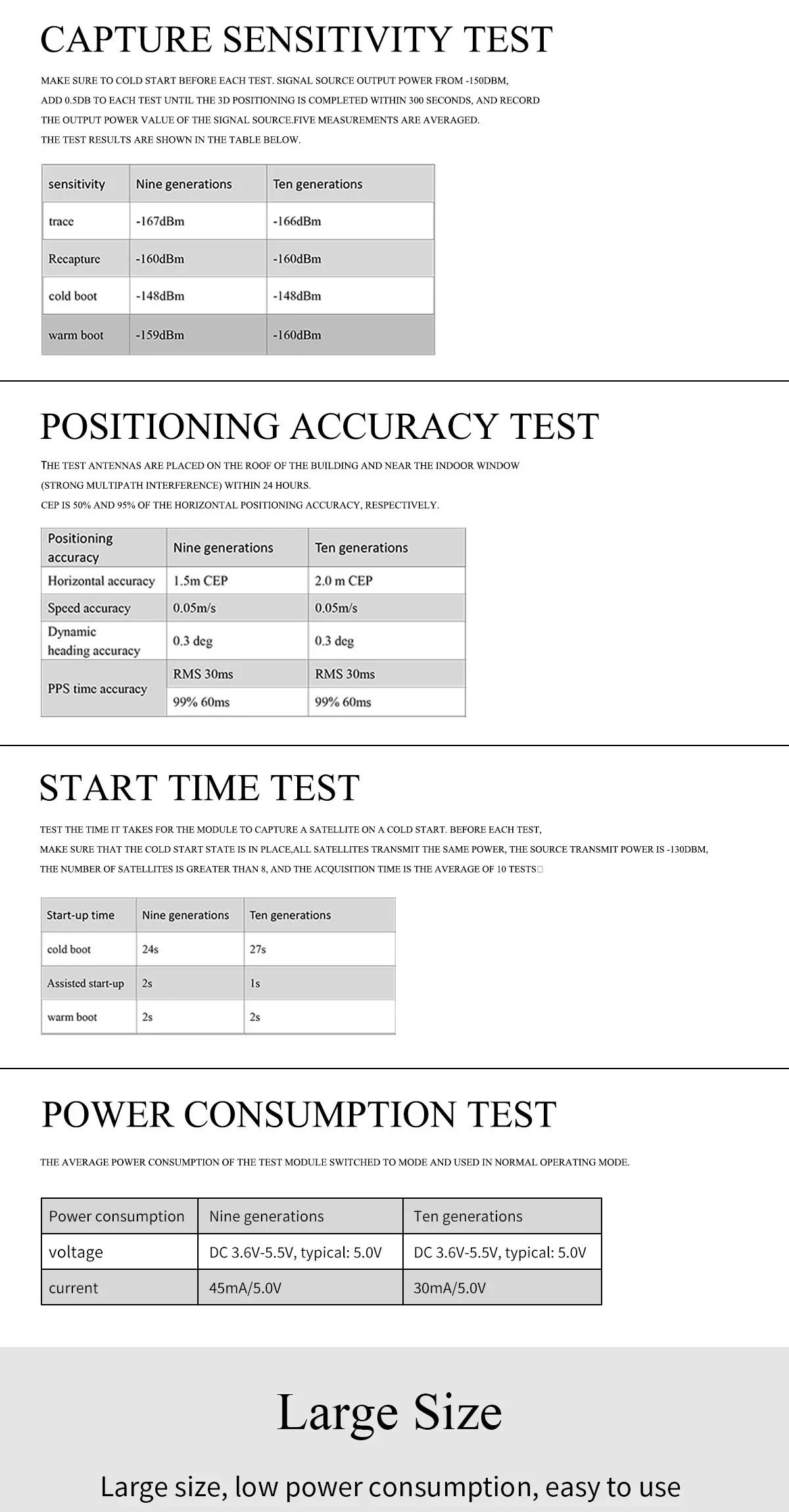
테스트 결과는 감도, 정확도, 시작 시간 및 저전력 소비 특성을 요약합니다.
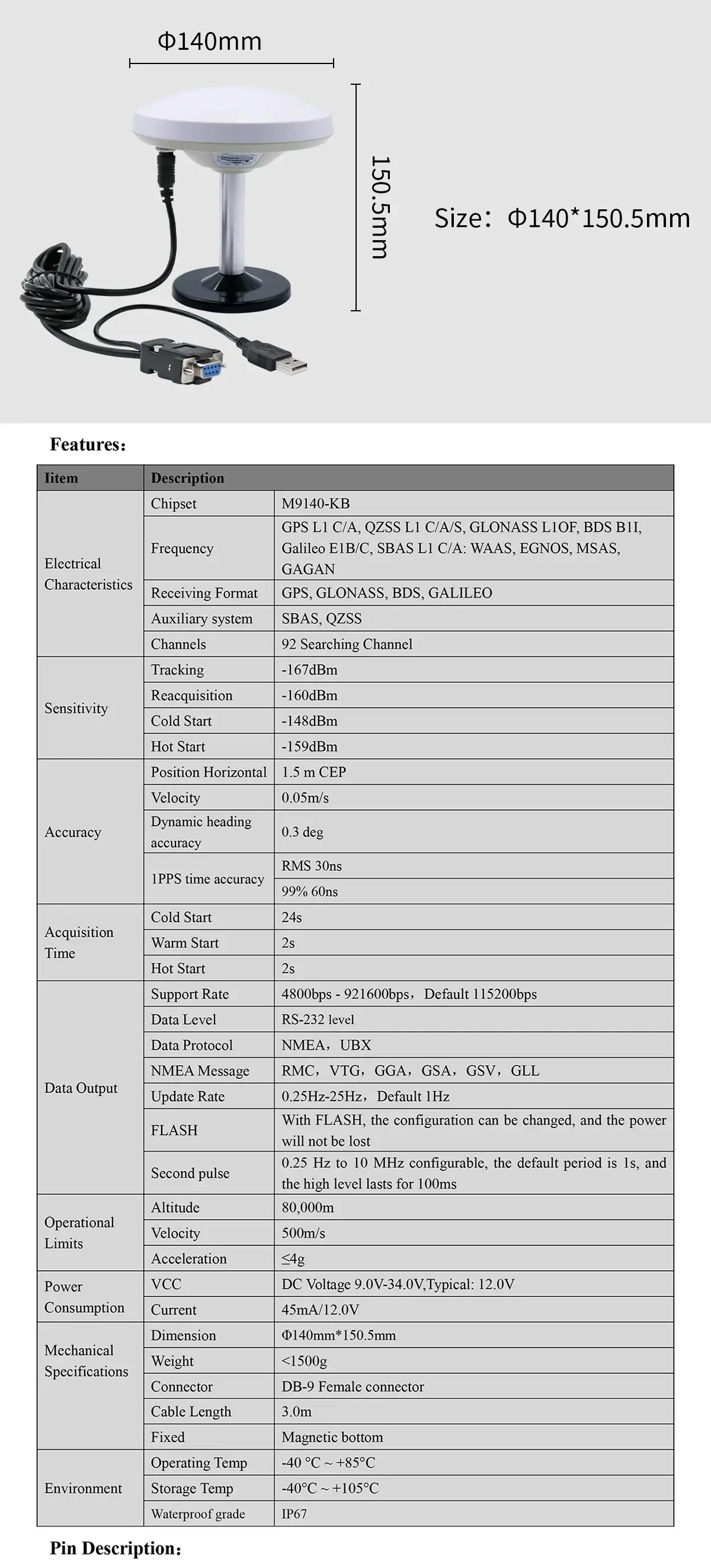
물리적 크기와 주요 전기 사양은 인클로저 계획 및 시스템 설계를 위해 제공됩니다.
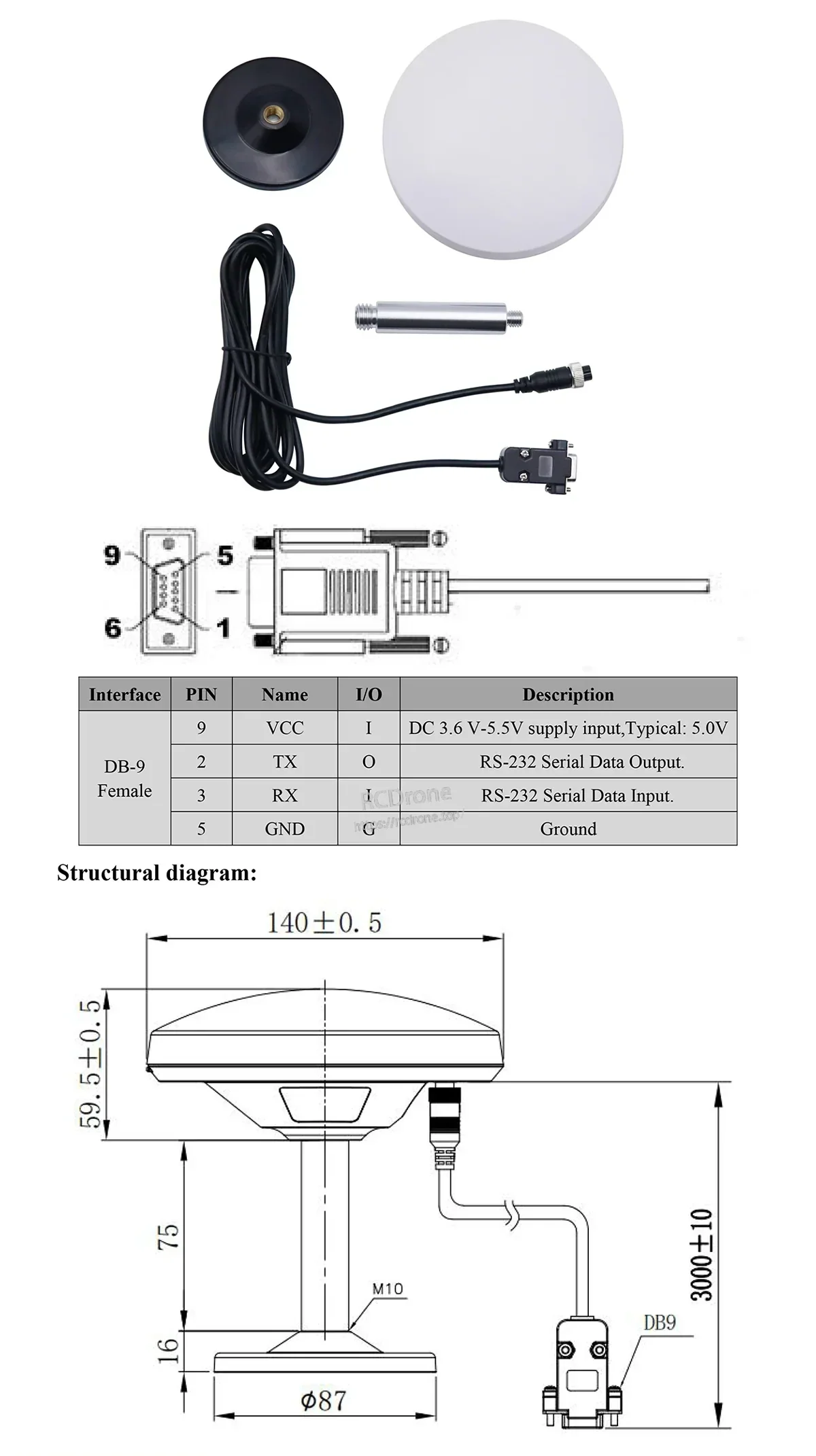
DB9 핀 정의 및 기계적 치수는 설치 전에 배선, 장착 및 케이블 경로를 확인하는 데 도움이 됩니다.
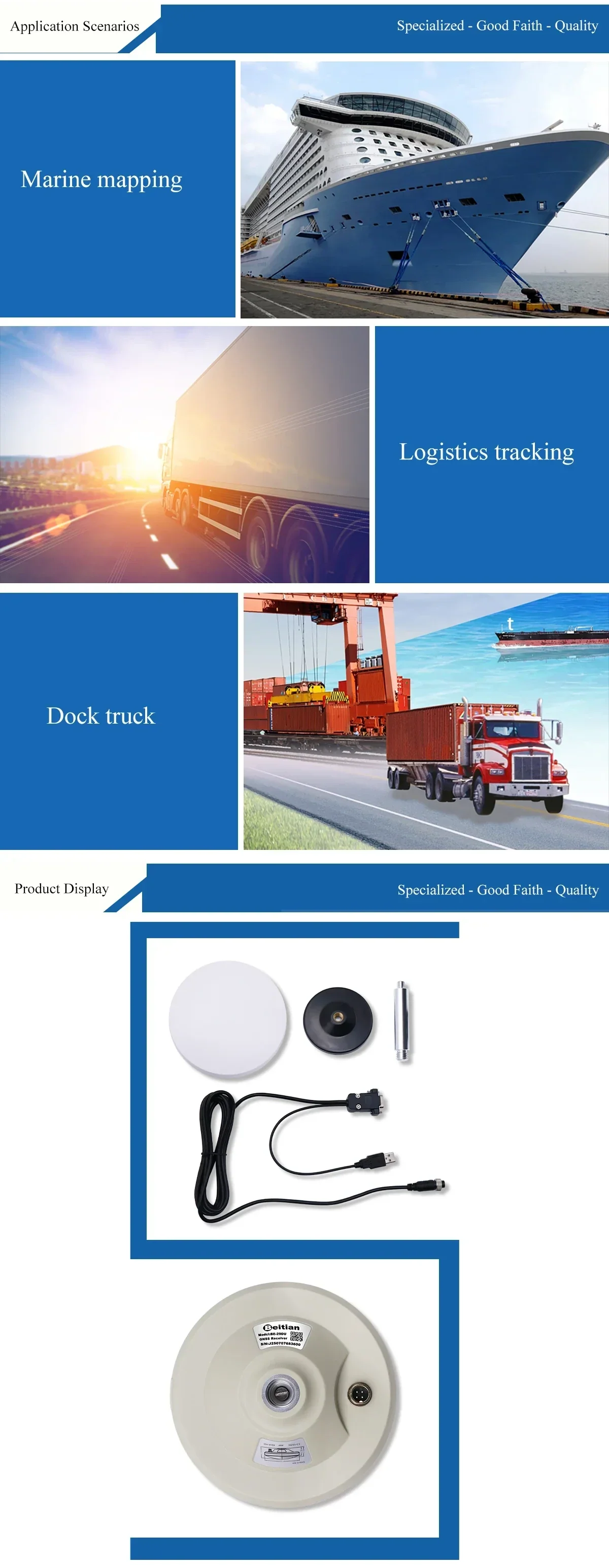
일반적인 배치는 선박 내비게이션, 함대/물류 추적 및 항구 또는 야드 차량을 포함합니다.
