VK VDT-2 Landbouw Mapping Module – Dubbel-Frequentie Multi-Systeem Hoog-Precisie Akkerbouw Mapper
VK VDT-2 Landbouw Mapping Module – Dubbel-Frequentie Multi-Systeem Hoog-Precisie Akkerbouw Mapper
VK
Kan beschikbaarheid voor afhalen niet laden
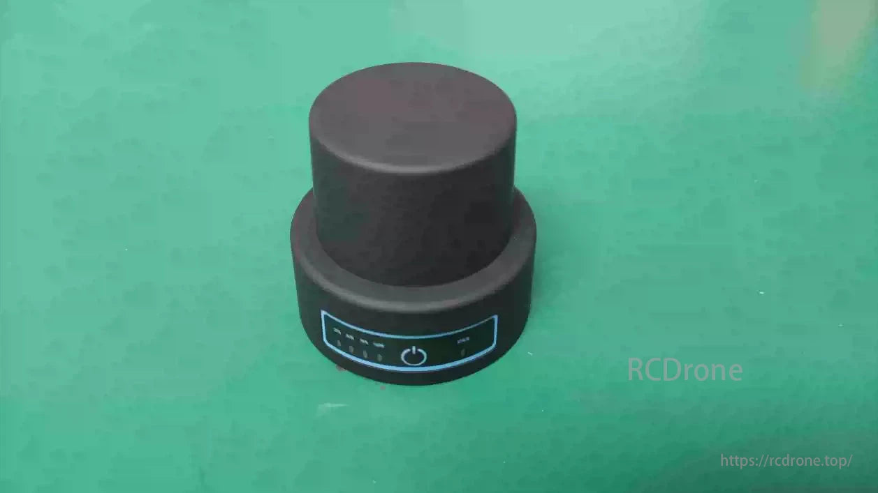
De VK VDT-2 is een lichtgewicht, hoogprecisie handheld mapper ontworpen voor het inmeten van landbouwgrond en toepassingen van landbouwdrones. Met dual-frequency satellietontvangst, multi-GNSS compatibiliteit, en Bluetooth draadloze transmissie, biedt het centimeter-niveau nauwkeurigheid voor efficiënte grensgegevensverzameling en naadloze integratie met landbouw UAV-systemen. De IP67 bescherming, compacte afmetingen en lange batterijduur maken het ideaal voor veldwerk in diverse omgevingsomstandigheden.
Belangrijkste Kenmerken
-
Dual-frequency GNSS met centimeter-niveau RTK nauwkeurigheid
-
Ondersteunt BeiDou, GPS, GLONASS, Galileo, QZSS
-
Compacte afmetingen en slechts 65g gewicht voor handheld gebruik
-
Bluetooth 4.0 draadloze connectiviteit
-
Compatibel met VK landbouw drone platforms
-
IP67 waterdicht en stofdicht
-
Langdurige batterijduur tot 6 uur
-
Eenvoudige gegevensupload en realtime veldweergave via VK's mapping software
Technische parameters
| Parameter | Specificatie |
|---|---|
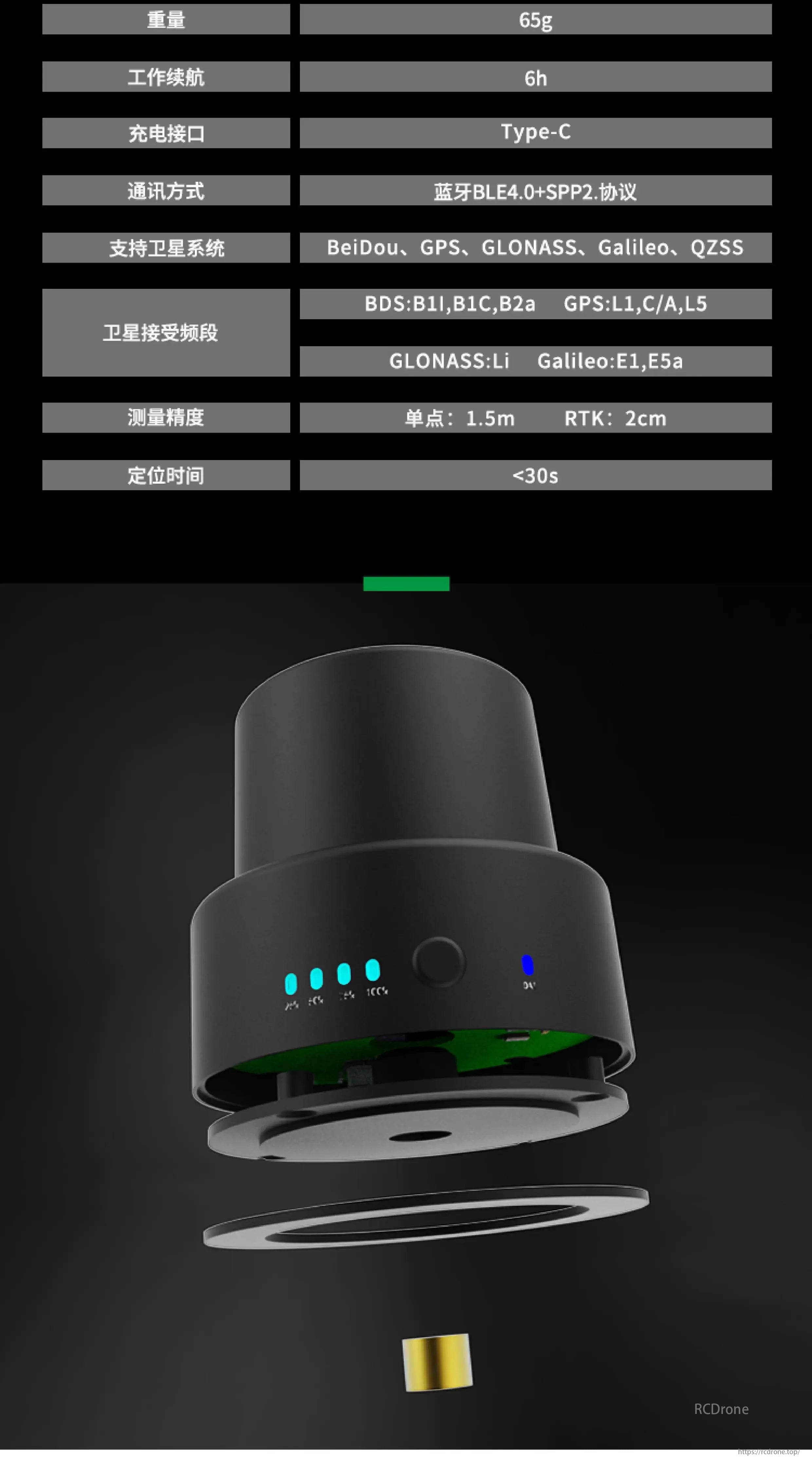
| Gewicht | 65g |
| Batterijduur | 6u |
| Oplaadinterface | Type-C |
| Communicatie | Bluetooth BLE4.0 + SPP2.0 Protocol |
| GNSS Ondersteuning | BeiDou, GPS, GLONASS, Galileo, QZSS |
| Signaalbanden | BDS: B1I, B1C, B2a GPS: L1, C/A, L5 GLONASS: L1 Galileo: E1, E5a |
| Meetnauwkeurigheid | Standalone: 1.5m RTK: 2cm |
| Positioneringstijd | <30s |
Toepassingsworkflow
-
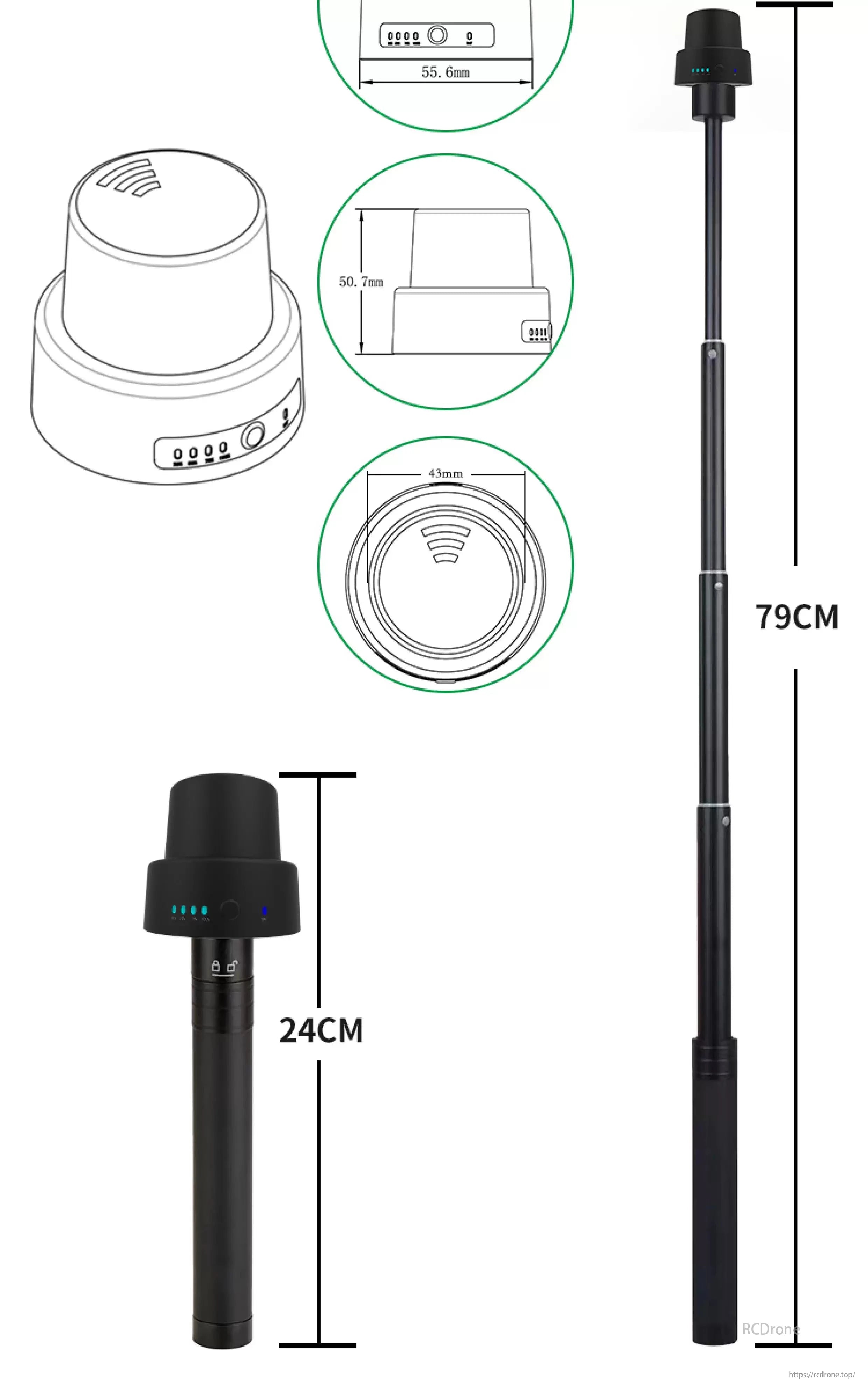
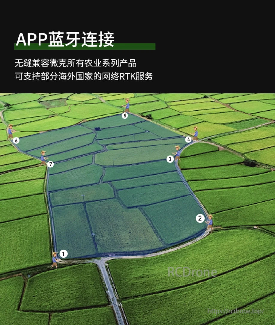
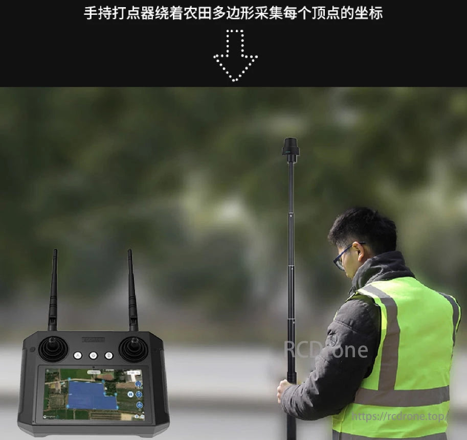
Veldonderzoek: Draag de VDT-2 met de telescopische stok en loop langs de veldgrenzen.
-
Realtime Mapping: Automatisch GPS-coördinaten van elke hoek vastleggen met de gekoppelde VK-controller of mobiele apparaat.
-
Gegevenssynchronisatie: Naadloos gemapte grenzen uploaden naar de cloud of missieplanningssoftware.
-
Integratie: Compatibel met RTK-geschikte drones voor geautomatiseerd spuiten, zaaien of gegevensverzameling.
De VK VDT-2 RTK mapper is speciaal ontworpen voor professionals in de landbouw, waardoor slimme, efficiënte en schaalbare landbouwinspecties mogelijk zijn.
Details
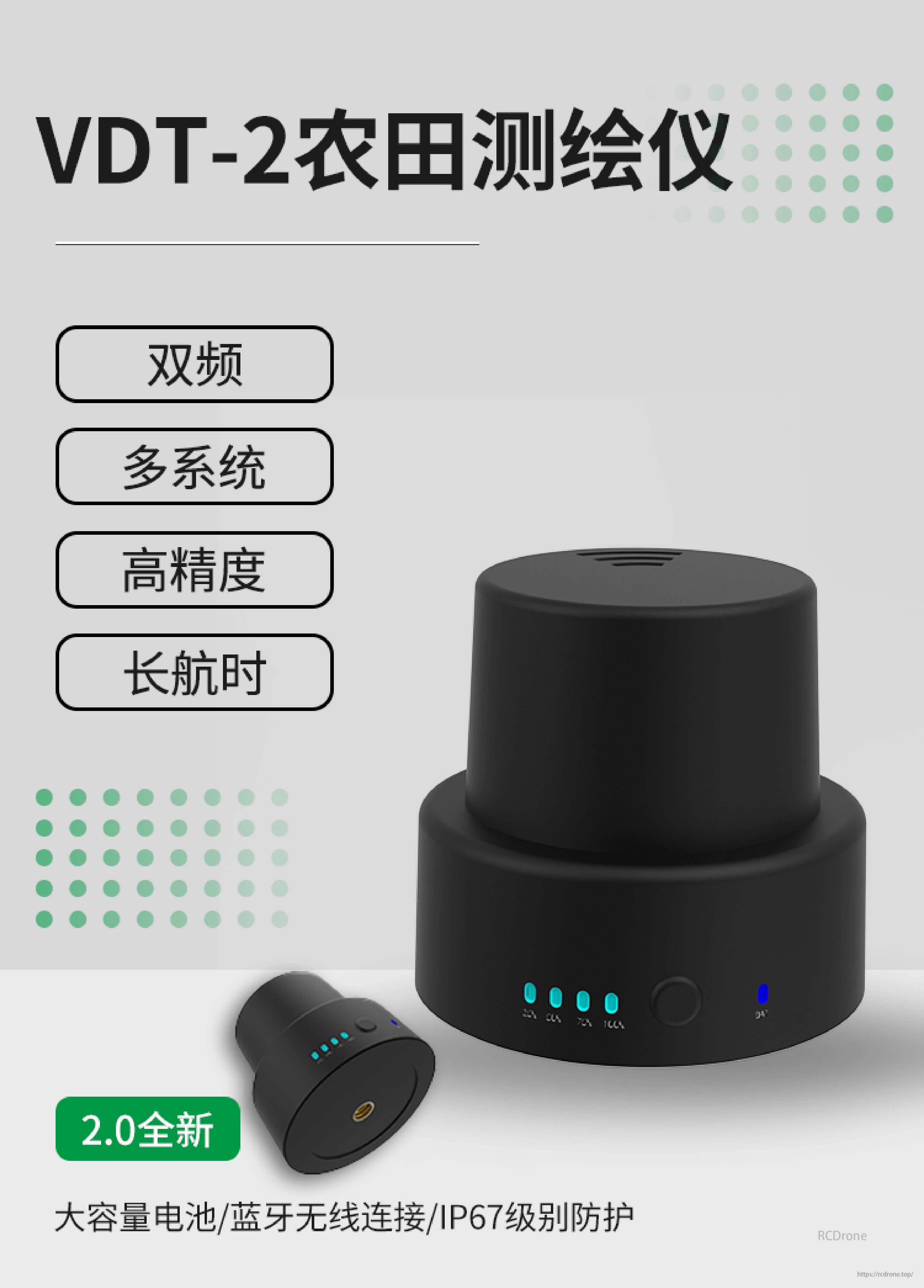
VDT-2 Landbouw Mapper: Dubbel frequentie, multi-systeem, hoge precisie, lange uithoudingsvermogen. Versie 2.0 met grote batterij, Bluetooth, IP67 bescherming.
VK VDT-2 Landbouw Mapper: 65g, 6u batterij, Type-C opladen, BLE4.0+SPP2, ondersteunt BeiDou, GPS, GLONASS, Galileo, QZSS. Precisie: 1,5m enkel, 2cm RTK. Positioneringstijd onder de 30 seconden.
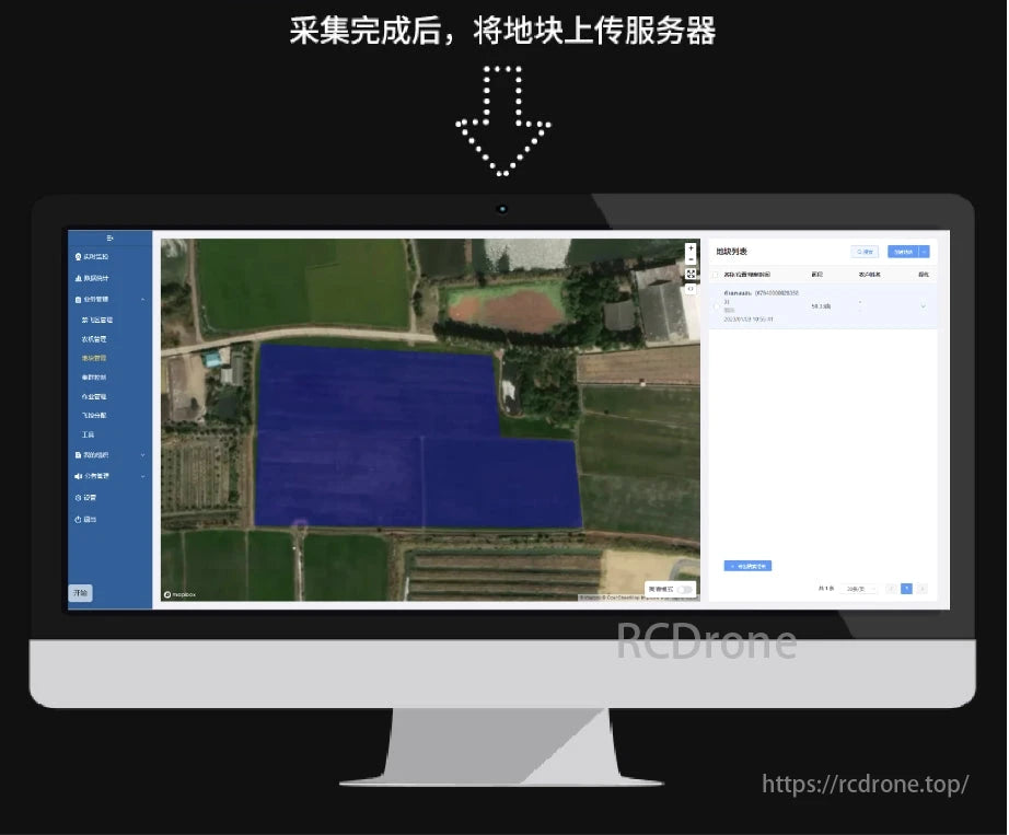
De interface van de Landbouw Mapper toont veldgegevens, opties voor analyse en instellingen. Gegevensuploadproces aangegeven.
Related Collections