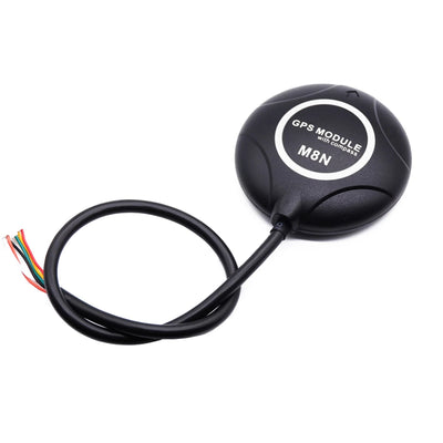
Beitian UM980/K902 Fullfrekvens RTK GNSS-kort för UAV-navigering, högprecisions BDS/GPS-modul
Beitian UM980/K902 Fullfrekvens RTK GNSS-kort för UAV-navigering, högprecisions BDS/GPS-modul
Beitian
Det gick inte att ladda hämtningstillgänglighet


Översikt
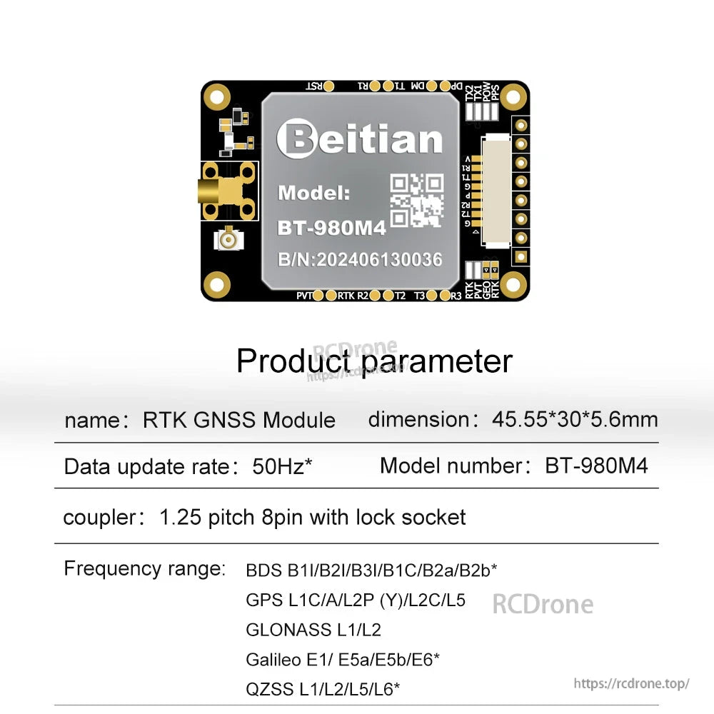
Beitian UM980/K902 är ett fullfrekvens RTK GNSS-kort för UAV-navigering och andra högprecisionspositioneringsapplikationer. Det integrerar en GNSS-modul (UM980 eller K902, beroende på modell) och stöder multikonstellationsmottagning såsom BDS/GPS/GLONASS/Galileo/QZSS för centimeter-nivå RTK-positionering och meter-nivå enkelpunktpositionering.
Nyckelfunktioner
- Integrerade GNSS-chipalternativ: UM980 eller K902 (modellberoende)
- RTK-positionering (RMS):
- K902-serien: (Horisontell) (8+10-6xD)mm; (Vertikal) (15+10-6xD)mm
- UM980-serien: Platt: 0.8 cm +1 ppm; Höjd: 1.5 cm +1 ppm
- Enkelpunktpositionering: Platt yta 1.5 m; Höjd 2.5 m
- Tidsnoggrannhet: 20 ns
- Snabbt gå in i RTK-läge: initialiseringstid är mindre än 5 s (typiskt värde)
- Uppdateringsfrekvens:
- K902-serien: standard 5 Hz
- UM980-serien: <=50 Hz (Standard: 1 Hz)
- Flera anslutningsmetoder visas: trådad anslutningsmetod och radioanslutningsmetod (bas/rover)
- Adaptiv anti-interferensförmåga (suppressar interferenssignaler av breda och smala band samt kontinuerliga vågor)
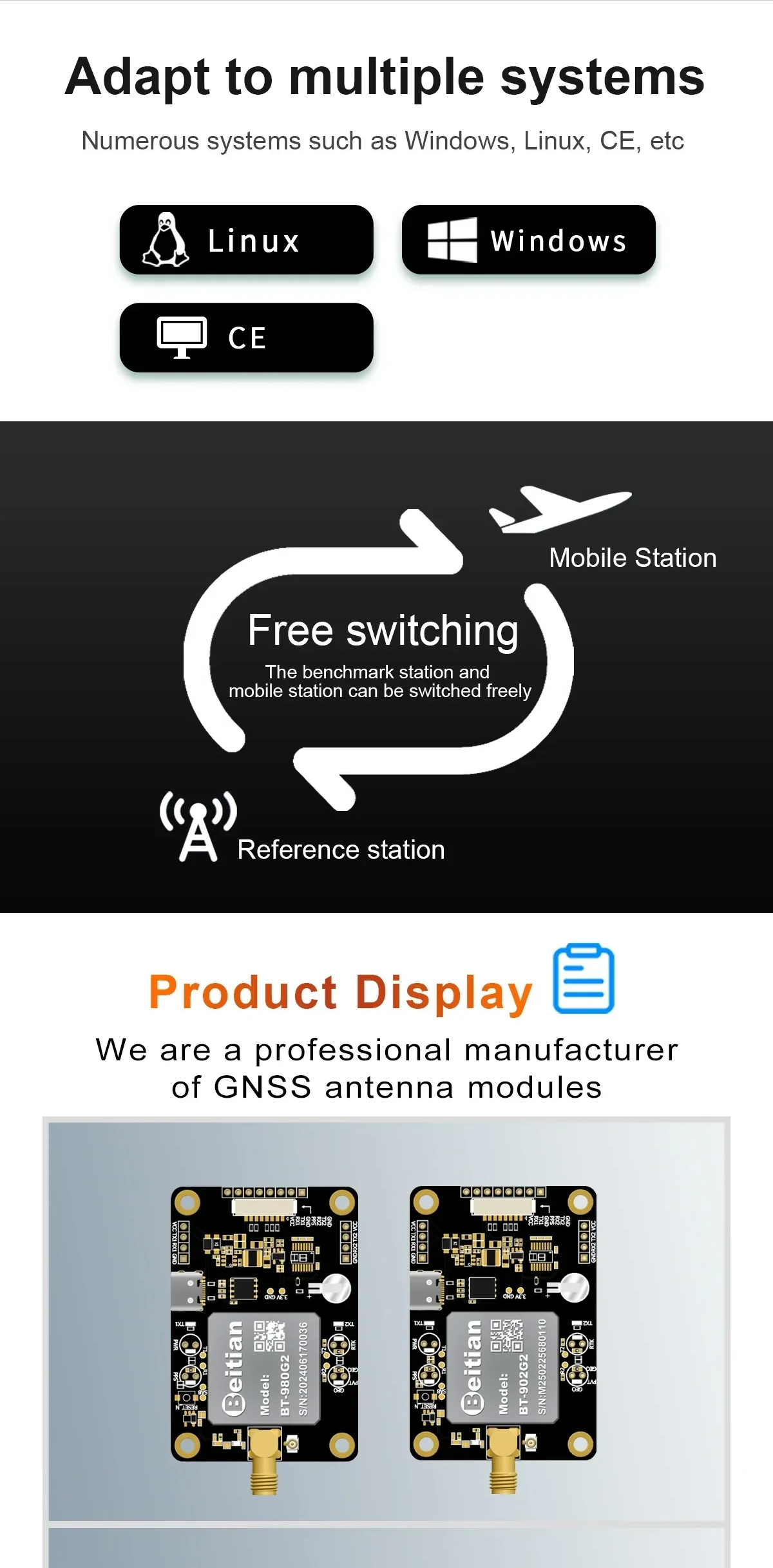
- Stöder flera system som anges: Windows, Linux, CE
Modellalternativ
- BT-980G1; BT-980G2; BT-980G3; BT-980G4
- BT-980M1; BT-980M2; BT-980M3; BT-980M4
- BT-902G1; BT-902G2; BT-902G3; BT-902G4
- BT-902M1; BT-902M2; BT-902M3; BT-902M4
Specifikationer
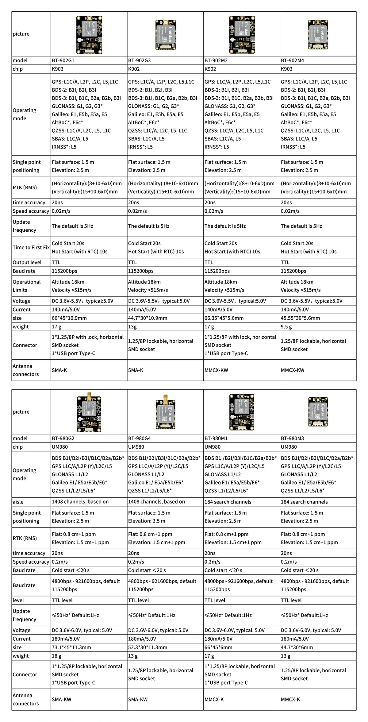
K902-serien (modeller som visas: BT-902G1 / BT-902G3 / BT-902M2 / BT-902M4)
| Chip | K902 |
| Driftsläge | GPS: L1C/A, L2P, L2C, L5, L1C; BDS-2: B1I, B2I, B3I; BDS-3: B1I, B1C, B2a, B2b, B3I; GLONASS: G1, G2, G3*; Galileo: E1, E5B, E5a, E5, AltBOC*, E6c*; QZSS: L1C/A, L2C, L5, L1C; SBAS: L1C/A, L5; IRNSS*: L5 |
| Enpunktspositionering | Platt yta: 1.5 m; Höjd: 2.5 m |
| RTK (RMS) | (Horisontalitet): (8+10-6xD)mm; (Vertikalitet): (15+10-6xD)mm |
| Tidsnoggrannhet | 20 ns |
| Hastighetsnoggrannhet | 0.02 m/s |
| Uppdateringsfrekvens | Standard är 5 Hz |
| Tid till första fix | Kallstart 20 s; Varmstart (med RTC) 10 s |
| Utgångsnivå | TTL |
| Baud rate | 115200 bps |
| Operativa gränser | Altitude 18 km; Hastighet <515 m/s |
| Spänning | DC 3.6 V-5.5 V, typisk: 5.0 V |
| Ström | 140 mA/5.0 V |
| Modell | Storlek | Vikt | Kontakt | Antennaanslutningar |
|---|---|---|---|---|
| BT-902G1 | 66*45*10.9mm | 17 g | 1*1.25/8P med lås, horisontell SMD-kontakt; 1*USB-port Typ-C | SMA-K |
| BT-902G3 | 44.7*30*10.9mm | 13 g | 1.25/8P låsbar, horisontell SMD-kontakt | SMA-K |
| BT-902M2 | 66.35*45*5.6mm | 17 g | 1*1.25/8P med lås, horisontell SMD-kontakt; 1*USB-port Typ-C | MMCX-KW |
| BT-902M4 | 45.55*30*5.6mm | 9.5 g | 1.25/8P låsbar, horisontell SMD-kontakt | MMCX-KW |
UM980-serien (modeller som visas: BT-980G2 / BT-980G4 / BT-980M1 / BT-980M3)
| Chip | UM980 |
| Driftsläge | BDS B1I/B2I/B3I/B1C/B2a/B2b*; GPS L1C/A/L2P (Y)/L2C/L5; GLONASS L1/L2; Galileo E1/E5a/E5b/E6*; QZSS L1/L2/L5/L6* |
| Kanal | BT-980G2/BT-980G4: 1408 kanaler, baserat på; BT-980M1/BT-980M3: 184 sökkanaler |
| Enpunktspositionering | Plan yta: 1,5 m; Höjd: 2,5 m |
| RTK (RMS) | Plan: 0,8 cm +1 ppm; Höjd: 1,5 cm +1 ppm |
| Tidsnoggrannhet | 20 ns |
| Hastighetsnoggrannhet | 0.2 m/s |
| Tid till första fix | Kallstart <20 s |
| Baud rate | 4800bps - 921600bps, standard 115200bps |
| Nivå | TTL-nivå |
| Uppdateringsfrekvens | <=50Hz* Standard:1Hz |
| Spänning | DC 3.6V-6.0V, typisk: 5.0V |
| Ström | 180mA/5.0V |
| Modell | Storlek | Vikt | Kontakt | Antennaanslutningar |
|---|---|---|---|---|
| BT-980G2 | 73.1*45*11.3mm | 18 g | 1*1.25/8P låsbar, horisontell SMD-kontakt; 1*USB-port Typ-C | SMA-KW |
| BT-980G4 | 52.3*30*11.3mm | 13 g | 1.25/8P låsbar, horisontell SMD-kontakt | SMA-KW |
| BT-980M1 | 66*45*6mm | 17 g | 1*1.25/8P låsbar, horisontell SMD-kontakt; 1*USB-port Typ-C | MMCX-K |
| BT-980M3 | 44.7*30*6mm | 13 g | 1.25/8P låsbar, horisontell SMD-kontakt | MMCX-K |
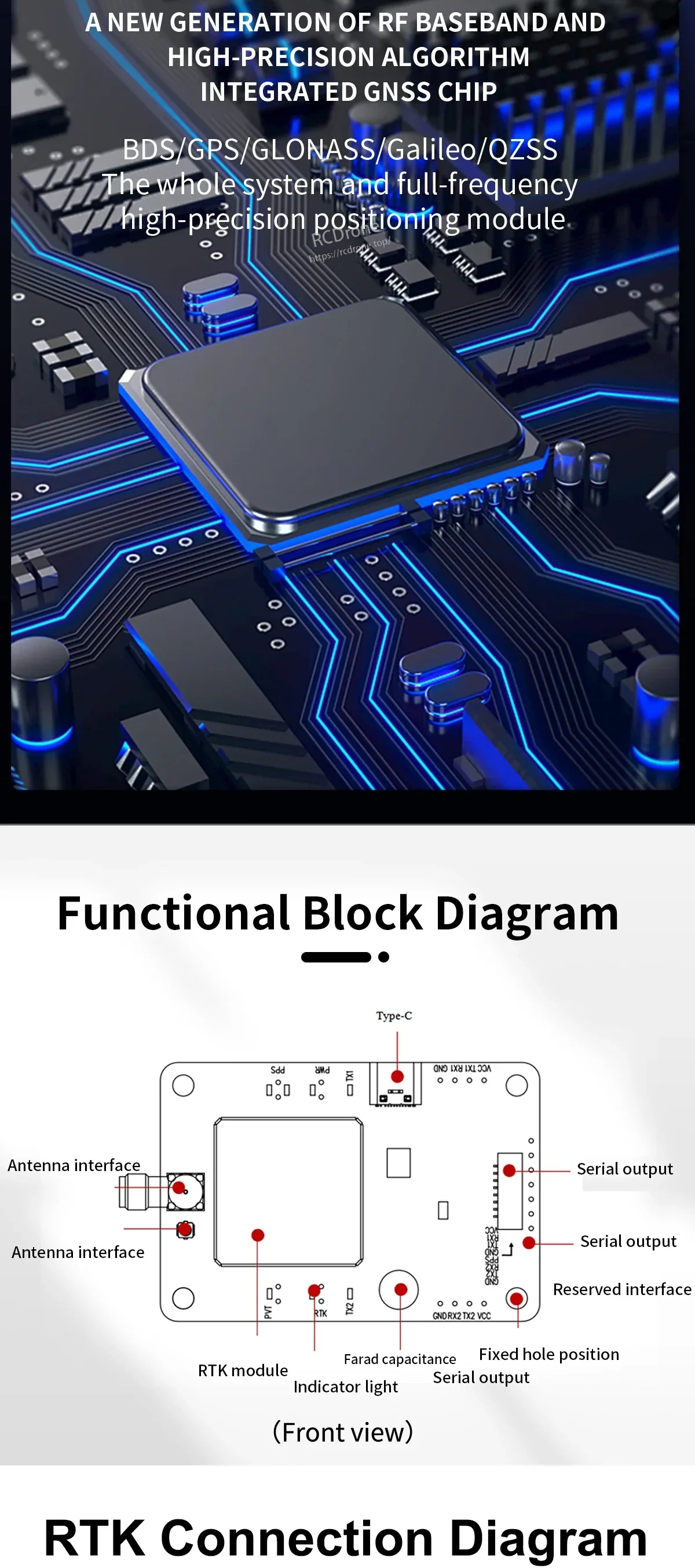
Styrenhet Layout / Gränssnitt (som märkt)
- Typ-C
- Antenngränssnitt (märkt två gånger)
- Seriell utgång (märkt flera gånger)
- Reserverat gränssnitt
- Indikatorlampa
- RTK-modul
- Farad kapacitans
- Fast hålposition
RTK-anslutning (schematisk visad)
- Konstellationer som visas: BDS / GPS / GLONASS / GALILEO
- Visade lägen: Radioanslutningsmetod (extern radiostation) och Trådad anslutningsmetod
- Bas/Rover som visas: Värdstation (Bas) och Slavstation (Rover)
- Strömförsörjning som visas: 5V > 1A (Källa)
- Signalmärkningar som visas: RX1, TX1, GND, VCC, RX2, TX2
Vad som ingår
- GNSS styrenhet/modul (nomenon) x1
- 1.25 8p med lås socket seriell kabel x1
- USB till TYPE-C kabel x1
Tillämpningar
- Droner / UAV-navigering
- Körprov och förarutbildning
- Jordbruksmaskiner navigering
- Robotar och intelligenta körsystem som kräver högprecisionspositionering
För modellvalsstöd och integrationshjälp, kontakta [email protected] or besök https://rcdrone.top/.
Detaljer
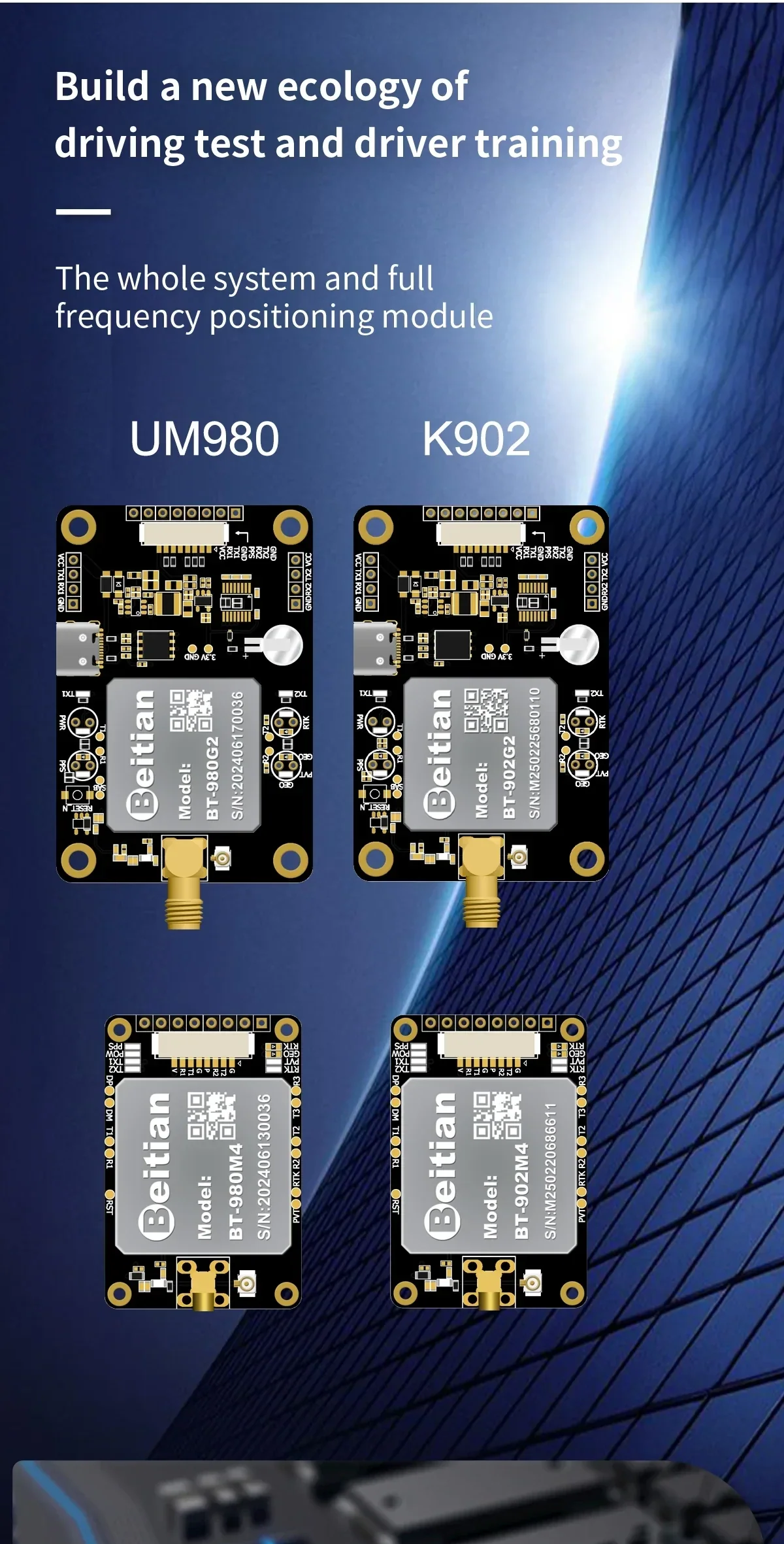
Välj UM980 eller K902 beroende på dina uppdateringsbehov och integrationsutrymme för UAV- och robotnavigeringsbyggen.
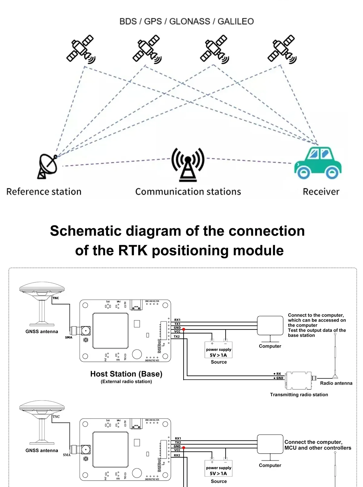
RTK-installationer kopplar en bas (referens) station med en rovermottagare för att leverera centimeter-nivå positionering när korrigeringar tillämpas.
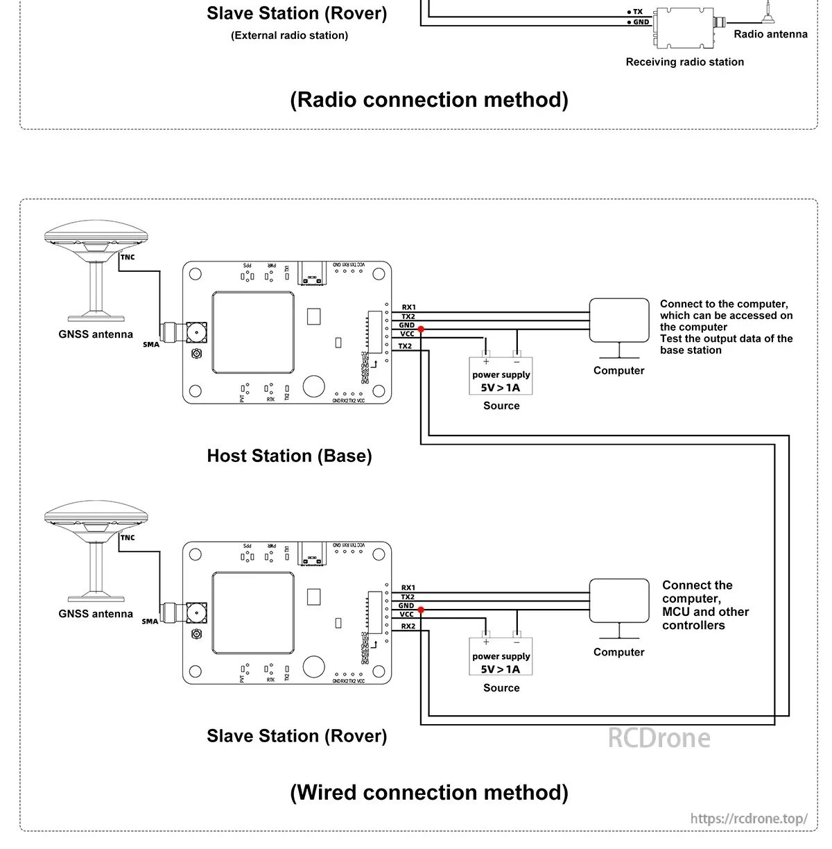
Både trådbundna och radio korrigeringslänkar stöds, vilket gör det enkelt att matcha din markstation och telemetriarbetsflöde.
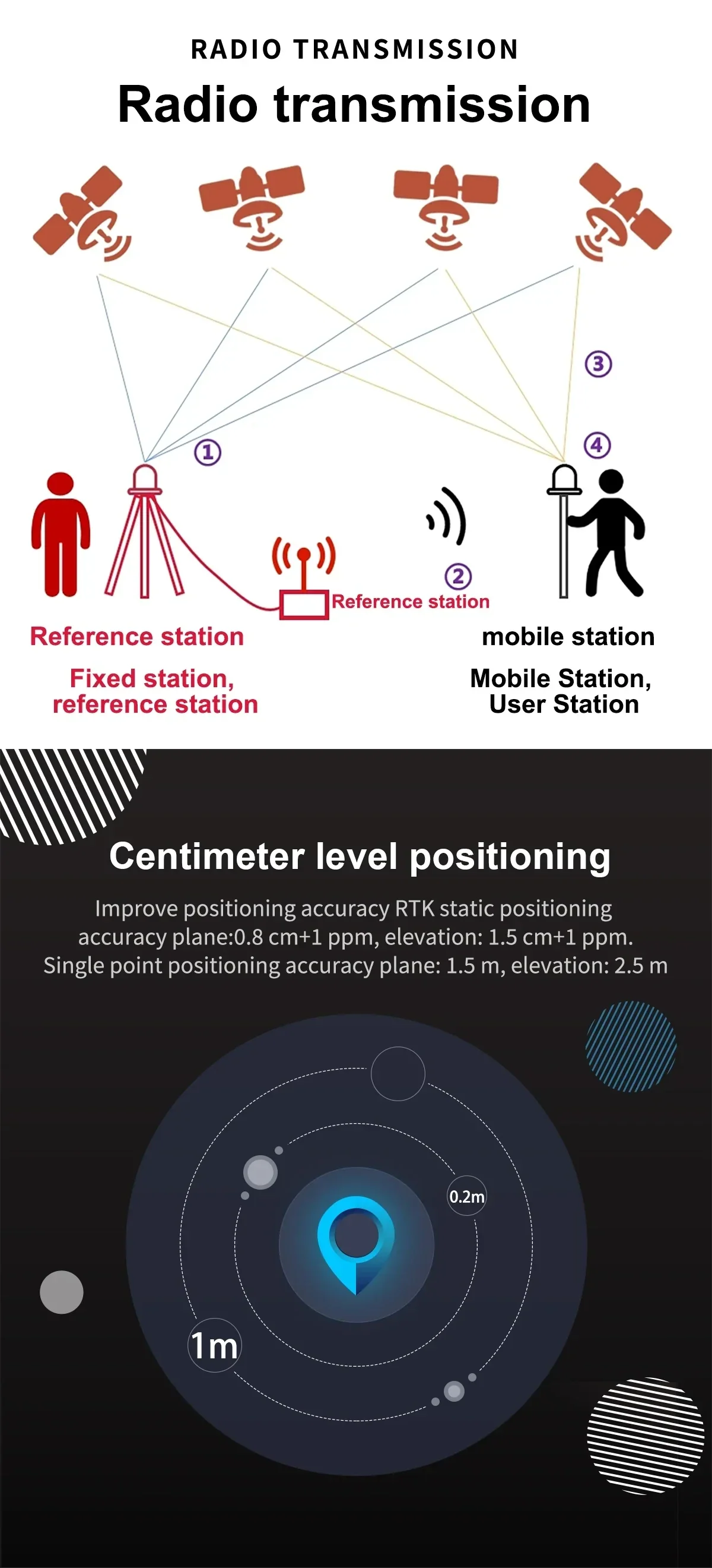
Centimeter-nivå RTK-positionering förbättrar vägledningsnoggrannheten för autonoma fordon, drönare och mätarbetsflöden.
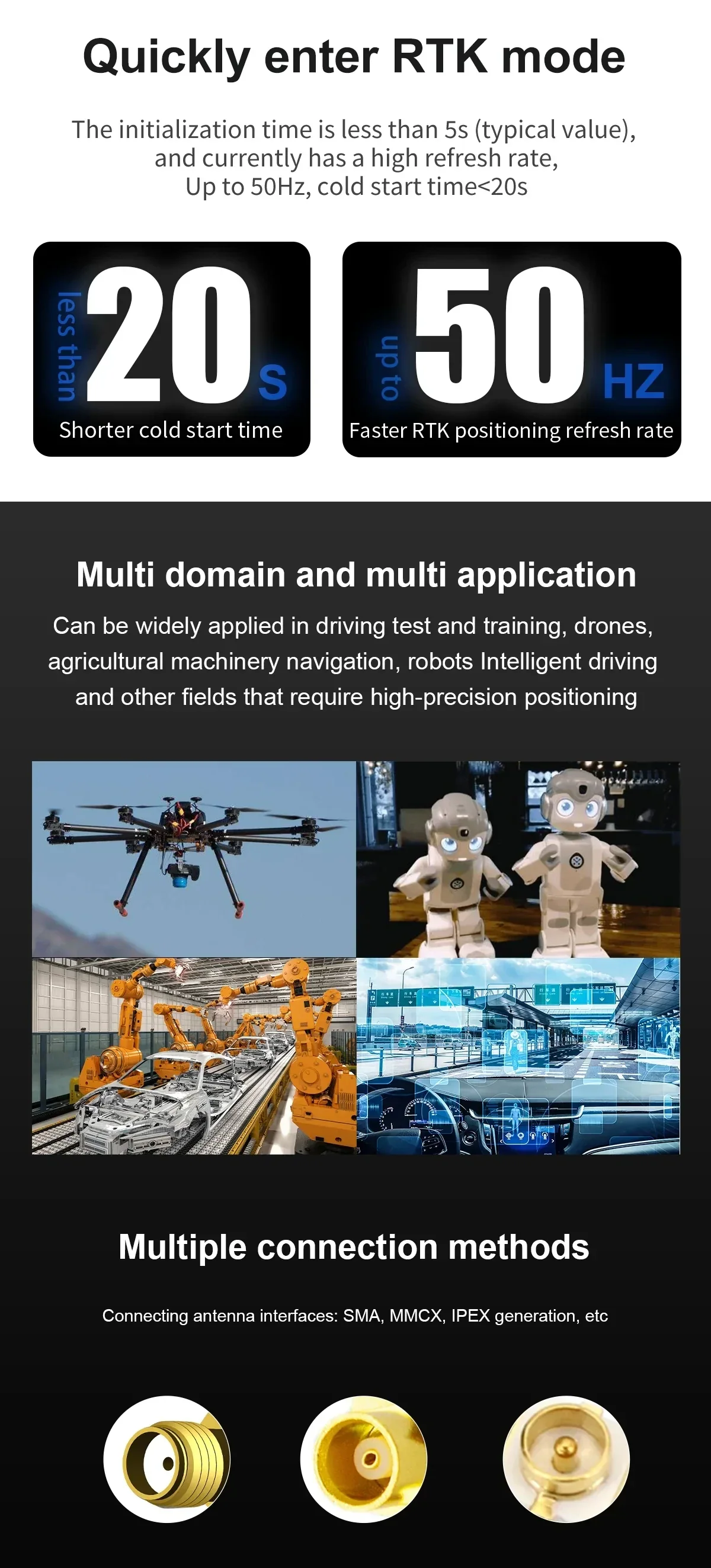
Snabb initiering och flexibla antennanslutningsalternativ hjälper till att effektivisera installationer över UAV:er, jordbruk och industriella plattformar.

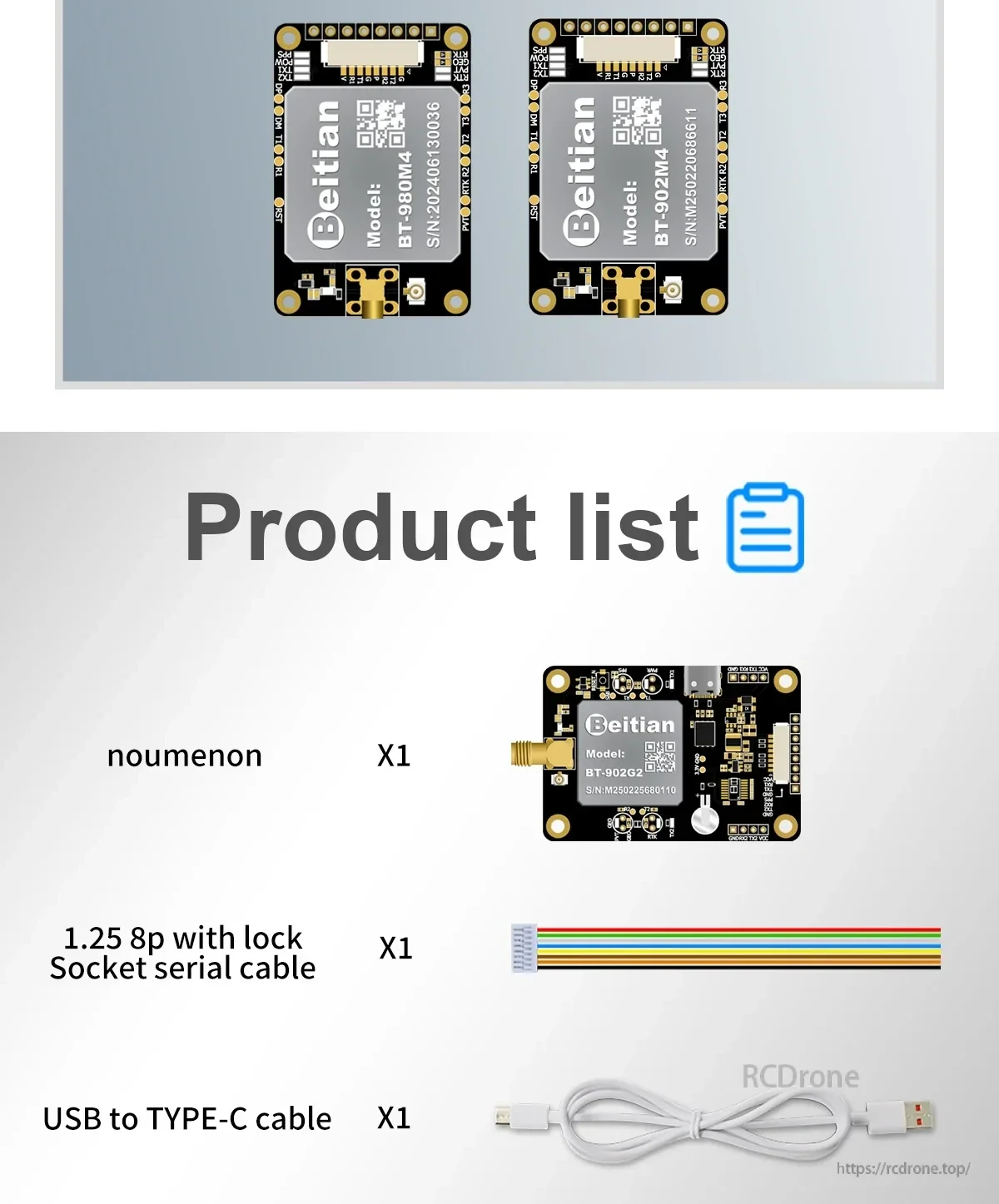
Inkluderade kablar förenklar bänksetup, konfiguration och seriell kommunikation under integration och testning.