Yahboom 3米*2米 AI視覺自動駕駛軌道地圖(雙軌)適用於AI攝像頭智能車
Yahboom 3米*2米 AI視覺自動駕駛軌道地圖(雙軌)適用於AI攝像頭智能車
yahboom
定價
$88.99 USD
定價
售價
$88.99 USD
單價
每
已包含稅額。
結帳時計算運費。
無法載入取貨服務供應情況
概述
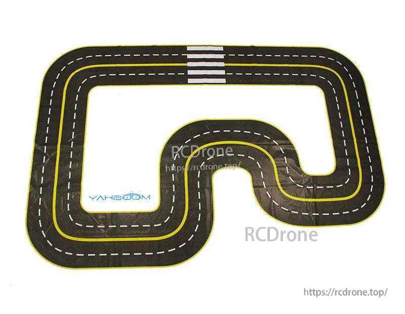
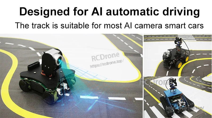
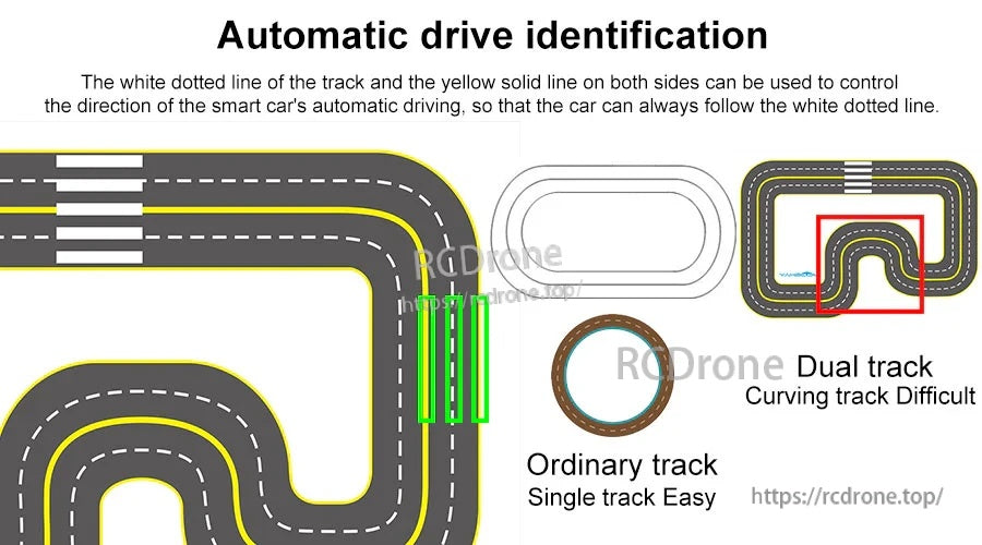
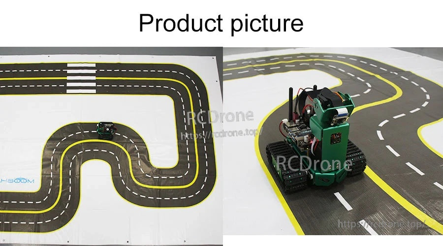
Yahboom AI 視覺自動駕駛賽道地圖 (最大至3m*2m)專為大多數 AI 攝像頭智能車的 AI 自動駕駛/自動駕駛實驗而設計。它使用雙軌佈局,並設有參考標記(白色虛線和黃色實線)以幫助在視覺跟踪過程中引導和控制車輛的運動方向。
與普通的圓形賽道相比,這張地圖包括90° 直角, 不同角度的轉彎,以及一個模擬人行道 以支持更多樣化的駕駛場景。
主要特點
- 大尺寸雙軌道, 設計用於AI自動駕駛
- 視覺跟踪參考線: 白色虛線 + 兩側黃色實線
- 軌道設計包括90°直角彎道, 連續曲線和模擬人行道
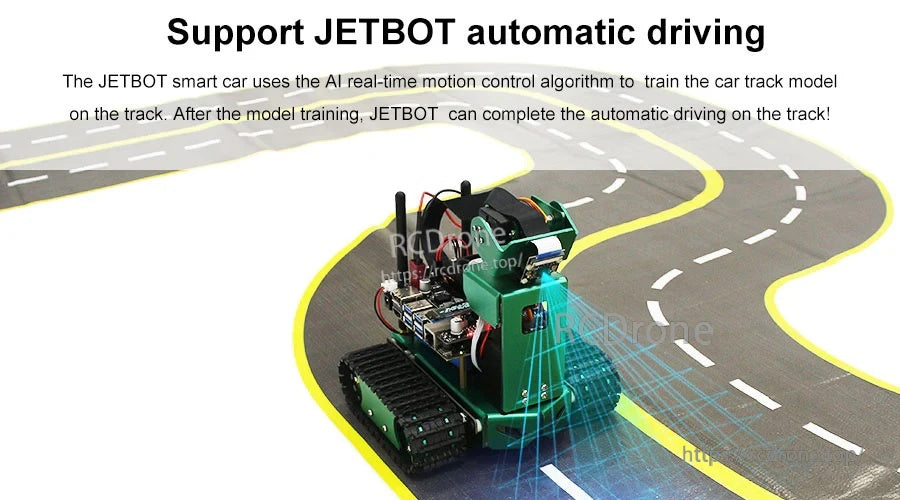
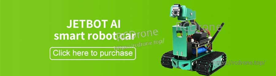
- 適用於大多數AI攝像頭智能車; 支持JETBOT 自動駕駛工作流程(模型訓練然後在軌道上自主駕駛)
- 耐用材料描述為防水布; 跟踪參數列表防水布
規格
| 產品名稱 | AI視覺自動駕駛軌道 |
| 尺寸 | 2m*3m(也描述為最高3m*2m) |
| 材料 | 防水布(防水布) |
| 軌道數量 | 2 |
| 彎曲角度 | 90° |
| 軌道難度 | 連續曲線/人行道 |
| 單側軌道寬度 | 20cm |
| 其他可見標記 | 40CM(標籤顯示在跟踪參數圖上) |
包含內容
- AI視覺自動駕駛軌道圖 *1
應用場景
- AI攝像車視覺線跟隨和自動駕駛訓練
- 雙軌通過、雙軌駕駛和雙車競速場景
- 測試直角轉彎、多半徑曲線和模擬人行道區域的極端情況
如需產品選擇幫助或售後支持,請聯繫https://rcdrone.top/或發送電子郵件至[email protected] .
賽道地圖購買指南(參考)
購買指南圖形列出了以下賽道地圖選項(代表Yahboom產品):
| 基礎賽道地圖 | 難度:L1 | 原理:2通道紅外線追蹤 | 尺寸:57*42cm(紙張) |
| 進階賽道地圖 | 難度:L2 | 原理:3通道或以上紅外線追蹤 | 尺寸:200*150cm(防水帆布) |
| 自動駕駛地圖迷你版 | 難度:L3 | 原理:視覺識別模組 & 交通標誌模型訓練 & 紅外線/視覺追蹤 | 尺寸:200*150cm(PVC材料) |
| 自動駕駛賽道地圖 | 難度:L4 | 原理:自動駕駛地圖模型訓練 & 交通標誌模型訓練 & SLAM 路網導航 | 尺寸:320*280cm (UV打印高端油畫布) |
| AI大模型場景沙盒地圖 | 難度:L5 | 原理:模擬工廠處理/檢查 & SLAM 路網導航 & AI大模型應用 | 尺寸:410*300CM (UV打印高端油畫布) |
詳情
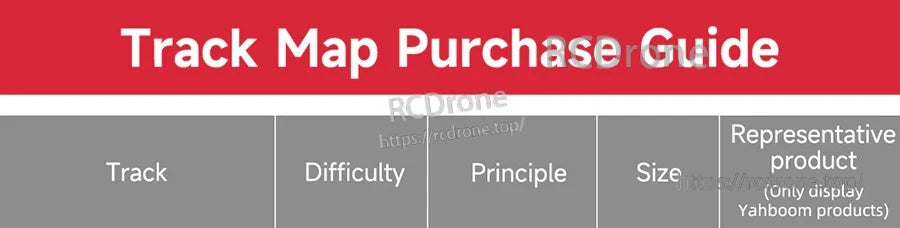
根據難度級別和感應方法選擇合適的賽道地圖,從紅外線循跡到視覺、SLAM和大模型場景。
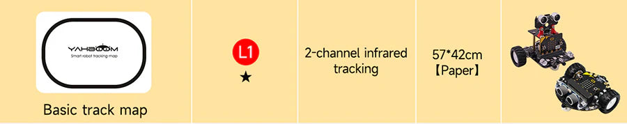
緊湊型L1紙軌道非常適合入門級紅外線循跡實驗。
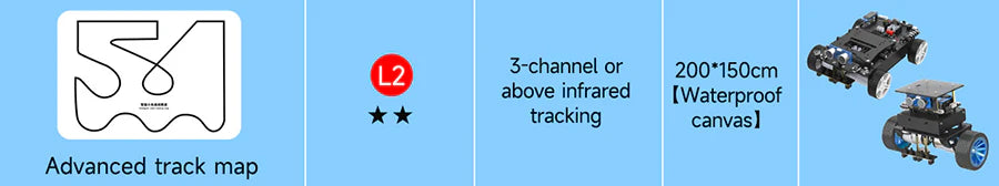
升級到更大的防水帆布軌道以進行多通道紅外線跟蹤練習。
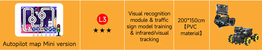
迷你自動駕駛地圖增加了視覺識別和交通標誌訓練,佔用空間更小。
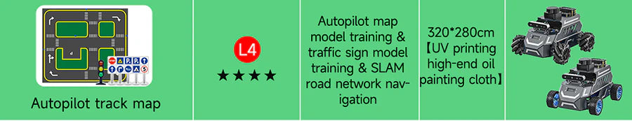
更高難度的自動駕駛地圖支持模型訓練和SLAM風格的道路網絡導航。
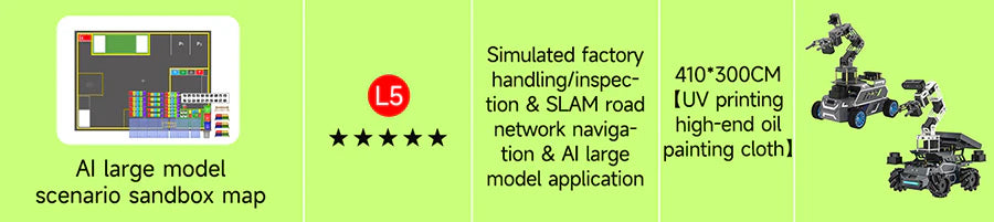
場景沙盒佈局專為複雜的物流和檢查工作流程而設計。
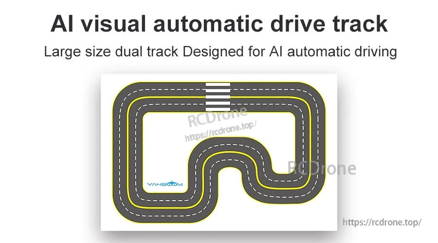
3米×2米雙軌佈局增加了直角和多樣曲線,以進行更真實的自動駕駛練習。
高對比度車道標記幫助視覺模組在視覺循跡過程中鎖定方向提示。
在訓練模型後,相同的賽道可用於無人駕駛圈和可重複的測試。
白色虛線引導加上黃色側線提供穩定的參考,用於轉向控制和車道保持。
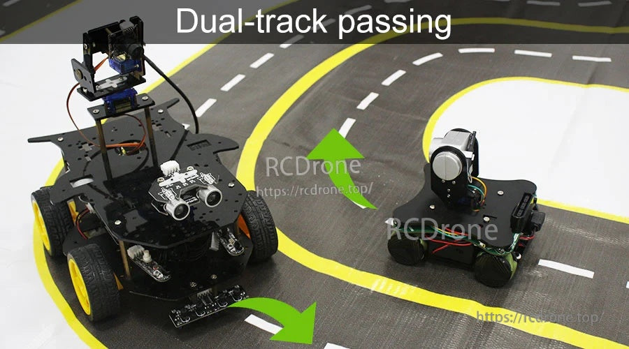
雙車道使練習超車、雙車競速和多車行為變得更容易。
墊子平放,便於在教室、實驗室或家庭工作空間快速設置。
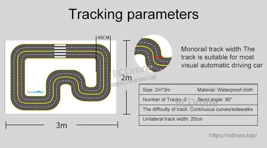
關鍵參數包括2米×3米的尺寸、兩條軌道、90°轉角和20厘米單車道寬度的防水布。