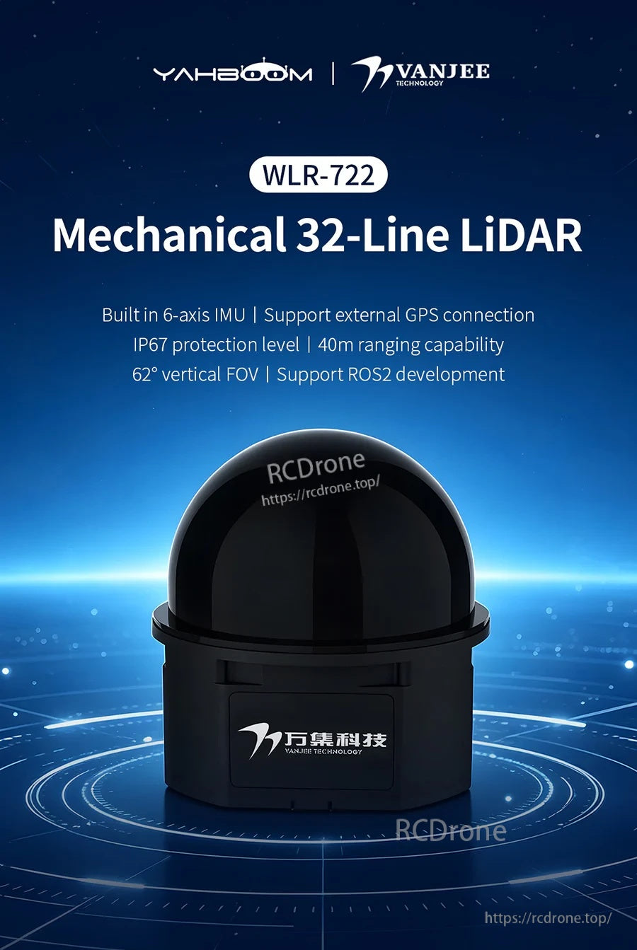
VANJEE WLR-722 32線機械式LiDAR 40米TOF 360° 62°視場角 IP67 乙太網 ROS2 Autoware
VANJEE WLR-722 32線機械式LiDAR 40米TOF 360° 62°視場角 IP67 乙太網 ROS2 Autoware
Yahboom
無法載入取貨服務供應情況
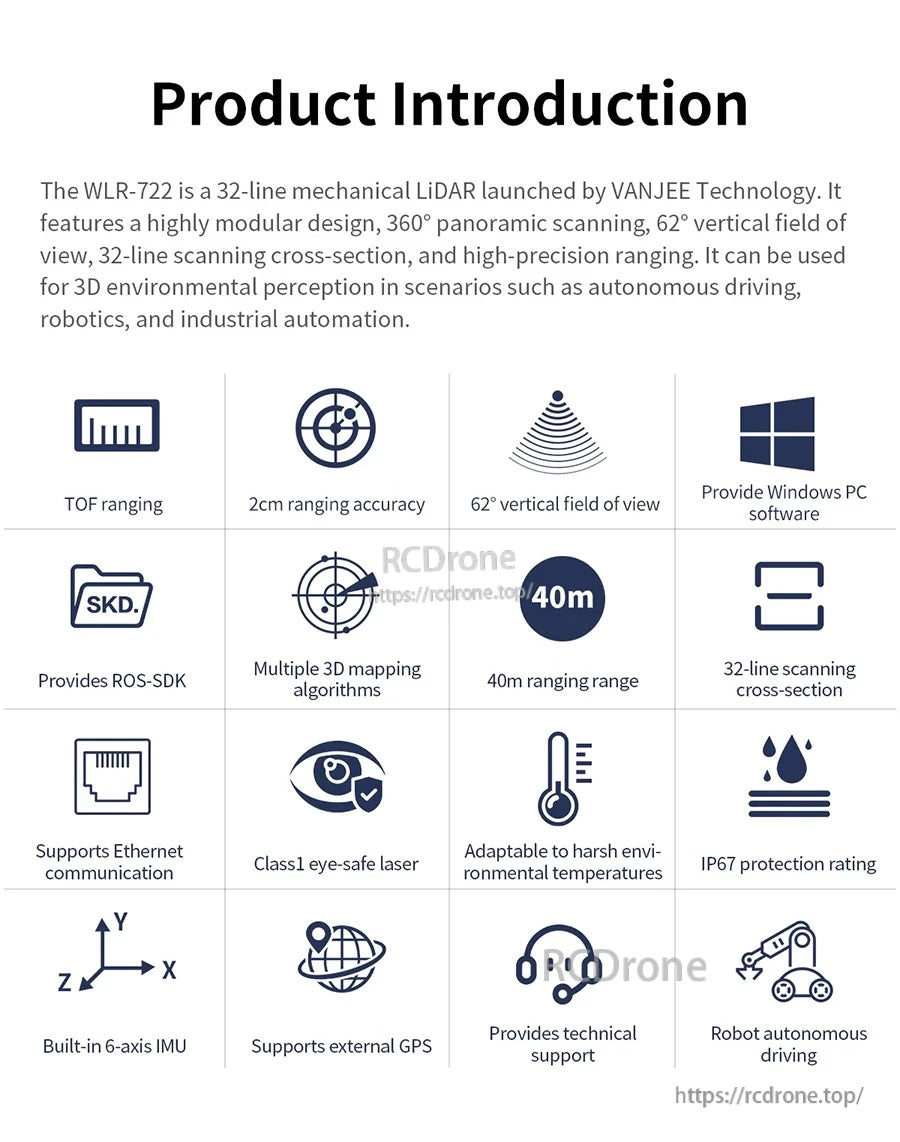
概述
VANJEE WLR-722 是一款 32 線機械式 LiDAR,適用於機器人和低速自動駕駛場景。它使用 TOF(飛行時間)測距原理,提供 360° 全景掃描和 62° 垂直視野,實現 3D 環境感知以進行地圖繪製和導航。
主要特點
- 32線球面掃描設計;寬視野:62°(垂直)x 360°(水平)
- 測距能力:最遠40米;測距精度:最高±2厘米(典型值)
- 內建6軸IMU(ICM-42688),可校正因加速/減速或不平坦地形造成的點雲失真
- IP67防護等級;封閉的獨立外殼有助於保護內部旋轉機構以穩定運行
- 以太網通信;傳輸方式:UDP/IP
- 支持外部GPS連接;時間來源:NTP / PTP / GPS
- 激光:1級(眼睛安全),905nm波長
- 軟體生態系統:提供ROS-SDK;支持ROS2開發;適配Autoware.Universe 並提供相關例程
- 提供Windows PC軟體
規格
| 型號 | WLR-722 |
| 行數 | 32 行 |
| 距離測量範圍 | 0.2~40m@10% |
| 距離測量精度 | ±2cm (典型值) |
| 水平掃描視場角 | 360° |
| 水平掃描解析度 | 0.3° |
| 垂直掃描視場角 | 62° (-12°~50°) |
| 垂直掃描解析度 | 1~4, 29~32: 高達 2°; 5~28: 2° (均勻分佈) |
| 掃描頻率 | 10Hz |
| 回波模式 | 單回波 |
| 激光波長 | 905nm |
| 人眼安全等級 | Class 1 (眼睛安全) |
| 通信接口 | 以太網 |
| 工作電壓 | 12-32V DC (電源功率 >20W) |
| 功率 | 5W |
| IMU | ICM-42688 |
| 防護等級 | IP67 |
| 尺寸 | 直徑 75mm x 75mm x 75mm |
| 淨重 | 265g> |
| 操作溫度 | -25°C~60°C |
| 儲存溫度 | -40°C~80°C |
| 傳輸方式 | UDP/IP |
| 輸出數據 | 距離、水平方位、反射率 |
| 時間來源 | NTP, PTP, GPS |
| GPS同步精度 | <=10ns |
| GPS時鐘漂移 | <=10ns/s |
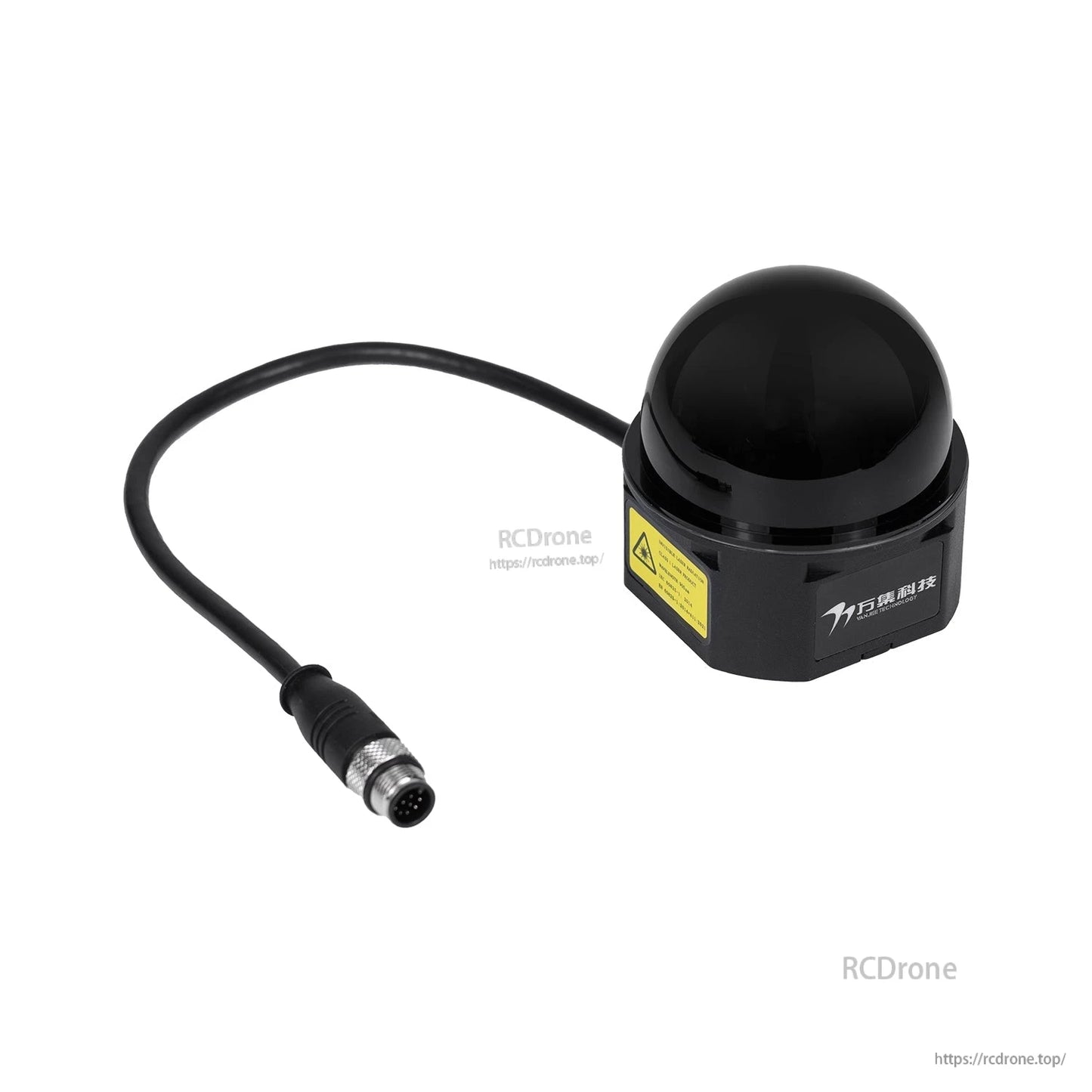
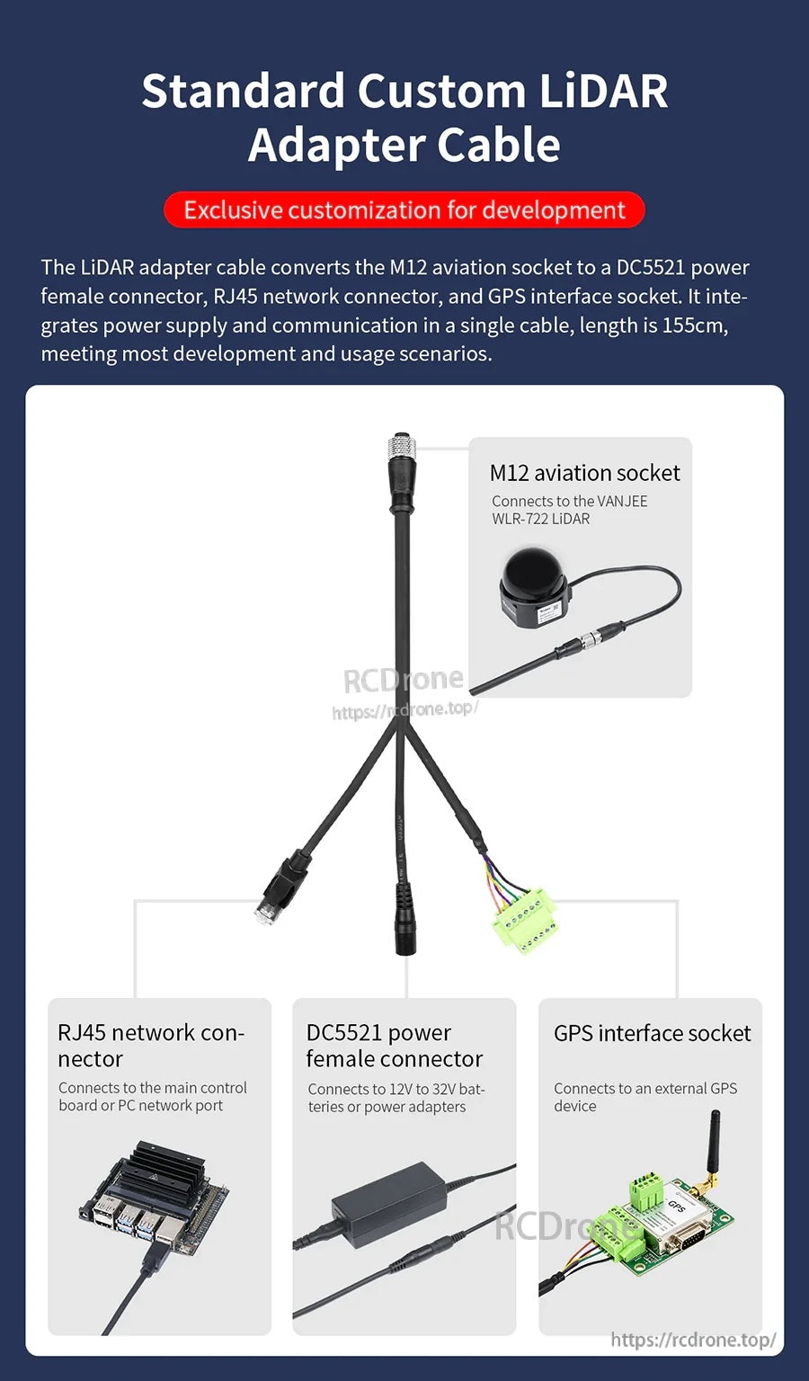
轉接線 (1 to 3)
提供標準定制的LiDAR轉接線以供開發。它將M12航空插座轉換為DC5521電源母接頭、RJ45網絡接頭和GPS接口插座,將電源供應和通信集成在一根電纜中。
- 電纜長度:155cm
- M12航空插座:連接到VANJEE WLR-722 LiDAR
- RJ45網絡連接器:連接到主控板或PC網絡端口
- DC5521電源母接頭:連接到12V至32V電池或電源適配器
- GPS接口插座:連接到外部GPS設備
應用
- 機器人3D環境感知、地圖繪製和導航
- 低速自動駕駛平台
- 需要360°感知的工業自動化場景
教程
官方教程頁面:https://www.yahboom.net/study/WLR722-32
視頻
支持
如有售前問題、集成指導(Ethernet/ROS/ROS2/Autoware.Universe)或售後協助,請聯繫[email protected] or訪問https://rcdrone.top/.
詳細信息
VANJEE WLR-722 提供 32 線機械掃描,具有 360° 視野和 62° 的垂直視野,實現可靠的 3D 感知。
核心功能包括 TOF 測距、以太網輸出、IP67 防護、內建 IMU 支援,以及 ROS 工作流程的開發工具。
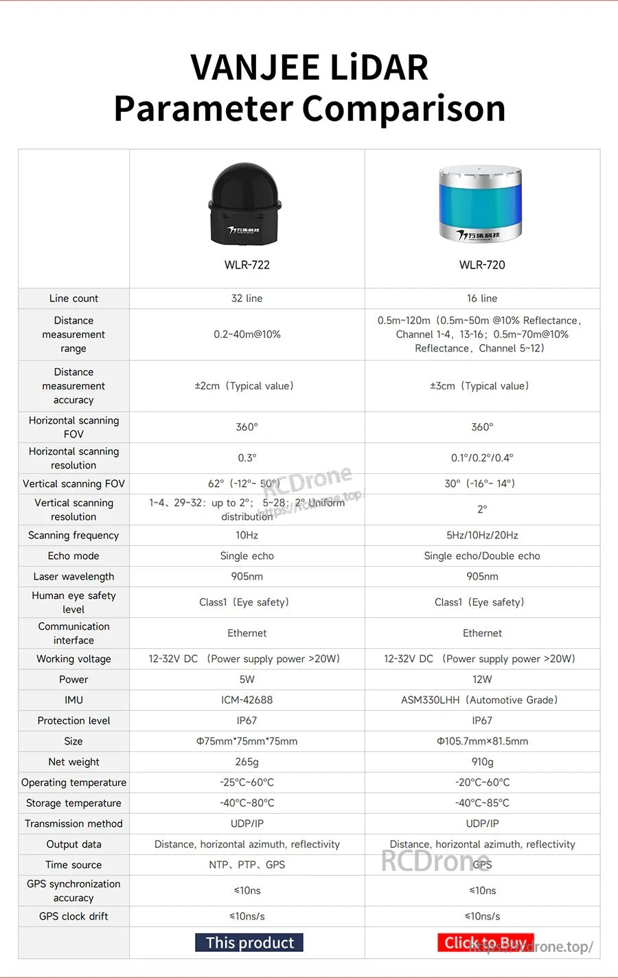
並排比較有助於在整合到機器人或車輛平台之前確認 WLR-722 的關鍵參數。
標準適配器電纜結合了電源、以太網絡和外部 GPS 介面,簡化了檯面測試和部署佈線。

該傳感器專為機器人和低速自動駕駛設計,支持室內和室外任務中的地圖繪製、導航和障礙物感知。

ROS-SDK 的可用性縮短了在 ROS/ROS2 環境中構建感知管道和傳感器驅動程序的團隊的開發時間。

預先適應的映射/導航程序幫助團隊在ROS設置中更快地驗證SLAM和路徑規劃。
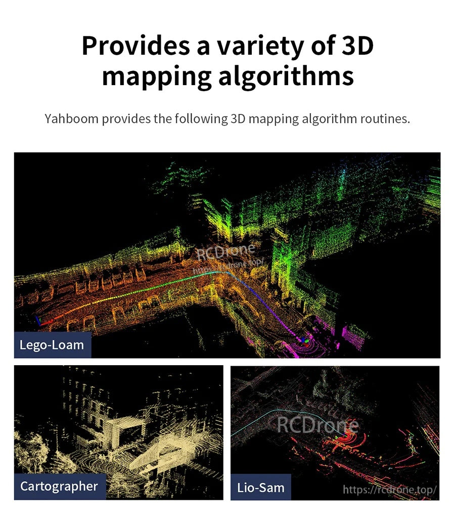
多種3D映射算法選項支持不同的SLAM策略,取決於環境的複雜性和計算預算。

Autoware.Universe兼容性支持依賴於標準化模塊和工作流程的自動駕駛研究堆棧。
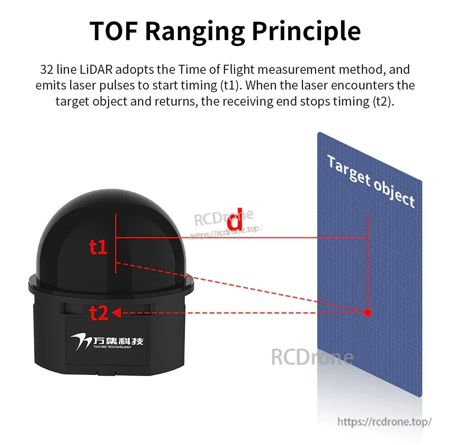
飛行時間測量通過計算激光脈衝的往返時間來計算距離,從而實現3D點雲的一致測距。

具有廣泛垂直覆蓋的32通道掃描模式在運動過程中改善了對近地面和高架障礙物的檢測。
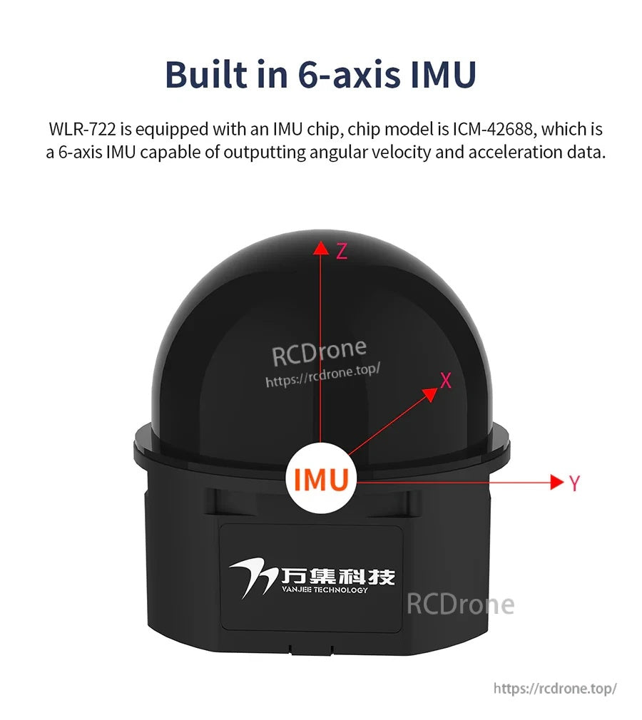
內置的6軸IMU有助於減少運動引起的失真,提高在不平地面或加速變化期間的映射穩定性。
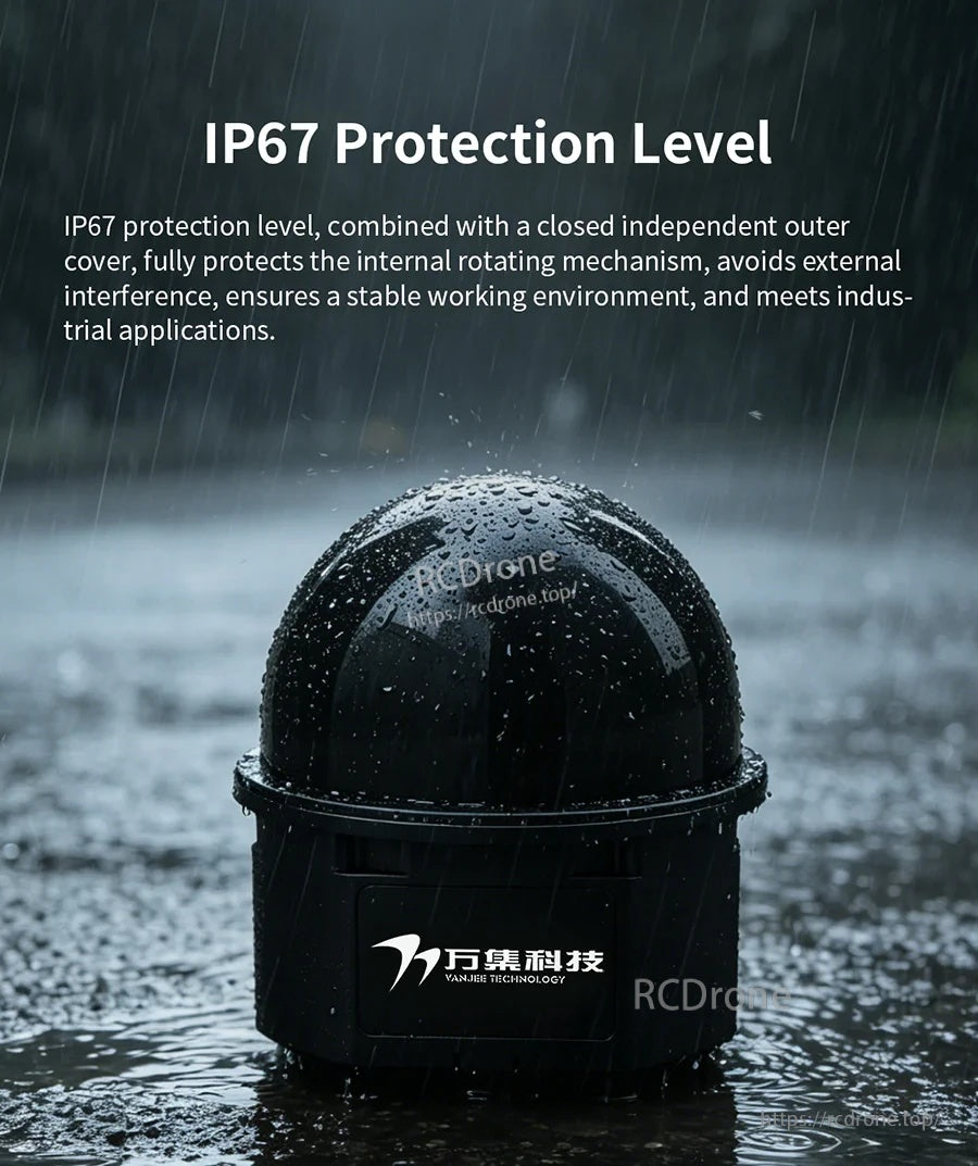
IP67 密封和封閉的外蓋有助於保護旋轉機構,以在潮濕或多塵的環境中穩定運行。
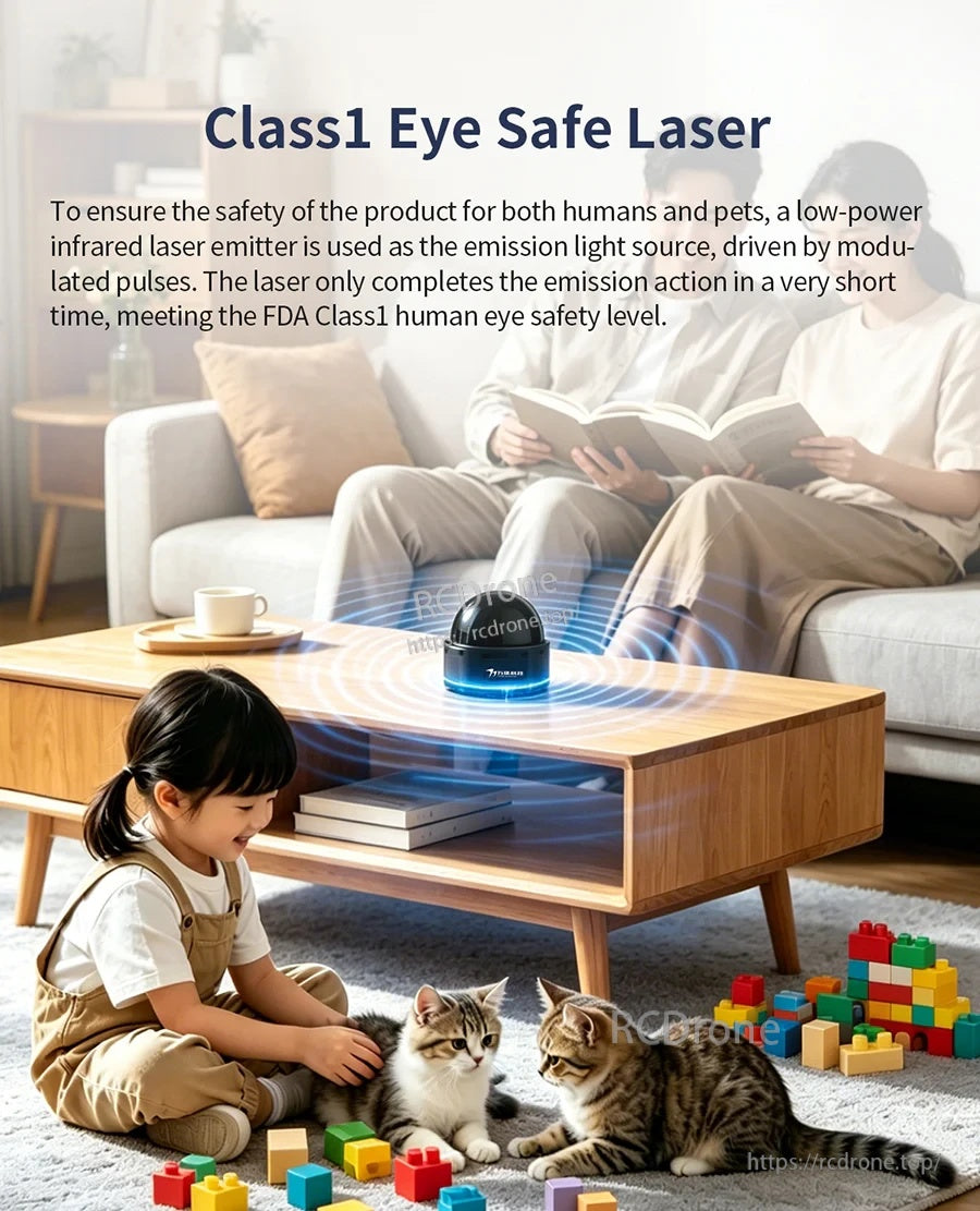
Class 1、對眼睛安全的雷射設計支持在測試或操作期間人和寵物可能在附近的共享空間中使用。
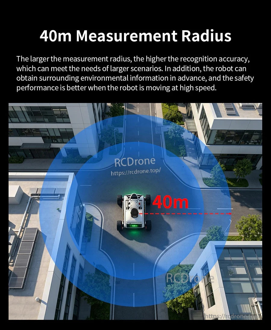
高達 40 米的測距支持更早的障礙物感知和更順暢的路徑規劃,適用於較大的室內區域和戶外路線。

Windows 客戶端軟體可讓您在設置、校準和現場測試期間查看和驗證 360° 點雲輸出。
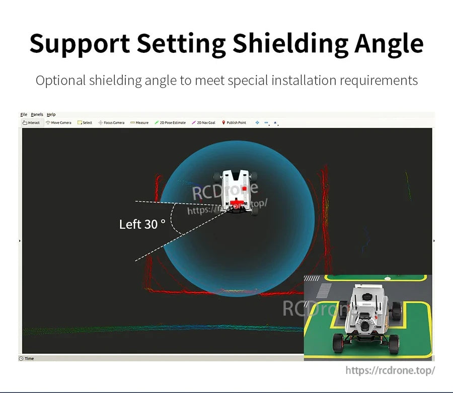
可選的屏蔽角度允許遮蔽被遮擋或不需要的區域,以更好地匹配傳感器放置和車輛幾何形狀。
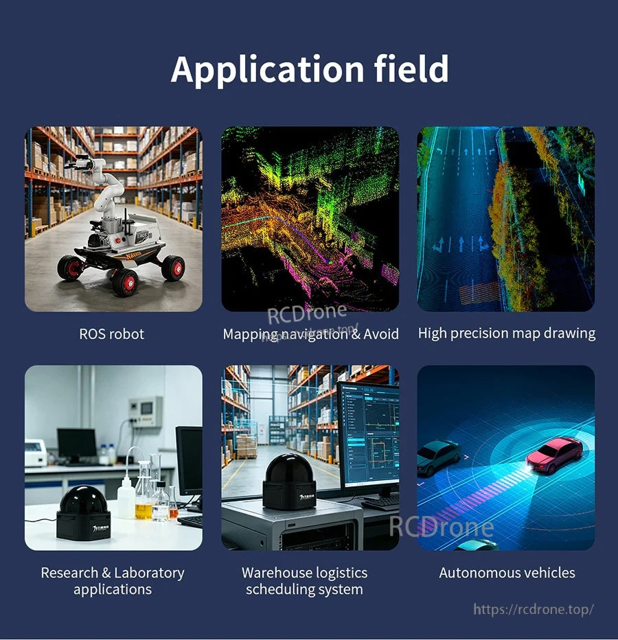
典型應用包括倉庫機器人、研究平台、物流調度系統和自動駕駛車輛原型。
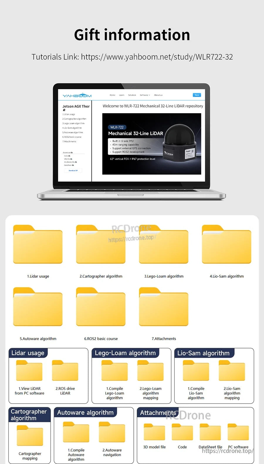
VANJEE WLR-722 教學材料和可下載文件夾幫助您獲取 LiDAR 使用指南和相關算法資源。
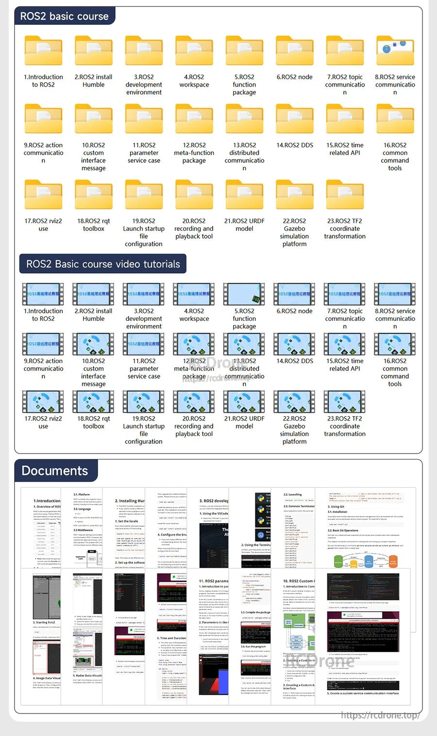
ROS2 基礎課程將學習內容組織成模塊化文件夾,並提供視頻教程和支持文件作為參考。

VANJEE WLR-722 的尺寸圖以毫米為單位,幫助確認安裝孔間距、總高度和連接器間隙,以便整合。
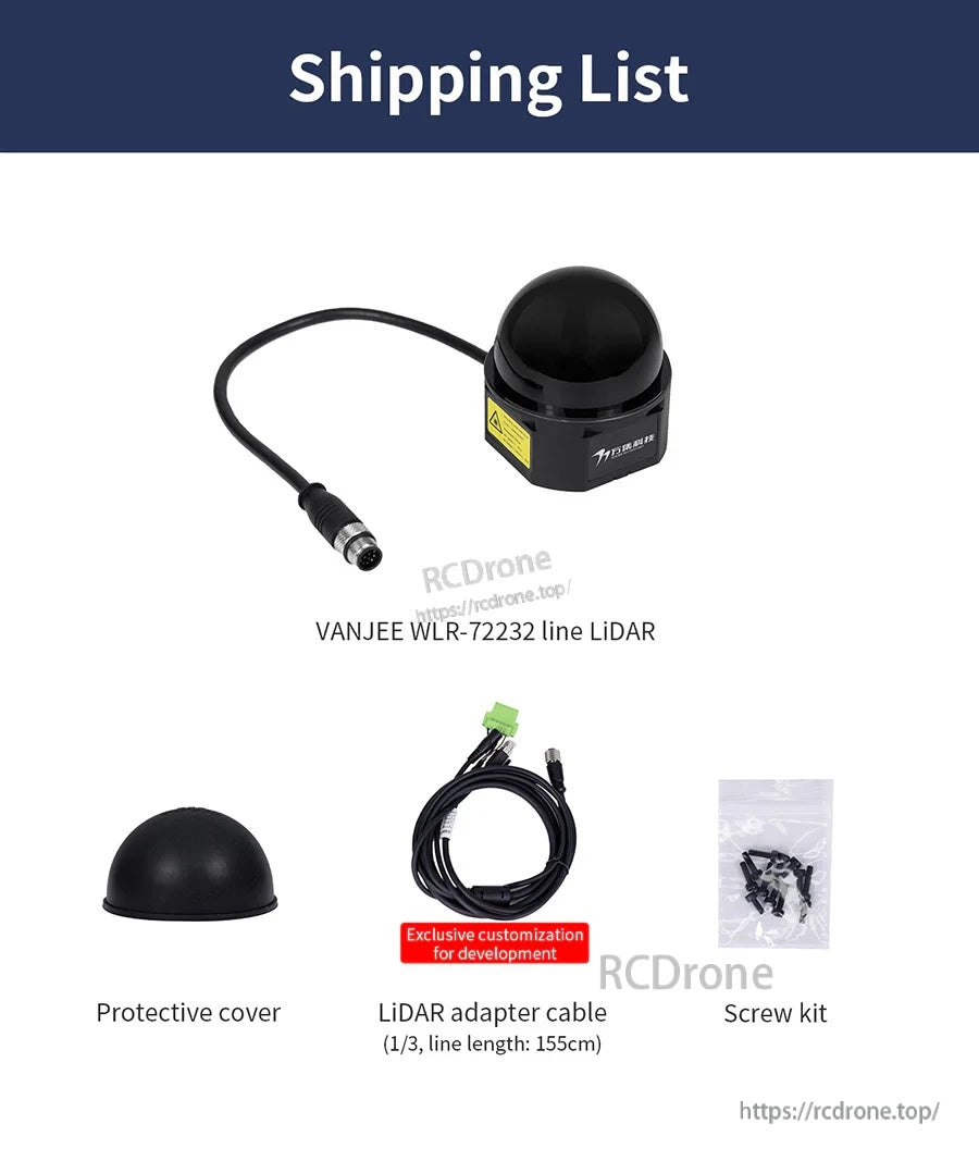
VANJEE WLR-722 LiDAR 套件包括傳感器、保護蓋、LiDAR 轉接電纜和安裝用螺絲套件。
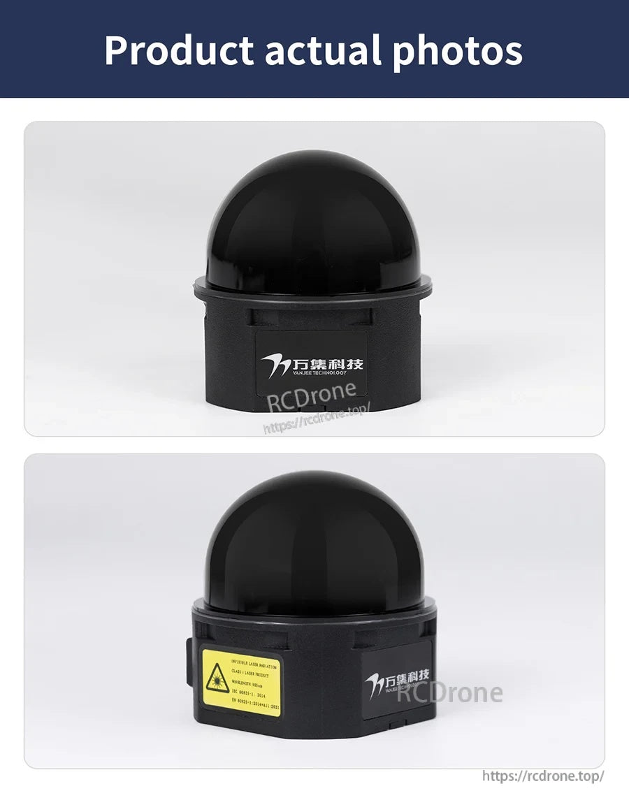
VANJEE WLR-722 機械式 LiDAR 具有緊湊的黑色圓頂式外殼,適合在機器人平台上整合。