


Beitian BT-T076 Antena GNSS Multi-Konstelasi Jalur Penuh SMA-J untuk Penentududukan RTK UAV
Beitian BT-T076 Antena GNSS Multi-Konstelasi Jalur Penuh SMA-J untuk Penentududukan RTK UAV
Beitian
Tidak dapat memuatkan ketersediaan pengambilan


Overview
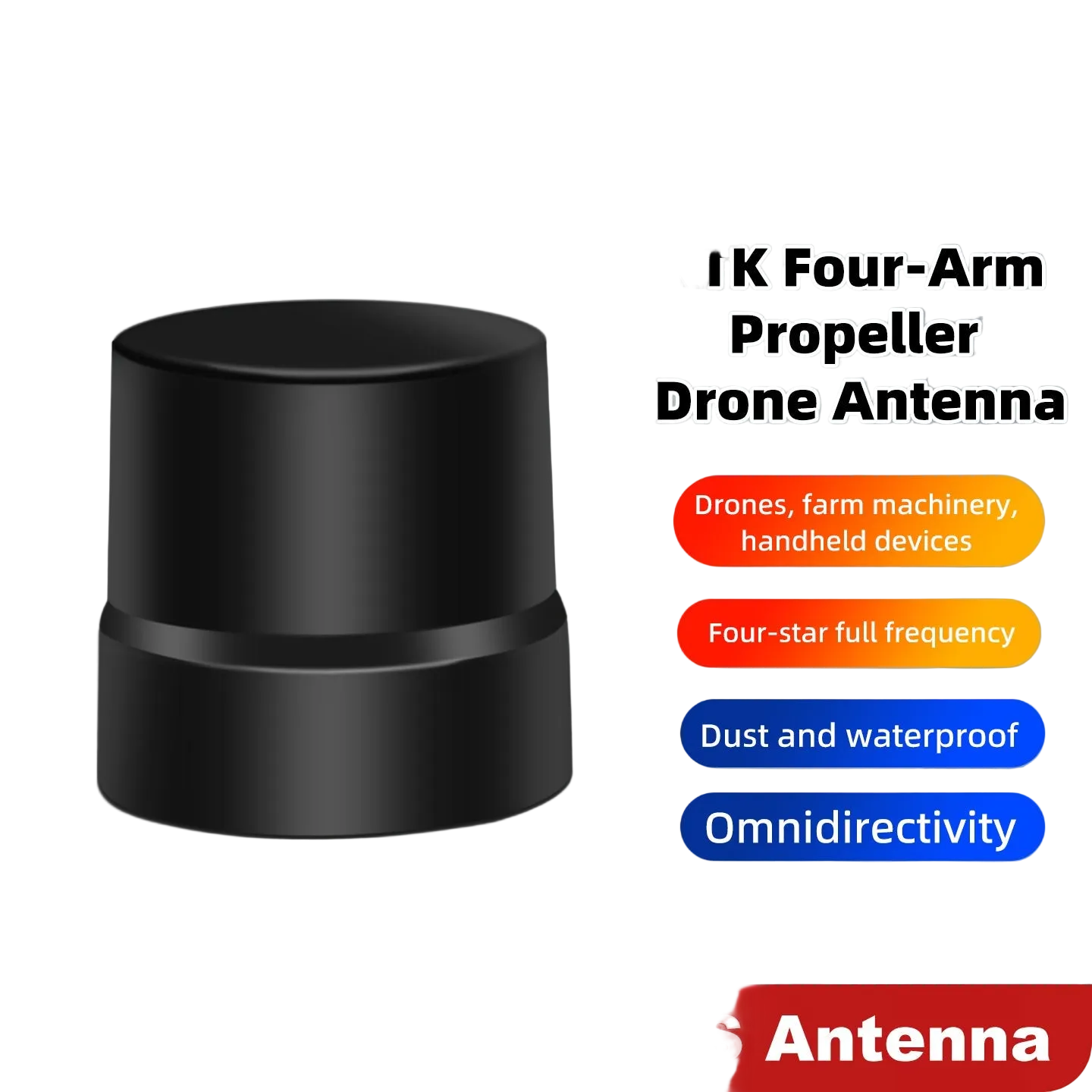
Beitian BT-T076 adalah antena GNSS helical quadrifilar berketepatan tinggi untuk aplikasi penentuan kedudukan profesional seperti stesen asas RTK, pengukuran/pemetaan, dan tinjauan udara UAV. Ia menyokong penerimaan jalur penuh, multi-konstelasi dengan pusat fasa yang stabil, prestasi anti-multipath, dan liputan mendatar omnidirectional 360° untuk operasi luar jangka panjang dalam sistem penentuan kedudukan tahap sentimeter.
BT-T076 direka dengan saiz kompak dan berat ringan untuk disesuaikan dengan platform UAV, terminal mudah alih, dan peralatan RTK kecil.
Ciri Utama
- Sokongan GNSS jalur penuh + L-Band: GPS / GLONASS / GALILEO / BDS / QZSS / IRNSS / SBAS
- Polarization bulatan tangan kanan (RHCP)
- Sudut liputan mendatar 360°
- Ralat pusat fasa rendah: ±2 mm
- LNA terintegrasi dengan gain 32±2 dB
- Faktor bentuk kompak: Φ39.0 × 40.8 mm; berat ≤35 g
Spesifikasi
| Model | BT-T076 |
| Frekuesi / Konstelasi |
GPS L1/L2/L5 GLONASS L1/L2 GALILEO E1/E5a/E5b BDS B1/B2/B3 QZSS L1/L2/L5/L6 IRNSS L5 SBAS L1/L5 L-Band |
| Peningkatan | 3 dB |
| Antenna AR | ≤3 dB |
| Sudut liputan mendatar | 360° |
| VSWR | ≤2 |
| Polarization | Polarization bulat tangan kanan |
| Impedans port | 50 Ω |
| Kesalahan pusat fasa | ±2 mm |
| Peningkatan LNA | 32±2 dB |
| Angka hingar | ≤2 dB |
| Voltan operasi | 3.3–5.0 V |
| Arus operasi | ≤55 mA |
| Output VSWR | ≤2 |
| Kepanjangan dalam jalur | ±2 dB |
| Penundaan penghantaran diferensial | ≤5 ns |
| Jenis penyambung | SMA-J |
| Saiz antena | Φ39.0 × 40.8 mm |
| Berat antena | ≤35 g |
| Suasana operasi | -40 hingga +70 °C |
| Suasana penyimpanan | -55 hingga +70 °C |
Dimensi
- Panjang utama: 40.80 ±0.3 mm
- Diameter luar: Φ43.50 ±0.2 mm
- Diameter ciri dalam: Φ26.6 ±0.1 mm
- Lubang pemasangan: 3 × M2.5, kedalaman 7 mm
Permohonan
- Stesen asas RTK, pengukuran dan pemetaan
- Pengukuran udara UAV dan pertanian tepat
- Pemantauan ubah bentuk
- Kenderaan/kapal tanpa pemandu, robot autonomi, dan navigasi marin
Untuk panduan pemasangan dan soalan keserasian pra-jualan (sokongan penerima, kabel/adaptor, dan integrasi), hubungi https://rcdrone.top/ atau emel [email protected].
Butiran
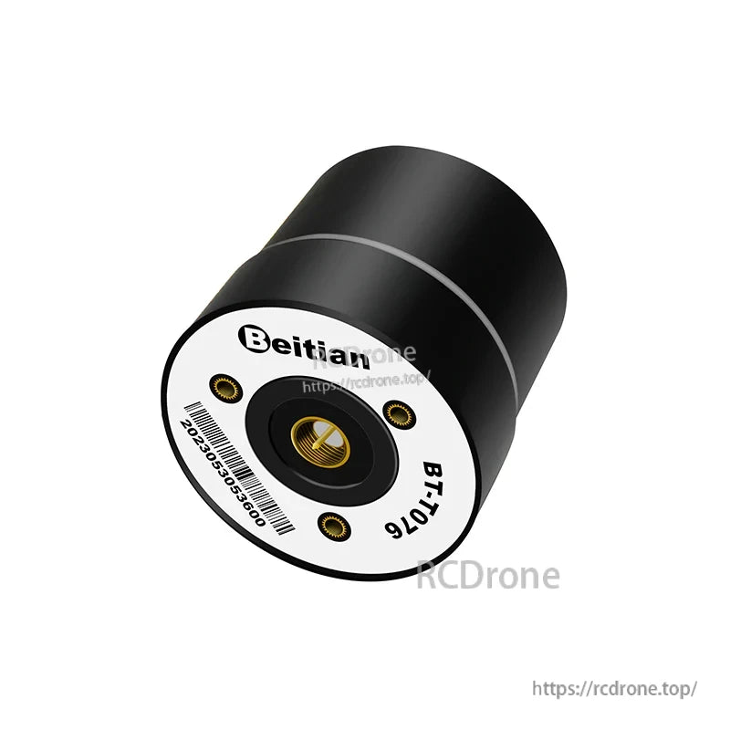
Direka untuk pengukuran RTK dan penentuan kedudukan UAV, BT-T076 menyediakan penerimaan RHCP omnidirectional dalam badan yang padat dan ringan.
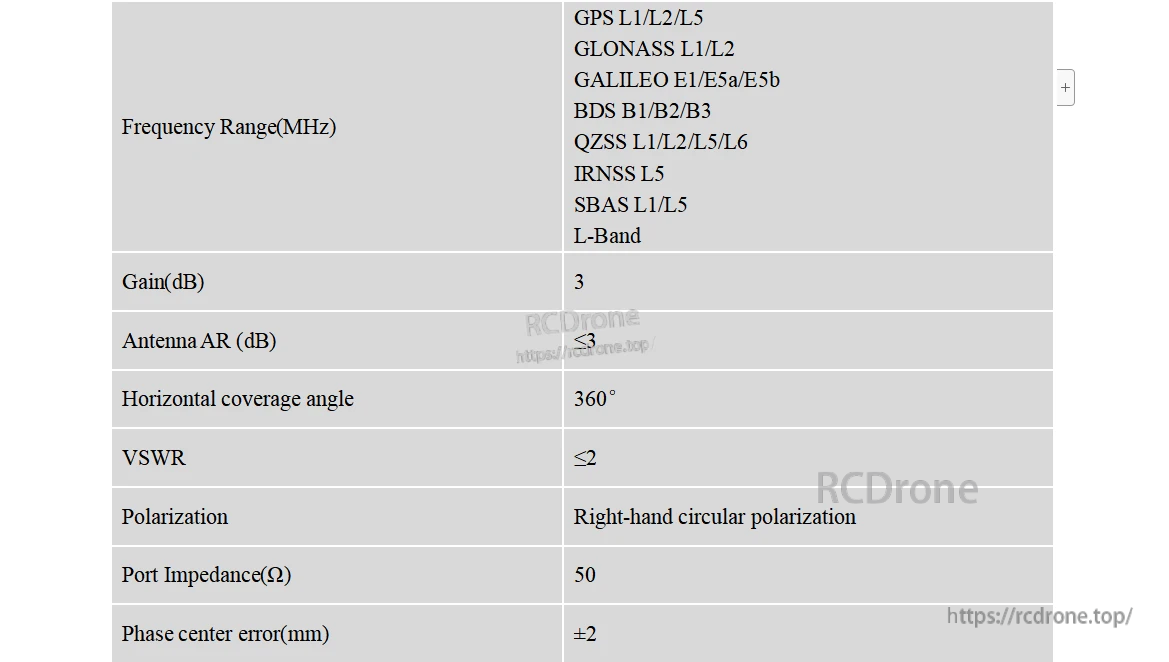
Sokongan jalur penuh multi-konstelasi dan L-band membantu mengekalkan penjejakan yang boleh dipercayai merentasi sistem GNSS untuk aplikasi tepat.
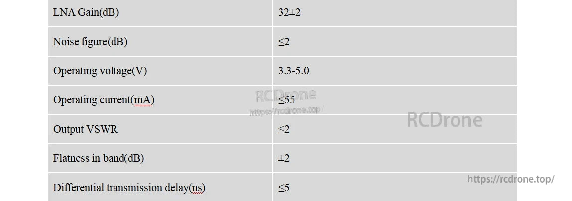

Sambungan SMA-J dan faktor bentuk sub-35 g memudahkan integrasi pada peralatan RTK kecil, peranti genggam, dan platform UAV.

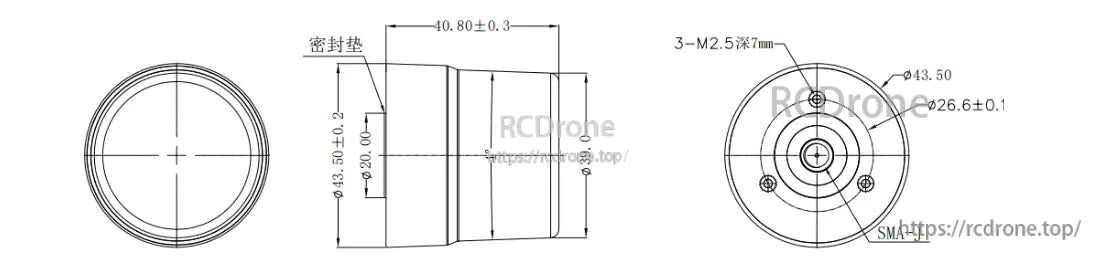
Dimensi pemasangan terperinci menyokong reka bentuk mekanikal yang tepat untuk braket, penutup, dan pemasangan UAV.