Genel bakış
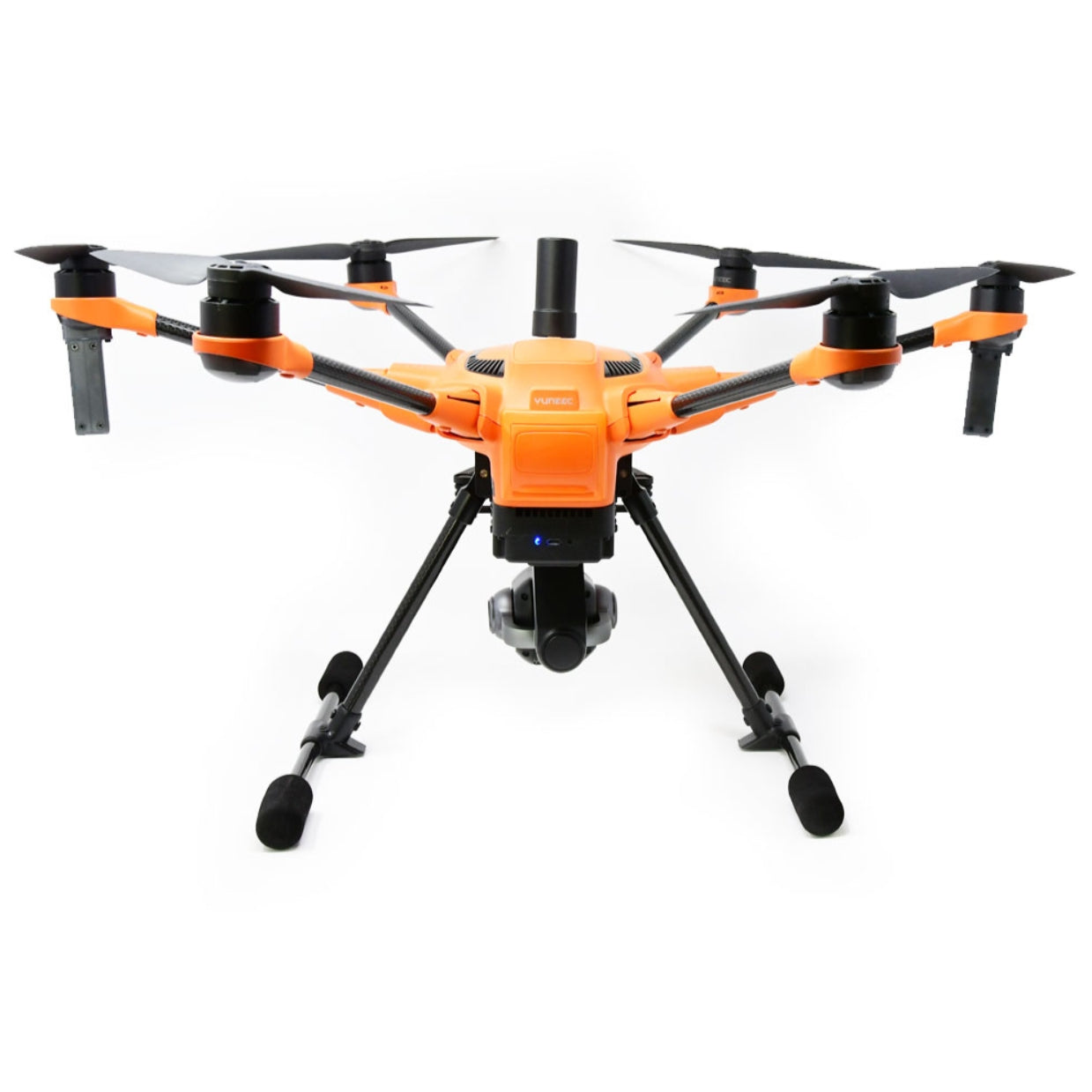
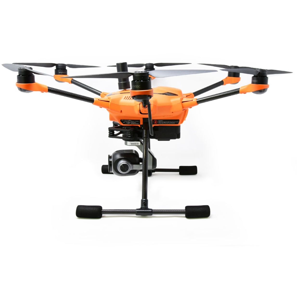
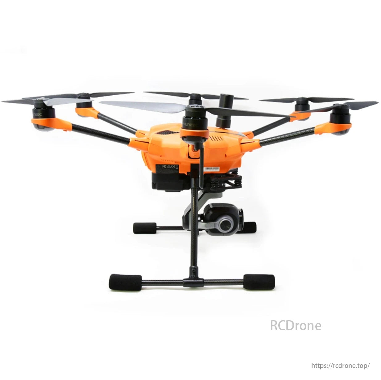
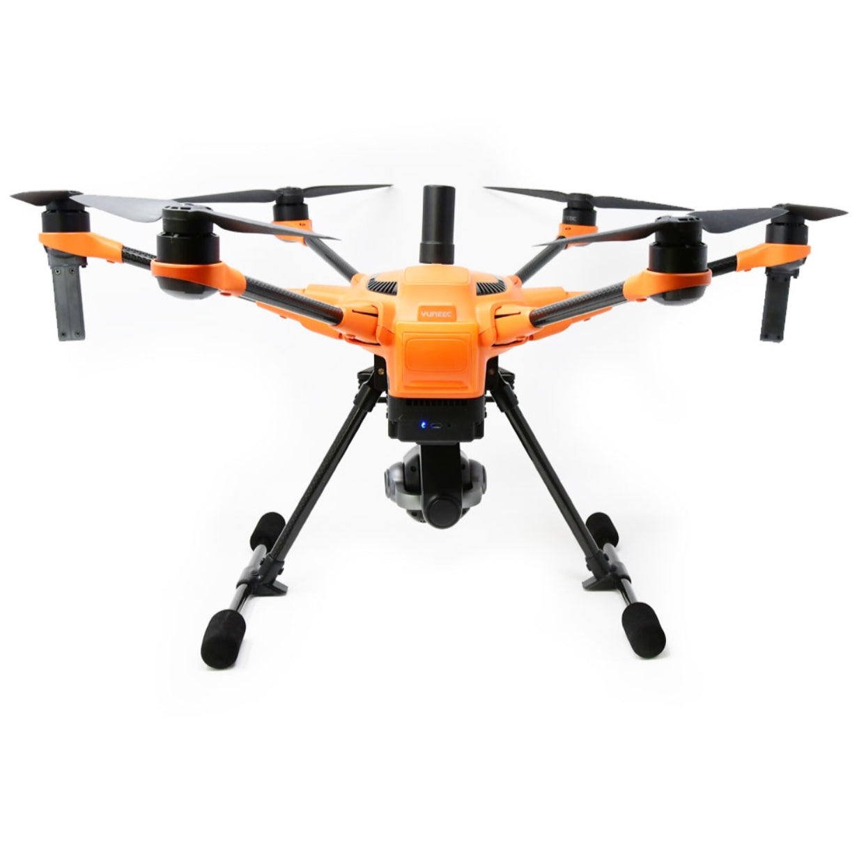
The Yuneec H520E RTK Hekzakopter Endüstriyel denetimler, arazi ölçümü, kamu güvenliği ve diğer zorlu uygulamalar için tasarlanmış profesyonel düzeyde bir İHA'dır. 4S-6200mAh LiPo pil ile çalışan H520E, optimum koşullar altında 25-30 dakikalık uçuş süresi sunar ve kamera olmadan yaklaşık 4,1 lbs (1860 g) kalkış ağırlığını destekler. 520 mm diyagonal uzunluk (kanatlar olmadan) ve geri çekilebilir iniş takımı ile 44,7 mph'ye (20 m/s) kadar hızlara ulaşabilir. Sistem ayrıca 5 rotorlu arıza emniyeti, 3 eksenli sabitlenmiş gimbal ve sıcak değiştirilebilir yük seçeneklerine (E30Z/X, E90/X, E10T/X, CGOET/X) sahiptir ve uçağı kapatmadan sorunsuz kamera değişiklikleri sağlar.
H520E, 7 inçlik Android™ dokunmatik ekrana ve 1,7 mil'e kadar iletim mesafesine sahip ST16E yer istasyonuyla standart olarak gelir. Bu hepsi bir arada kontrol cihazı, entegre DataPilot™ yazılımı aracılığıyla görev planlamasını mümkün kılar, uçuş yolu planlaması (yol noktaları, yörünge uçuşu, çapraz tarama ve daha fazlası) ve otomatik araştırmalar sunarken harici cihazlara olan ihtiyacı ortadan kaldırır. Sistem, tüm uçuş günlüklerini, fotoğrafları ve videoları yerel olarak depolayarak maksimum veri güvenliği sağlar; uzak sunuculara otomatik veri aktarımı olmaz.
Entegre engel önleme, 16 ft (5 m) içindeki engelleri algılamak için bir ultrasonik sensör kullanır ve 8,9 mph'ye (4 m/s) kadar hızlarda daha güvenli operasyonlara olanak tanır. H520E RTK çeşidi, santimetre düzeyinde konumlandırma doğruluğu için gelişmiş bir RTK modülü (Nebulas-II GNSS SoC tabanlı) içerir ve GPS L1/L2, GLONASS L1/L2, Galileo E1/E5b ve BDS B1/B2'yi destekler. Sağlam performans, 25 saniyenin altındaki soğuk başlatma süreleri, 5 saniyeden kısa sürede güvenilir başlatma ve 20 Hz güncelleme oranını içerir. Zorlu koşullara dayanacak şekilde tasarlanan H520E, 32°F ila 104°F (0°C ila 40°C) arasında çalışabilir ve RTK modülü, –40°C ila 85°C arasındaki genişletilmiş sıcaklık aralıkları için derecelendirilmiştir.
İster denetimler için ayrıntılı görüntüler yakalamak, ister inşaat ve mimari için 3B haritalar veya modeller oluşturmak, ister arama ve kurtarma için termal görüntüleme verileri sağlamak olsun, H520E Hexacopter profesyonel kullanıcılara ihtiyaç duydukları istikrarı, hassasiyeti ve veri güvenliğini sunar. Tüm bunlar, ekip modunu, gelişmiş görev planlamasını ve YUNEEC UpdatePilot uygulaması aracılığıyla sürekli güncellemeleri destekleyen sezgisel bir platform aracılığıyla kontrol edilir.
Özellikler
H520E
Uçuş Süresi: 25-30 dk (Optimum Koşullar)
Pil: 4S-6200mAh LiPo
Kalkış Ağırlığı: 4,1 lbs (1860 g) Kamera Olmadan
Çapraz Uzunluk: 520 mm (Bıçaksız 20,5 inç)
Boyutlar: 21,7x19x12,1 inç (551x482x309 mm)
Maksimum Hız: 44,7 mil/saat (20 m/s)
Maksimum Tırmanma Hızı: 11,1 mph (5 m/s)
Maksimum İniş Hızı: 6,7 mph (3 m/s)
Maksimum Uçuş Yüksekliği: 1.640 ft (500 m)
Maksimum Açısal Hız: 120°/s
Motorlar: 720kV
Şarj cihazı: SC4000-4H
Çalışma Sıcaklığı: 32°F - 104°F (0°C - 40°C)
Depolama Sıcaklığı: 14°F - 122°F (-10°C - 50°C)
ST16E Yer İstasyonu
Ekran: 7 inç Android Dokunmatik Ekran
İşletim Sistemi: Android ™
Kanallar: 16
*İletim Mesafesi: 1,7 Mil'e Kadar
Pil: 3.6V 8700mAh 31.32Wh Li-Ion
Frekans: 2,4 GHz
Videolink Frekansı: 2.4GHz
Videolink Çözünürlüğü: 720 p
Çalışma Sıcaklığı: 32°F - 104°F (0°C - 40°C)
Video Çıkışları: HDMI
Engellerden Kaçınma Sistemi
Sensör: Ultrasonik (Ön)
Uçuş Hızı: 8,9 mph (4 m/s)
Çalışma Ortamı: Yükseklik > 4,9 ft (1,5 m)
Engellere Uzaklık < 16 ft (< 5 m)
RTK MODÜLÜ
Boyut: 30 × 40 × 4 mm
Sıcaklık:
Çalışma: - 40°C~85°C
Depolama: - 55°C~95°C
Nem: %95 Yoğuşma yok
Titreşim:
GJB150.16-2009, MIL-STD-810
Şok:
GJB150.18-2009, MIL-STD-810
Elektrik Voltajı: 3,3 VDC +5%/–3%
LNA Çıkışı: 4,75~5,10 V, 0~100 mA
Dalgalanma Voltajı: 100 mV pp (maks.)
Güç Tüketimi: 2,4 W (tipik)
Fonksiyonel Portlar: 3x UART(LV-TTL), 1x1PPS(LV-TTL) 1x Olay
PERFORMANS ÖZELLİKLERİ
Kanallar: Nebulas-II GNSS SoC'ye dayalı 432 Kanal | Hız Doğruluğu (RMS) | 0,03 m/s
Frekanslar:
BDS B1/B2 | Zaman Doğruluğu (RMS) | 20ns
GPS L1/L2 | İlk Düzeltmeye Kadar Geçen Süre (TTFF) | Soğuk başlatma <25s
GLONASS L1/L2 | Başlatma Süresi | < 5s (tipik)
Galileo E1/E5b | Başlatma güvenilirliği | > %99,9
QZSS L1/L5 | Yeniden edinme | < 1sn
Tek Nokta Konumlandırma (RMS):
Yatay: 1,5 m | Düzeltme | RTCM v2.3/3.0/3.2
Dikey: 2,5 m | Veri Çıkışı | NMEA-0183,Unicore
Yatay: 0,4 m | Güncelleme Oranı | 20 Hz
DGPS (RMS):
Dikey: 0,8 m | Eylemsiz Navigasyon Doğruluğu | GPS engellenen koşullar sırasında kat edilen mesafenin %5'inden az
RTK (RMS):
Yatay: 1 cm + 1 ppm
Dikey: 1,5 cm + 1 ppm
Uyumlu Yükler
E90x (YUNE90XUS)
PATLAMA HIZI: (FOTOĞRAF) 3@1S / 5@1S / 7@1S
RENK DUYARLILIĞI: RGB
SIKIŞTIRMA BİT HIZI: 100MBPS
SIKIŞTIRMA TÜRÜ: AVC/HEVC
DNR: 2D FİLTRE
ETKİLİ PİKSEL: 20 MEGAPİKSEL
Görüş Alanı: DFOV 90,3 ± 3°
ODAK UZUNLUĞU: 23MM
KARE HIZI: 24/25/30/48/50/60/120
FSTOP ARALIĞI: F2.8 ± %5
GİMBAL EKSENİ: 3
GIMBAL KONTROL DOĞRULUĞU: ± .02°
GIMBAL MAKSİMUM KONTROL ARALIĞI: EĞİM: -90° - 30° PAN: 360° SINIRSIZ
GIMBAL MAKSİMUM KONTROL HIZI: EĞİM: 50°/S PAN: 50°/S
ISO ARALIĞI: 100 - 12800
MAKSİMUM VİDEO ÇÖZÜNÜRLÜĞÜ: 4K 60FPS
MİNİMUM SD KART SINIFI: 10 U3
MTF 104LP/MM, MERKEZ: 0.6, KÖŞE: 0.4
SENSÖR BOYUTU: 1 İNÇ CMOS
ENSTANTANE HIZI: 1/8000 - 8S
PANJUR TİPİ: RULO
Sinyal Gürültü Oranı: ISO100, Sinyal Gürültü Oranı 36DB
DEPOLAMA SICAKLIĞI: 10°C - 30°C
AĞIRLIK: 330G
CGOETx (YUNETXUS)
Termal Özellikler:
Görüş Alanı: Diyagonal: 71° Görüş Alanı: Yatay: 56° Hassasiyet: < 50 mK
Kızılötesi Kamera: Soğutulmamış Vox (Vanadyum Oksit) mikrobolometre Piksel boyutu: 12
LWIR Dalga Boyu: 8-14 Resim Hızı: 9 Hz
Fotoğraf formatı: JPEG, TIFF (14bit RAW) Video formatı: MP4
Sıcaklık dengesi: Otomatik Sıcaklık etkili aralığı: -10° ila 180°
Çözünürlük: ST16S önizlemesi için 160x120, 1280x720'ye genişletildi
Görsel/RGB kamera Özellikleri:
Sensör: ½.8” 2M
Görüş alanı: Diyagonal: 90° ISO aralığı: 100-12800
Deklanşör Hızı: 1/30 - 1/8000 sn
Video çözünürlüğü: 1920 x 1080p 30 fps Fotoğraf formatı: JPEG
Video formatı: MP4
E30Zx (YUNE30ZXUS)
BOYUTLAR: 148 x 106 x 145 mm
SENSÖR BOYUTU: 1/2,8 inç CMOS
ETKİLİ PİKSELLER: 2,13 MP
AĞIRLIK: 595 gr (1,3 lbs)
ZOOM ÖZELLİKLERİ:
Optik: 30x
Dijital: 6x
KAMERA LENS: F1.6 (Geniş) ila F4.7 (Tele), 29 mm - 872 mm eşdeğeri
FOV: 63,7° (Geniş), 2,3° (Tele)
FOTOĞRAF ÇÖZÜNÜRLÜĞÜ: 16:9, 1920x1080
VİDEO ÇÖZÜNÜRLÜĞÜ: 1080p @25/30/50/60 fps
FOTOĞRAF FORMATI: JPEG
VİDEO FORMATI: MP4
ISO ARALIĞI: 100-6400
AÇISAL TİTREŞİM ARALIĞI: ±0,02°
ENSTANTANE HIZI: 1/30-1/6000s
BEYAZ DENGESİ: Otomatik, Manuel (2000 - 10000)
KONTROL ARALIĞI:
Eğim: -120° ila 30°
Pan: 360° sınırsız
MAKSİMUM KONTROL HIZI:
Kaydırma: 50° /sn
Eğim:50° /sn
ÇALIŞMA SICAKLIĞI: 14° - 113°F
DEPOLAMA SICAKLIĞI: -4° - 140°F
E10T34x (YUNE10T34XUS)
Ağırlık: 350 gr
Boyutlar: 115 x 80 x 130 mm
Kontrol Edilebilir Aralık: Eğim: 15° ila -90° / Pan: 360° sınırsız
Uyumlu Platformlar: H520E (yaklaşık 28 dk uçuş süresi)
OPTİK KAMERA
Görüş Alanı: 89,6°
Sensör: 1/2.8" 2MP 23mm F2.8
Menzil: 2 km
Fotoğraf Çözünürlüğü: 16:9, 1920x1080, JPG
TF Desteği: FAT32(= 32 GB) / exFAT(>32 GB)
Video Çözünürlüğü: FHD (1920x1080), H264
(NTSC) 24/25/30/48/60, MP4
ISO: 100 - 12800
Deklanşör: 1/30 - 1/8000sn
FLIR® TERMAL KAMERA
Termal Çözünürlük: 320x256
Sensör Teknolojisi: soğutulmamış VOx mikrobolometre
Etkin Kare Hızı: < 9Hz
Piksel Boyutu: 12 µm
Spektral Aralık: 8-14 µm
Sahne Aralığı (Düşük Kazanç): -40°C ila 550°C
Nokta Ölçer: >%98,5, küme yok > 3x3
Hassasiyet: < 50 mK, @f/1.0
Sahne Aralığı (Yüksek Kazanç): 640 × 512: -25°C ila 135°C / 320 × 256: -25°C ila
100°C
Renk ve Monokrom Paletler (LUT'ler): Evet
Görüntü Optimizasyonu: Evet
Dijital Ayrıntı Geliştirme: Evet
Polarite Kontrolü (siyah sıcak/beyaz sıcak): Evet
Video Biçimi: MP4
Fotoğraf Formatı: JPEG, TIFF
E10Tv32x (YUNE10TVXUS)
Ağırlık: 350 gr
Boyutlar: 115 x 80 x 130 mm
Kontrol Edilebilir Aralık: Eğim: 15° ila -90° / Pan: 360° sınırsız
Uyumlu Platformlar: H520E (yaklaşık 28 dk uçuş süresi)
OPTİK KAMERA
Görüş Alanı: 89,6°
Sensör: 1/2.8" 2MP 23mm F2.8
Menzil: 2 km
Fotoğraf Çözünürlüğü: 16:9, 1920x1080, JPG
TF Desteği: FAT32(= 32 GB) / exFAT(>32 GB)
Video Çözünürlüğü: FHD (1920x1080), H264
(NTSC) 24/25/30/48/60, MP4
ISO: 100 - 12800
Deklanşör: 1/30 - 1/8000sn
FLIR® TERMAL KAMERA
Termal Çözünürlük: 640x512
Sensör Teknolojisi: soğutulmamış VOx mikrobolometre
Etkin Kare Hızı: < 9Hz
Piksel Boyutu: 12 µm
Spektral Aralık: 8-14 µm
Sahne Aralığı (Düşük Kazanç): -40°C ila 550°C
Nokta Ölçer: >%98,5, küme yok > 3x3
Hassasiyet: < 50 mK, @f/1.0
Sahne Aralığı (Yüksek Kazanç): 640 × 512: -25°C ila 135°C / 320 × 256: -25°C ila
100°C
Renk ve Monokrom Paletler (LUT'ler): Evet
Görüntü Optimizasyonu: Evet
Dijital Ayrıntı Geliştirme: Evet
Polarite Kontrolü (siyah sıcak/beyaz sıcak): Evet
Video Biçimi: MP4
Fotoğraf Formatı: JPEG, TIFF
E20Tvx (YUNE20TVX33US)
Kamera Ağırlığı: 358 gr (12,62 oz)
Dengeleme halkası:
Açısal titreşim aralığı: ±0,02°
Kontrol Edilebilir Aralık:
Eğim:-110° ila 30° / Pan:±165°
Maksimum Açısal Hız: Eğim: 30°/s, Pan: 120°/s
Çalışma Sıcaklığı: -10°C - 40°C (14°F - 104°F)
Termal Lens:
FOV, köşegen: 41,4°
Görüş Alanı: 33° x 26.6°
Hassasiyet: < 50 mK
Piksel aralığı: 12um
LWIR Dalga Boyu: 8 - 14 µm
Frekans: Tam Kare Hızı: 25Hz
Fotoğraf Formatı: JPEG
Video Biçimi: MP4
Sıcaklık Telafisi: Otomatik
Çözünürlük: 640x512
Sıcaklık Ölçüm Aralığı:
Yüksek Kazanç -20°-150°
Düşük Kazanç 100°-500°
RGB Mercek:
Sensör: 1/2.8" 2.13MP
Diyafram: F2.8
Eşdeğer, Odak Uzaklığı: 23mm
Çapraz FOV: 90°
ISO Aralığı: 100-3200
Deklanşör Hızı: 1/30-1/8000s
Video Çözünürlüğü: 1920x1080p 60fps
Paket Listeleme
1 - Yuneec H520E RTK Ticari Hexacopter
1 - ST16E Yer İstasyonu Kontrol Cihazı
2 - 4S-6200mAh LiPo Piller
1 - OFDM Modülü
1 - Şarj Ünitesi (Tek Pil)
1 - Şarj Cihazı Güç Kaynağı
1 - Şarj Kablosu
5 - Saat Yönünde A Rotorları
5 - Saat Yönünün Tersine B Rotorları
1 - Microsd Kart
1 - Microsd Kart Adaptörü
1 - Kılavuz
Yük Seçenekleri
- E90x
- CGOETx
- E30Zx
- E10T34x
- E10T50x
- E10Tv32x
- E20Tvx
Yuneec H520E RTK Hexacopter Detayları

Yuneec H520E RTK Ticari Hexacopter: RTK teknolojisi ve hexacopter tasarımına sahip ticari kullanıma yönelik profesyonel sınıf insansız hava aracı.


HS2OE, endüstriyel kullanım için tasarlanmıştır ve hırslı profesyoneller için idealdir. Sabit ve hassas uçuş için altı rotorlu bir sisteme, uzak çekimler için uzun odak uzaklıklı lenslere ve STI6S/E Yer İstasyonu veya 4K/UHD video ve 20MP hareketsiz görüntülerden anında veri paylaşımına sahiptir.

Yuneec H520E RTK ticari hexacopter, yüksek rüzgarlı ortamlarda bile güvenilir, istikrarlı ve hassas uçuş sağlayarak, insanlı denetimlerin güvenli olmadığı durumlarda bile pozisyonunu koruyabiliyor ve güvenli bir şekilde uçabiliyor.

HS520E RTK Ticari Hexacopter verileriniz gizli kalır. Hexacopter ve uzaktan kumanda doğrudan iletişim kurarak harici sunuculara istem dışı veri aktarımını önler. Uçuş verileri, görüntüler, videolar ve günlük dosyaları iletilmez ve optimum koruma için kontrolünüz altında kalır.

Yörünge uçuşu, pilotun belirli bir mesafede tam olarak daire çizmesini sağlar

Yuneec H520E RTK Ticari Hexacopter, kesintisiz veri yakalama için sıcak değiştirilebilir yük seçeneklerine sahiptir. HSZO kameralarımız, sistemi kapatmadan termal görüntüleme, uzun odak uzaklığı veya geniş odak uzaklığı kameralarının hızlı bir şekilde değiştirilmesine olanak tanır. Bu, tutarlı veri depolama sağlar ve kesinti süresini azaltır.

Yuneec H520E RTK Ticari Hexacopter - ST16S/E hepsi bir arada kontrol cihazı, uçuş sırasında HS2OE üzerinde tam kontrol sağlayarak kullanıcıların yüksek kaliteli fotoğraflar ve videolar çekmesini sağlar.7 inçlik entegre ekran, gerçek zamanlı görüntüleri yansıtarak harici bir cihaza olan ihtiyacı ortadan kaldırıyor.

Yuneec H520E RTK Ticari Hexacopter, iki uzak sistem üzerinden helikopterin ve kameranın bağımsız kontrolünü sağlayan Takım Modu özelliğine sahiptir. Bu işbirliği aracı, bir pilotun drone'u çalıştırmasına olanak tanırken, ayrı bir operatör kameraya odaklanır.

Yuneec DataPilot yazılımı kullanıcıların en son güncellemelerle güncel kalmasını ve görevleri verimli bir şekilde yönetmesini sağlar. Uygulama otomatik yazılım güncellemesi, geri çağırma için görevlerin depolanması ve saha dışı uçuşların planlanmasına olanak tanır. Ayrıca, birden fazla sağlayıcıdan araştırma yolu oluşturma, hassas 3D çıktı ve harita önbelleğe alma özelliklerine sahiptir.

Yuneec H520E RTK Ticari Hexacopter, endüstriyel üretim süreçlerinin etkili bir şekilde izlenmesini sağlar. Ford Motor Company, İngiltere'deki Dagenham Motor Fabrikasında daha hızlı ve daha güvenli bakım çalışmaları için bu drone'u kullanır.

Yuneec H520E RTK Eğitimi
Yuneec H520E RTK Drone İncelemesi
Herkese Uyan Tek Bir Çözüm
- Çoklu yük uyumluluğu
- RTK ve PPK uyumlu
- Arızaya karşı güvenli tasarıma sahip yeni pil konektörü
- Yeni güçlü uçuş kontrol işlemcisi
- Profesyonel, ticari ve hükümet gereksinimleri için tasarlanmıştır
- Yeni 2-4 mil* (3,5-7 km*) uzun menzilli OFDM modülü
- Harici sunuculara veri aktarımı yok
- Yüksek hassasiyetli, düşük parazitli pusula
- Yeni 30 pinli yük arayüzü
- Bilgisayarda veya ST16E kontrol ünitesinde görev planlaması
- 5 rotorlu arıza emniyetli, kararlı ve güvenli 6 rotorlu sistem
- Enerji tasarruflu ve sessiz çalışma
- Entegre 7” dokunmatik ekran, ses çıkışı ve kapsamlı DataPilot™ yazılımına sahip ST16E kontrol cihazı
- Drone'un canlı görüntüsünü daha büyük monitörlere aktarmak için ST16E'den doğrudan HDMI sinyali
Eklenen Güvenlik
Yuneec H520E, güvenlik ve işlevsellik talepleri etrafında geliştirildi. 6 rotorlu sistem, bir rotor arızalansa bile H520E'nin güvenli bir şekilde uçmaya devam edebilmesini sağlayarak güvenli ve istikrarlı bir uçuşa olanak tanır. Dahili ultrasonik sensörler, H520E'nin engelleri algılamasını ve çarpışmalardan kaçınmasını sağlarken, pil voltaj çok düşük olduğunda uyarılar verir ve gerekirse arıza güvenli işlevine geçer. Ayrıca, H520E, yedekli bir kontrol sinyali, bir eve dönüş ve bir coğrafi çit işleviyle donatılmıştır; bu, dronun kullanıcı tarafından belirtilen bir yarıçapın ötesine hareket etmemesini sağlar.

Güncellenen DataPilot2.0 Sistemi
Yuneec DataPilot™, yol noktası ve araştırma görevlerini planlamak için kapsamlı bir yazılım çözümüdür. DataPilot™, H520E'nin donanımına ve yazılımına tamamen entegre edilmiştir ve kullanıcıların ihtiyaç duydukları bilgileri verimli ve tutarlı bir şekilde elde etmelerini sağlar. DataPilot™'u kullanarak, sahada veya masaüstünde tekrarlanabilir, geri çağrılabilir hava uçuş yolları için ortomaplar, 3B taramalar, mahsul verisi görüntüleri oluşturmak için gereken verileri toplayabilirsiniz.DataPilot™ yazılımı ayrıca, bağlantının olmadığı alanlarda erişim için birçok harita sağlayıcısından gelen haritaların depolanmasına olanak tanır ve güncel haritaların bulunmadığı alanlarda bile hassas yol noktası yerleştirme araçları sağlar.
*Verilerin işlenmesi ve 2D ve 3D modellerin oluşturulması için fotogrametri yazılımına ihtiyaç vardır.
Verilerinizi Güvende Tutun
Yuneec H520E kapalı bir sistem olarak geliştirilmiştir, teknik tasarımı üçüncü taraf sunucularla iletişimi engeller. İletişim yalnızca drone, yük ve ST16E yer istasyonu kontrolörü arasında gerçekleşir. Günlük dosyaları yerel olarak drone'da saklanır ve yalnızca Yuneec tarafından bir garanti durumunda servis amaçları için gereklidir. Sunuculara istemsiz veri aktarımı yoktur. Ne uçuş verileri ne de görüntüler, videolar veya günlük dosyaları harici sunuculara iletilmez ve sizin mülkiyetinizde kalır. Böylece verileriniz en iyi şekilde korunur.

ST16E Yer İstasyonu Kontrol Cihazı
Android tabanlı ST16E yer istasyonu kontrol cihazı, hızlı bir Intel dört çekirdekli işlemci ve OFDM desteği ile donatılmıştır. OFDM desteği sayesinde canlı görüntü iletimi 1,7 mile kadar genişletilebilir. Dokunmatik ekranlı entegre 7 inç ekran, Yuneec H520E'nin hassas ve sezgisel çalışmasını sağlar ve tüm uçuş bilgilerini ve kameradan gelen canlı görüntüyü gösterir. Canlı görüntü ayrıca ST16E'nin HDMI çıkışı aracılığıyla daha büyük bir monitöre aktarılabilir.
Yeni X-Connector ile Çok Yönlü Yük Seçenekleri
Yuneec H520E, çoklu yükleme seçenekleri sayesinde farklı uygulama alanlarına kolayca uyarlanabilir. Sensörleri saniyeler içinde değiştirin, kesinti süresi en aza indirilir ve üretkenlik artırılır. Bu, bir gimbal kamera kombinasyonunun, gövdeyi güç döngüsüne sokmadan bir diğeriyle değiştirilebileceği anlamına gelir.

Hukuk Uygulaması:
Yuneec H520E, kaza mahallinin yeniden yapılandırılması, suç mahallinin haritalanması, kalabalık kontrolü için "gökyüzündeki göz", istihbarat toplama veya hedeflenen alanları izleme için mükemmeldir. Yuneec H520E, kolluk kuvvetlerinin bir kaza mahallini mahkeme duruşmaları, raporlama veya arşivleme için daha sonra veri toplamak üzere 2B veya 3B olarak hızlı bir şekilde kaydetmesini sağlar. Gömülü GPS verilerine sahip kamera sistemleri, yangın araştırmacıları veya ilk müdahale ekipleri alana girmeden önce delil toplamanın yakalanmasını ve incelenmesini sağlar.
Denetimler:
H520E'nin hassas uçuş davranışıyla dikey yapılar güvenli ve verimli bir şekilde denetlenebilir. Uzun odak uzaklıkları, kullanıcıların görüntü kalitesinden veya derinlikten ödün vermeden görüntülenen nesneden daha geriye uçmalarına olanak tanır. DataPilot™, karşılaştırma, arıza değerlendirmesi veya bozulma çalışmaları amacıyla haftalık veya aylık yeniden uçuş gerektiren görevleri depolayabilir. sUAS denetimiyle sağlanan güvenlik iyileştirmesi ve maliyet düşürme, karşılaştırıldığında şaşırtıcıdır.
Arama ve Kurtarma:
Yuneec H520E, kirlenmiş bir olay yerinde güvenliği artırır, kurtarma ve iyileştirmeyi hızlandırır. İtfaiyeciler, dumanın içinden "görme" ve termal görüntüleme kullanarak sıcak noktaları hızla belirleme ve büyük bir olay yerindeki operasyonların kuşbakışı görünümünü elde etme yeteneğini takdir eder.Ayrıca drone, ilerideki engelleri tespit etmek, kazazedeleri bulmak, uzaktaki kaza yerlerini fotoğraflamak, arazi haritalaması yapmak, kaza yerini izlemek veya iletişimi iyileştirmek için de kullanılabiliyor.
Site Haritalama:
İnşaat öncesi araştırma, topoğrafik ölçümler ve proje ilerlemesi - Yuneec H520E, inşaat sahaları üzerinde tekrarlanabilir, mükemmel yerleştirmeli uçuşlar yapmak üzere tasarlanmıştır ve yalnızca ölçülebilir ve gösterilebilir proje verileri sağlamakla kalmaz, aynı zamanda daralma noktalarını, riskli alanları veya güvenlik ihlali noktalarını belirlemeye yardımcı olur. Otonom uçuş, çalışma sahasındaki değişiklikleri belirlemek ve zaman içinde karşılaştırmalar sağlamak için katmanlandırılabilen tekrarlanan uçuşlara olanak tanır.
H520E RTK'NIN ÖNEMLİ ÖZELLİKLERİ
- YUNEEC H520E ile tam entegre
- Mevcut tüm Yuneec H520E kamera yükleriyle uyumludur
- Daha hızlı ve daha hassas haritalama (örneğin karmaşık ölçümler, incelemeler, haritalama, 3B gösterimler)
- Yüksek doğrulukta göreli konumlandırma için RTK (Gerçek Zamanlı Kinematik) modülü: 1 cm + ppm yatay / 1,5 cm + ppm dikey
- GNSS'in zorlayıcı olduğu ortamlarda bile (örneğin yüksek binalar arasında) cm hassasiyetini koruyun
- 5 Hz konum, hız ve zaman güncelleme hızı
- 3 GNSS takımyıldızına kadar destek sinyalleri
- Ham GNSS verileri ve gerçek zamanlı çözümler dahil tüm veriler gemide saklanabilir - PPK (Post Processed Kinematics) için hazır
- Ağ RTK veya Baz İstasyonu dahil değildir
Sistem iki bileşenle çalışır, Yuneec H520E'deki RTK modülü ve bir baz istasyonu. Yuneec H520E RTK, zorlu GPS koşullarında (baz istasyonuna göre) çalışırken bile 30 saniyeden kısa bir sürede santimetre düzeyinde doğruluğa ulaşabilir. Sistem ayrıca, bir baz istasyonu kullanmak istememeniz durumunda mutlak küresel santimetre düzeyinde doğruluk için bir ağ RTK referans istasyonuyla (üçüncü taraf sağlayıcı aracılığıyla Ağ RTK, internet bağlantısı gerekir, ek ücretler uygulanabilir) çalıştırılabilir.
Yuneec H520E RTK sistemi, en yüksek hassasiyetin gerekli olduğu ticari uygulamaların önemli bir parçasıdır. 3D haritalama sırasında H520E RTK'yi kullanmak, önemli ölçüde daha az görüntü örtüşmesi sağlayacak, bu da daha az fotoğraf kullanılması ve daha kısa bir uçuşla sonuçlanacaktır. Ayrıca, incelemeler istenen nesneye çok daha yakın olabilir çünkü dronun konumu santimetreye kadar hassas olacaktır. Bu hassasiyet, örneğin bir inşaat ilerlemesini belgelemek için farklı günlerde çekilen birkaç görüntüyü karşılaştırırken de büyük bir avantajdır.
RTK modülü, zorlu ortamlarda bile hassas konumlandırmaya olanak tanır ve H520E'nin donanımına ve yazılımına tamamen entegredir. Bu, ödüllü DataPilot yazılımının tüm işlev yelpazesine hala sahip olduğunuz anlamına gelir. Ham GNSS verileri de dahil olmak üzere tüm veriler gemide kaydedilebilir. Bu nedenle, sistem zaten PPK (Sonradan İşlenmiş Kinematik) içindir.
RTK MODÜLÜ
- En Küçük Başlık Çözümü
- Kompakt SMD paketleme
- Tüm Takımyıldızları Çoklu Frekans
- 0.2°/1m temel Çift Anten Yönü
- Santimetre seviyesinde RTK
- 30*40 mm, SMD ambalaj
- BDS B1/B2+GPS L1/L2+GLONASS L1/L2+GALILEO E1/E5b+QZSS L1/L2'yi destekler
- DUAL-RTK Motor, bağımsız ana ve yardımcı anten RTK çözümü
- RTK: 1cm +1ppm(Y); 1,5cm+1ppm(D)
- 20 Hz'e kadar düşük gecikmeli konumlandırma ve yön çıkışı


