Overview
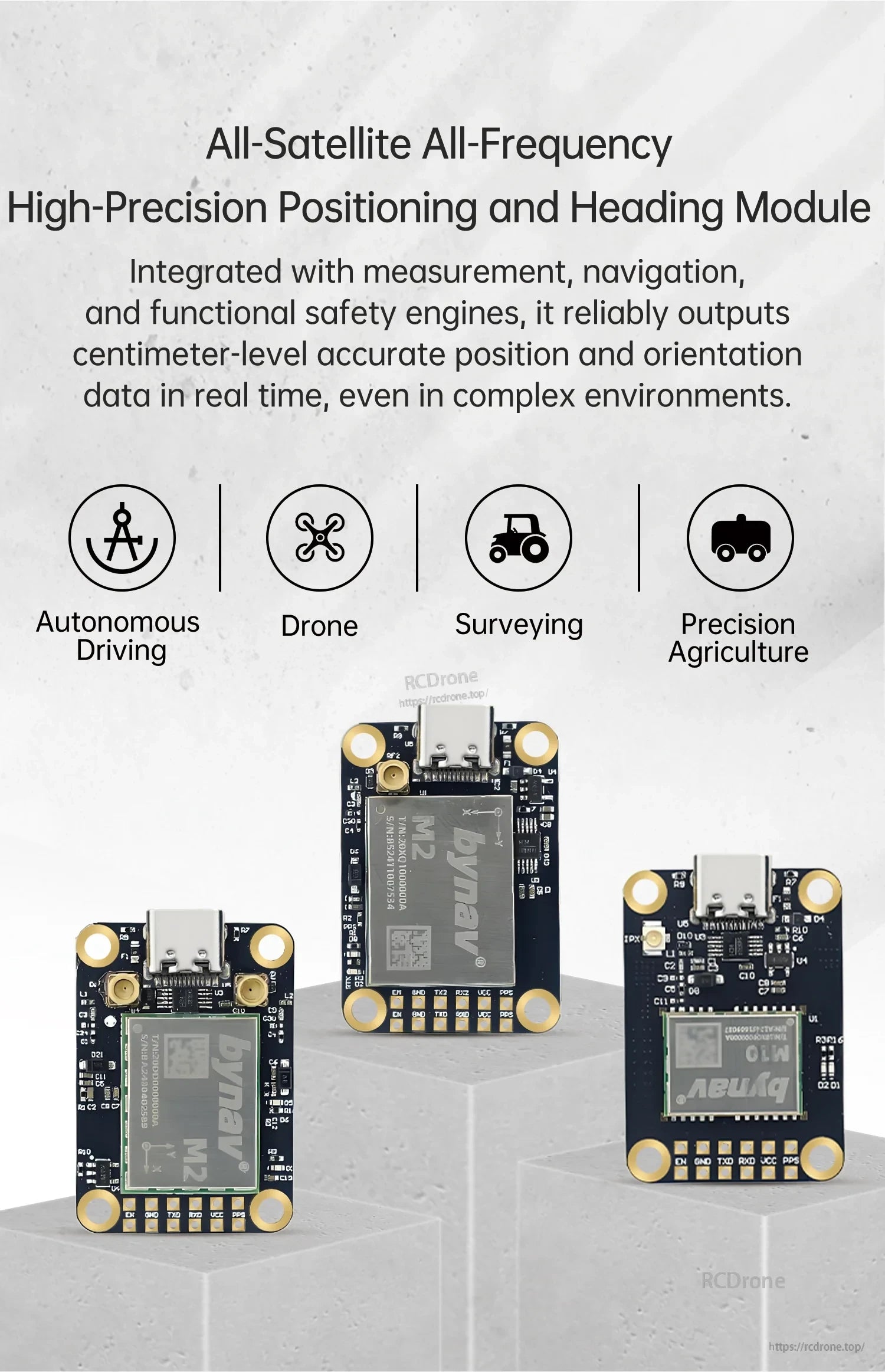
WitMotion WTRTK-M10 is an RTK GNSS module designed for full-constellation, full-frequency positioning in an extra-compact form factor, with anti-interference capability and cold-start TTFF of <= 30s. It is suitable for applications that need real-time, centimeter-level RTK positioning and orientation data output, including drones, surveying/mapping, autonomous driving, and precision agriculture.
Key Features
- Full-constellation, full-frequency RTK positioning module (WTRTK series)
- Cold Start TTFF: <= 30s; Hot Start TTFF: <= 5s
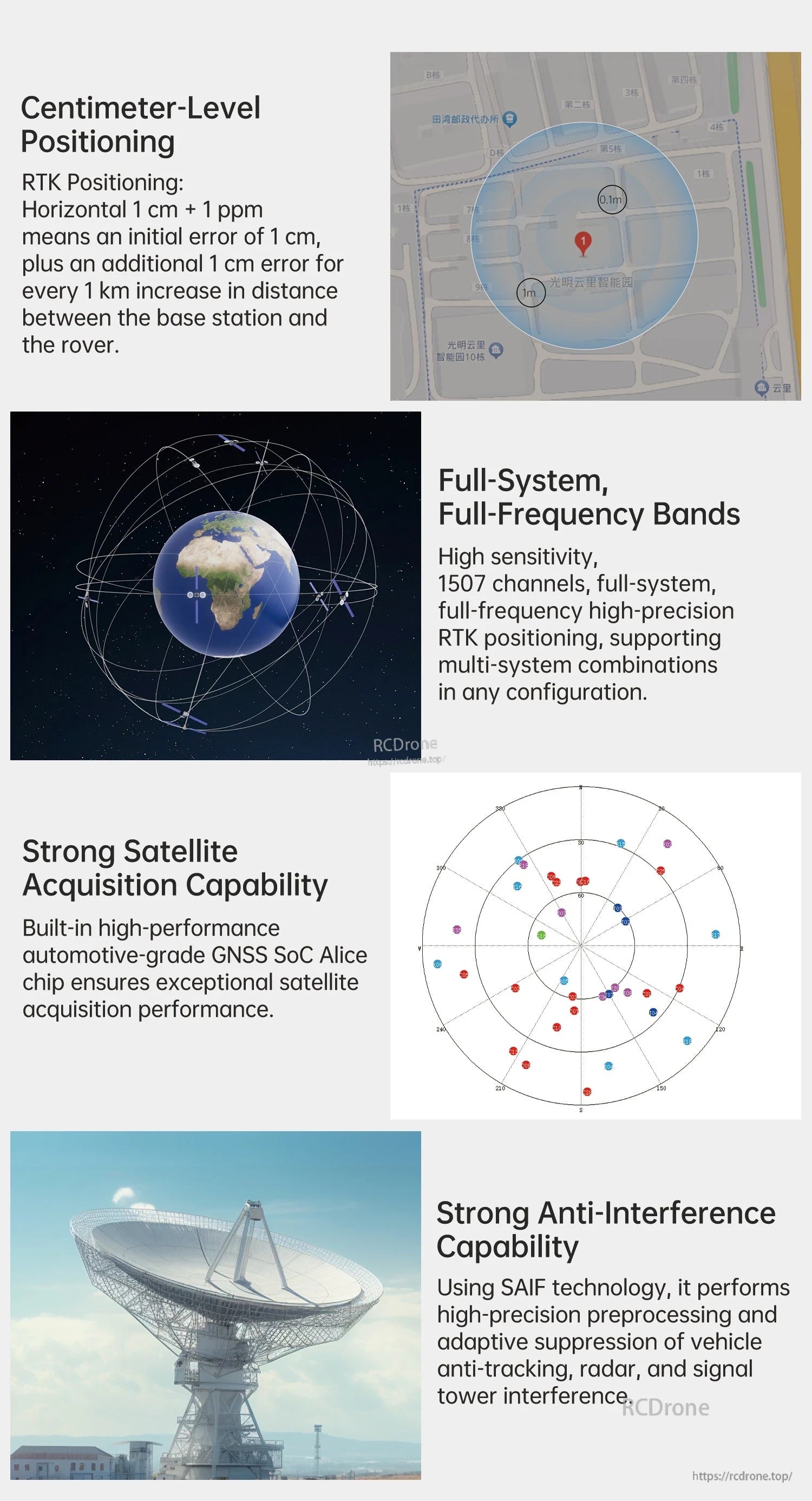
- RTK positioning accuracy: Horizontal 1 cm + 1 ppm; Vertical 1.5 cm + 1 ppm
- Single-point positioning accuracy: Horizontal 1.5 m; Vertical 2.5 m
- Time accuracy: 20ns
- Speed accuracy: 0.03m/s (RMS)
- High sensitivity, multi-channel GNSS reception (WTRTK-M10: 1500 channels)
- Anti-interference capability (SAIF technology stated)
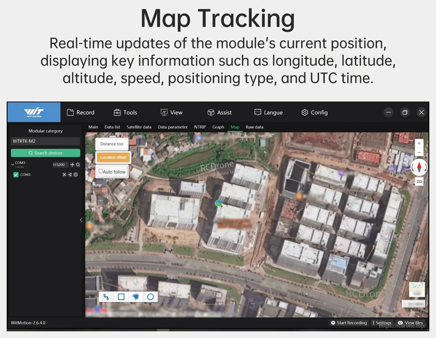
- Map tracking and signal display support (software UI shown): longitude, latitude, altitude, speed, positioning type, and UTC time
Specifications
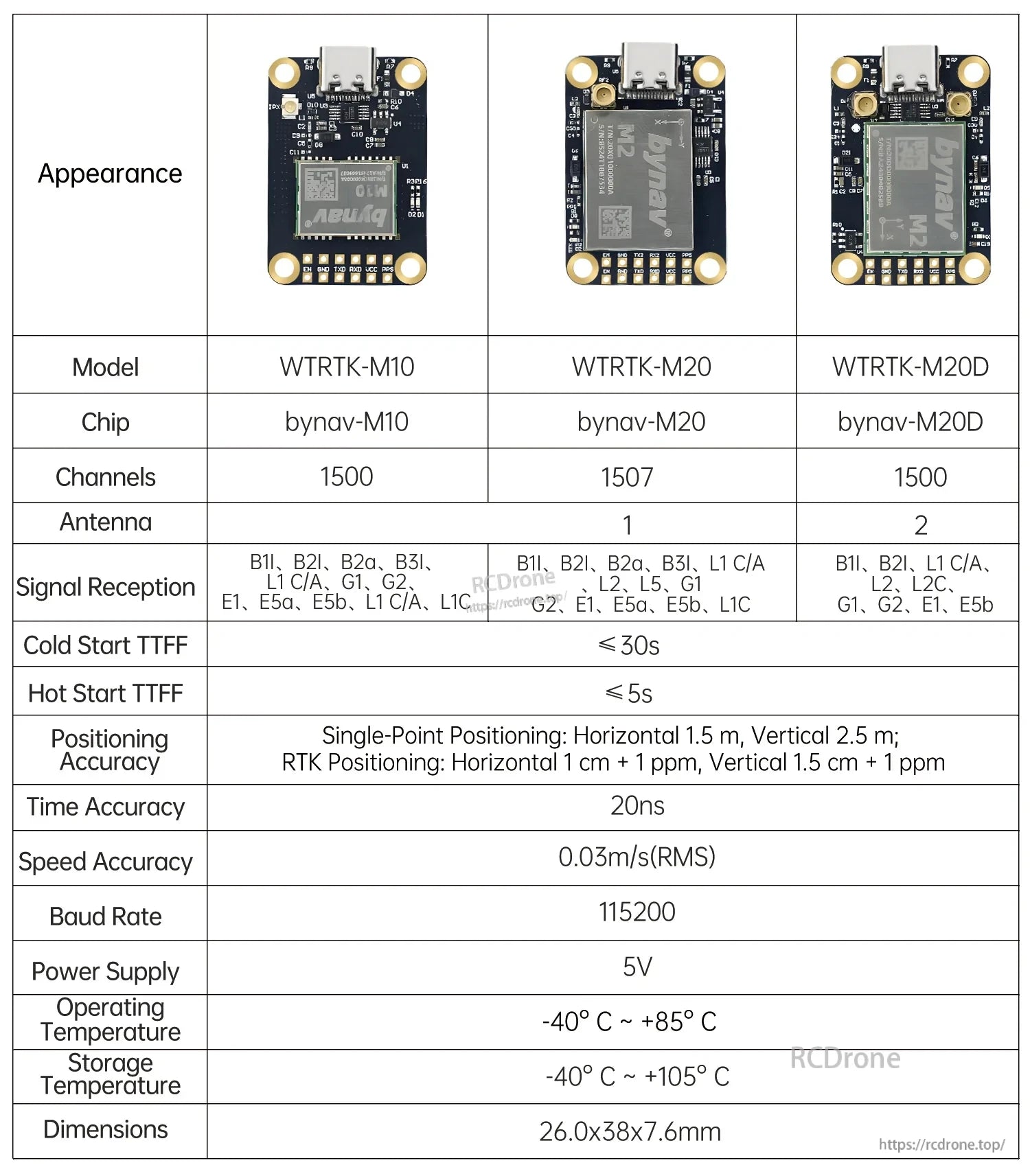
| Model | WTRTK-M10 |
| Chip | bynav-M10 |
| Channels | 1500 |
| Signal Reception | B1I, B2I, B2a, B3I, L1 C/A, G1, G2, E1, E5a, E5b, L1C |
| Cold Start TTFF | <= 30s |
| Hot Start TTFF | <= 5s |
| Positioning Accuracy | Single-Point Positioning: Horizontal 1.5 m, Vertical 2.5 m; RTK Positioning: Horizontal 1 cm + 1 ppm, Vertical 1.5 cm + 1 ppm |
| Time Accuracy | 20ns |
| Speed Accuracy | 0.03m/s (RMS) |
| Baud Rate | 115200 |
| Power Supply | 5V |
| Operating Temperature | -40 C ~ +85 C |
| Storage Temperature | -40 C ~ +105 C |
| Dimensions | 26.0 x 38 x 7.6mm |
RTK Principle (Summary)
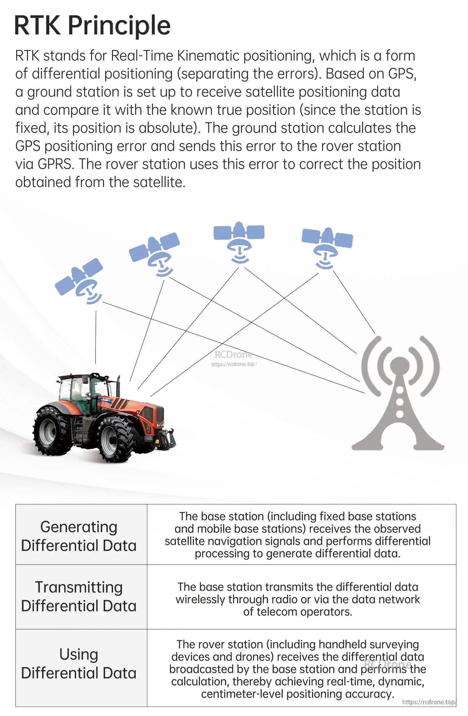
RTK (Real-Time Kinematic) is a differential positioning method that separates positioning errors by using a base station with a fixed, known position. The base station receives satellite navigation data, calculates positioning error, and transmits differential data to a rover. The rover uses this information to correct satellite-derived position, enabling real-time, dynamic, centimeter-level positioning accuracy.
RTK workflows typically include: generating differential data (base station), transmitting differential data (radio or network), and using differential data (rover such as surveying devices and drones).
Wiring / Pin Functions
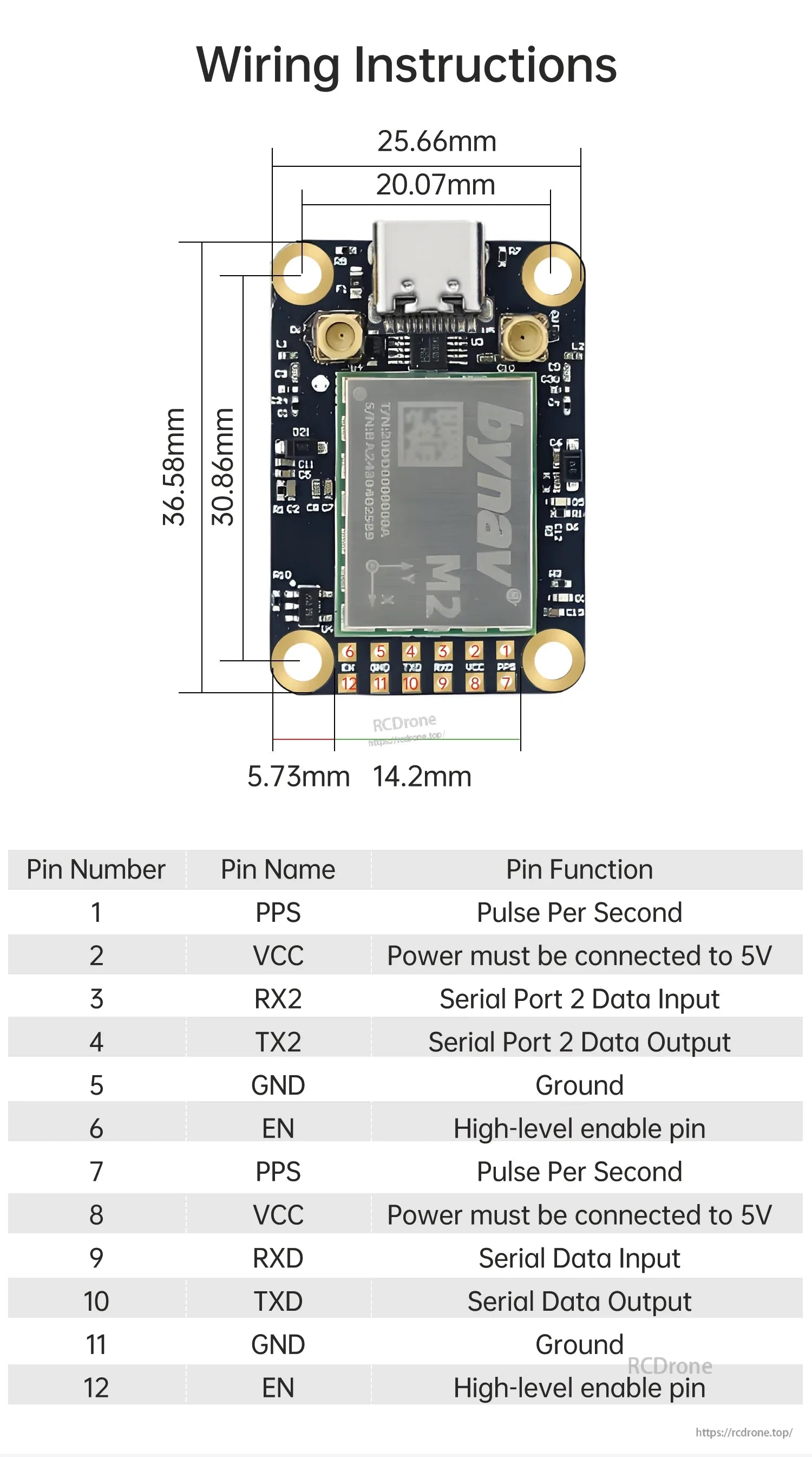
| Pin 1 | PPS | Pulse Per Second |
| Pin 2 | VCC | Power must be connected to 5V |
| Pin 3 | RX2 | Serial Port 2 Data Input |
| Pin 4 | TX2 | Serial Port 2 Data Output |
| Pin 5 | GND | Ground |
| Pin 6 | EN | High-level enable pin |
| Pin 7 | PPS | Pulse Per Second |
| Pin 8 | VCC | Power must be connected to 5V |
| Pin 9 | RXD | Serial Data Input |
| Pin 10 | TXD | Serial Data Output |
| Pin 11 | GND | Ground |
| Pin 12 | EN | High-level enable pin |
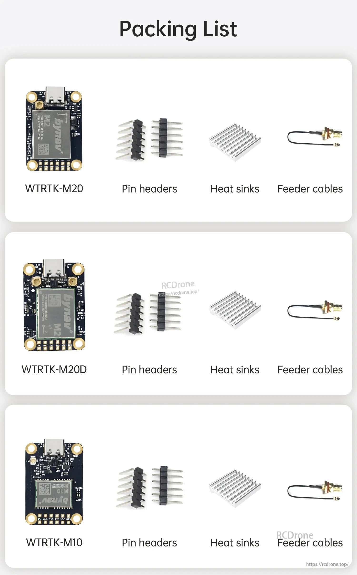
What's Included
- WTRTK-M10 module
- Pin headers
- Heat sinks
- Feeder cables
For pre-sales selection or integration support, contact support@rcdrone.top or visit https://rcdrone.top/.
Applications
- Drones
- Surveying and mapping
- Autonomous driving
- Precision agriculture
Available Options
- Style: WTRTK-M10
- Style: WTRTK-M20
- Style: WTRTK-M20D
Details

Compact RTK GNSS module built for full-constellation positioning in space-saving designs.

RTK uses base-station correction data to improve rover positioning in real time.

The module is designed for centimeter-level positioning and heading output in demanding field use.

High sensitivity and anti-interference design help maintain reliable positioning in complex environments.

Live map tracking makes it easy to monitor position and motion data during testing or deployment.

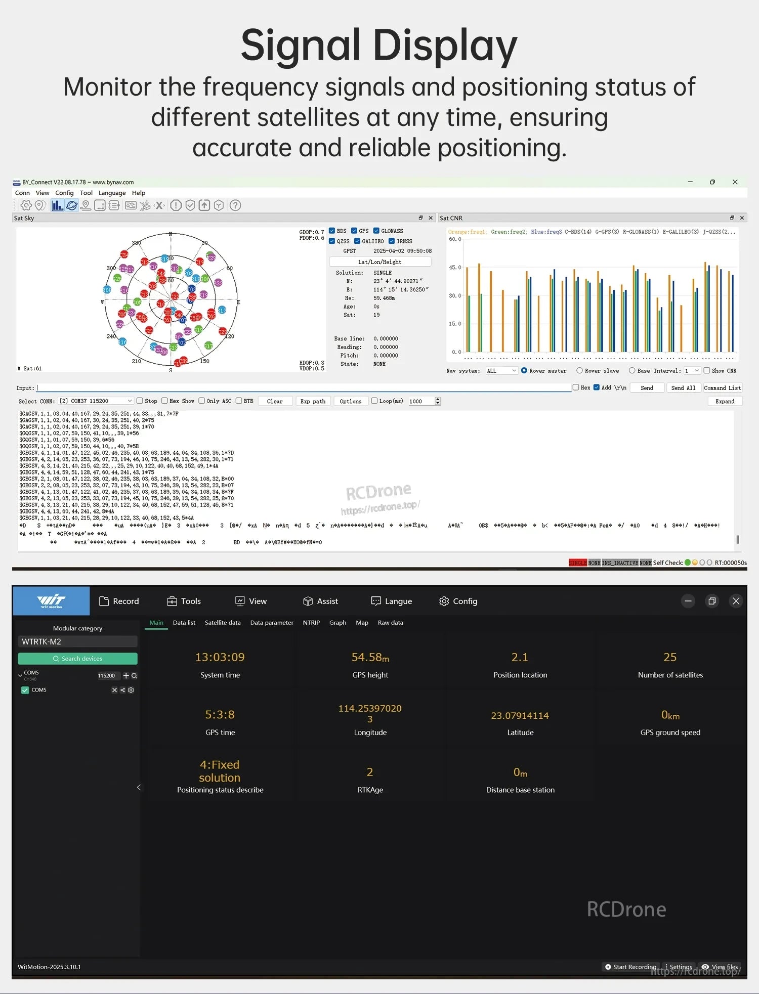
Signal monitoring helps confirm satellite reception and positioning status at a glance.

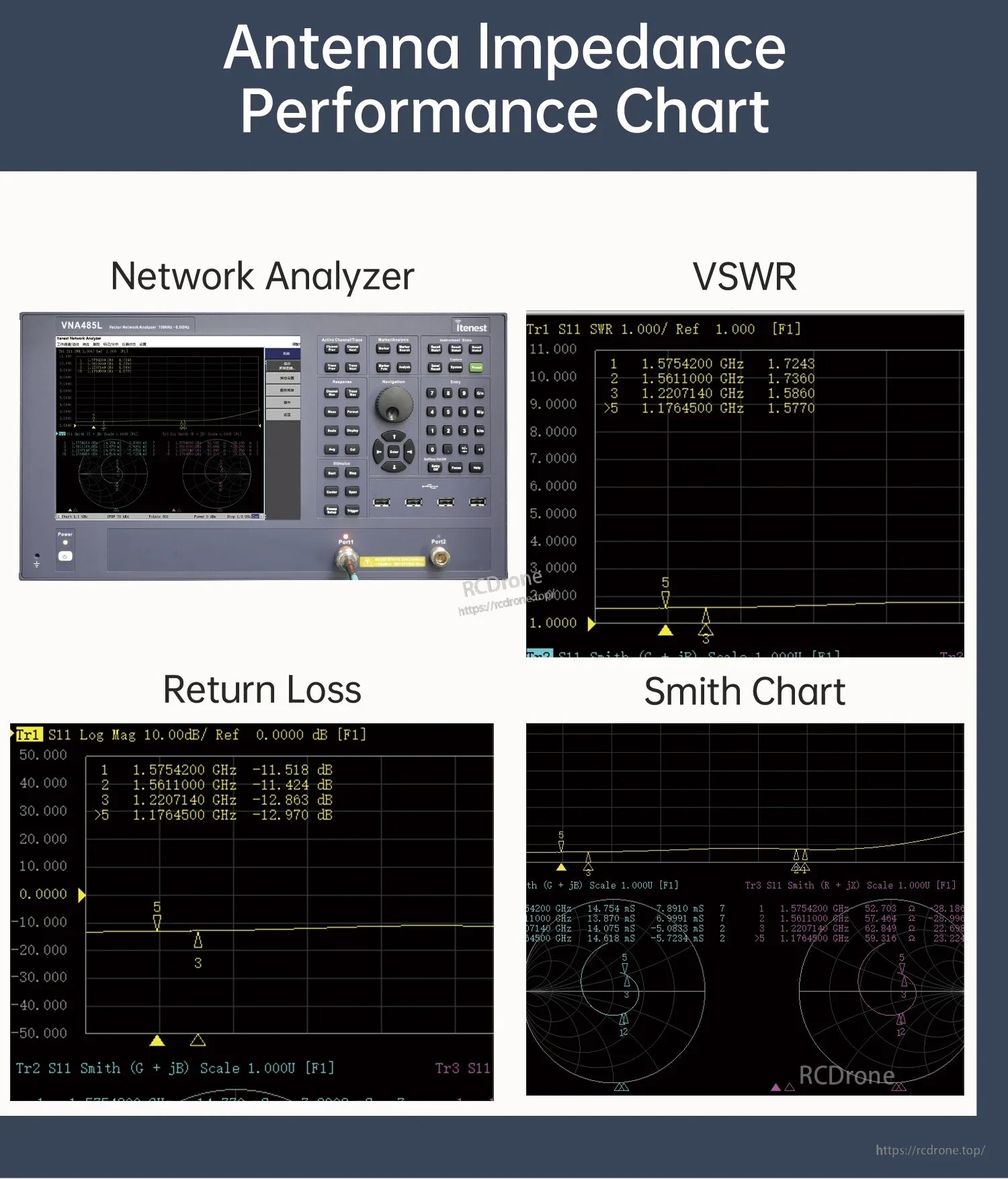
Antenna test results help verify RF performance across the supported frequency bands.

The module fits a wide range of RTK navigation and automation projects.

Pinout and dimensions simplify integration into custom hardware and embedded systems.

The package includes the module plus mounting and antenna accessories for setup.