


مستشعر العمق LiDAR Yunshis CS20 بدقة 640×480@8fps USB-C، زاوية H60°×V45° للروبوتات، AGV & الرؤية الصناعية
مستشعر العمق LiDAR Yunshis CS20 بدقة 640×480@8fps USB-C، زاوية H60°×V45° للروبوتات، AGV & الرؤية الصناعية
Yunshis
تعذر تحميل توفر الالتقاط


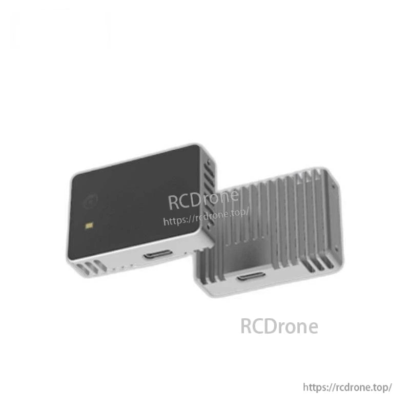
نظرة عامة
جهاز Yunshis CS20 LiDAR هو مستشعر تصوير عمق LiDAR مصمم لقياس العمق الداخلي على المدى القصير وإخراج سحابة النقاط عبر USB 2.0 (واجهة Type-C). يوفر تدفقات صور عمق بدقة ومعدلات إطارات قابلة للاختيار، ومصدر ضوء VCSEL بطول موجي 940 نانومتر، ودعم لنظام التشغيل ويندوز 10، ولينكس، وROS.
الميزات الرئيسية
- دقة قياس على مستوى السنتيمتر.
- نطاق القياس المدعوم: 0.1–5 متر (داخلي).
- نطاق ودقة قابلة للتعديل.
- يدعم بيانات العمق وسعة الإشارة المتزامنة زمنياً.
- العناصر المادية المحددة: المستقبل، المرسل، Type C، زجاج الغطاء، العلبة.
- برنامج اختبار عرض مرئي على جانب الكمبيوتر متاح لسيناريوهات عد الأشخاص.
للحصول على دعم ما قبل البيع والتكامل، اتصل بـ https://rcdrone.top/ أو أرسل بريدًا إلكترونيًا إلى [email protected].
المواصفات
| الفئة | المعلمة | القيمة |
|---|---|---|
| صورة العمق | الدقة*1 | 640*480@8fps/320*240@20fps |
| الدقة*2 | 320*240@25fps | |
| زاوية الرؤية | H60°xV45° | |
| المعلمات الأساسية | مسافة العمل*1 | 0.1-5م، داخلي |
| مسافة العمل*2 | 0.1-3.75م، داخلي | |
| الدقة*1 | 0.1~0.5م@±2.5سم؛ 0.5~5م@±1% | |
| الدقة*2 | 0.1~0.5م@±2.5سم؛ 0.5~3.75م@±1.5% | |
| طول موجة VCSEL | 940نانومتر | |
| أبعاد المنتج | 48مم x 34مم x 12مم | |
| نقل البيانات | USB 2.0 بروتوكول، واجهة نوع C | |
| الطاقة / النظام / السلامة | مزود الطاقة | 5V، متوسط 0.5A |
| استهلاك الطاقة | متوسط 1.2W | |
| نظام التشغيل | ويندوز 10، لينوكس، ROS | |
| درجة حرارة التشغيل | -10 ~ 50°C | |
| السلامة | ليزر CLASS1 |
الهيكل الميكانيكي (أبعاد الرسم)
- الأبعاد الكلية (مم): 48 x 34 x 12
- أبعاد الرسم الإضافية (مم): 7.7، 12.1، 9.2، 5.8، 24، 18.78، 7.67
- ملاحظة الخيط: 4-M2▽3
- موصل موضح: USB Type-C
سيناريوهات التطبيق
- الروبوتات البشرية
- الأذرع الروبوتية
- الهياكل الخارجية
- الروبوتات رباعية الأرجل
- مركبات AGV
- روبوتات ARU
- تجنب العقبات للروبوتات
- الرؤية الصناعية
- كشف الحي
حالة تطبيق نموذجية: عد الأشخاص
- نقطة الألم: الحلول التقليدية بالأشعة تحت الحمراء/الكاميرا قد تكون عرضة لتداخل الضوء، مع مخاطر العد المفقود أو الخاطئ.
- المزايا المذكورة: العد غير التلامسي؛ آمن ودقيق؛ سهل التركيب؛ قابلية واسعة للتطبيق؛ دعم تصور البيانات واتخاذ القرار؛ إخراج خريطة العمق والسحابة النقطية؛ حماية الخصوصية.
- ملاحظة: CS20 FOV: H60° / V45°؛ النطاق: 0.1–3.75 م. يجب أخذ منطقة التغطية في الاعتبار أثناء الاستخدام.
البرمجيات / واجهة المستخدم الرسومية
- الوظائف الأساسية: عرض معلومات الجهاز، التحكم في الجهاز، والحصول على تدفقات البيانات الأساسية.
- الوظائف المتقدمة: مزامنة وإعداد إطار البيانات، الحصول على بيانات سحابة النقاط، تسجيل البيانات، إلخ.
المستندات
- رسم LiDAR لـ Yunshis CS20 (PDF)
- دليل منتج Yunshis CS20 LiDAR (PDF)
- Yunshis CS20 RGBD LiDAR (ZIP)
- نموذج WoKang MINI 3D 1x_t.7z
الفيديوهات
التفاصيل
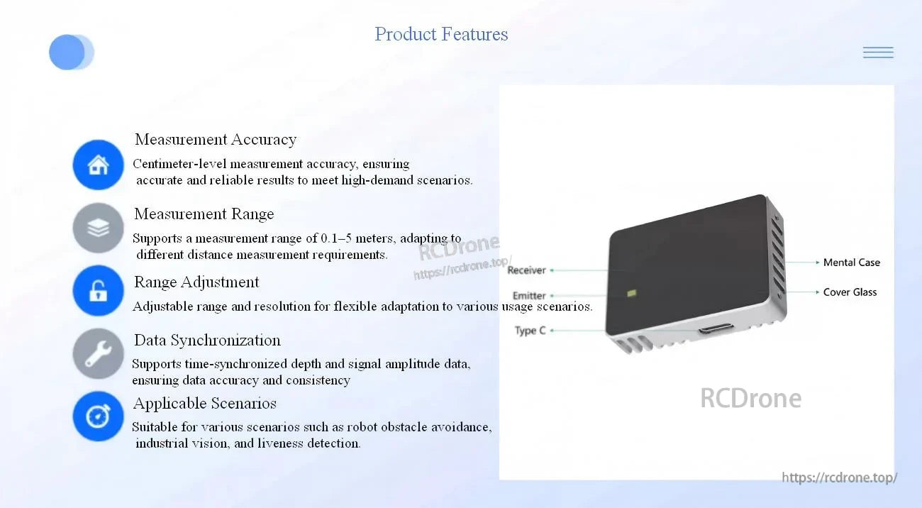
قياس العمق الداخلي بمستوى سنتيمتر في وحدة مدمجة، مع اتصال USB-C لسهولة التكامل مع الكمبيوتر/الروبوت.
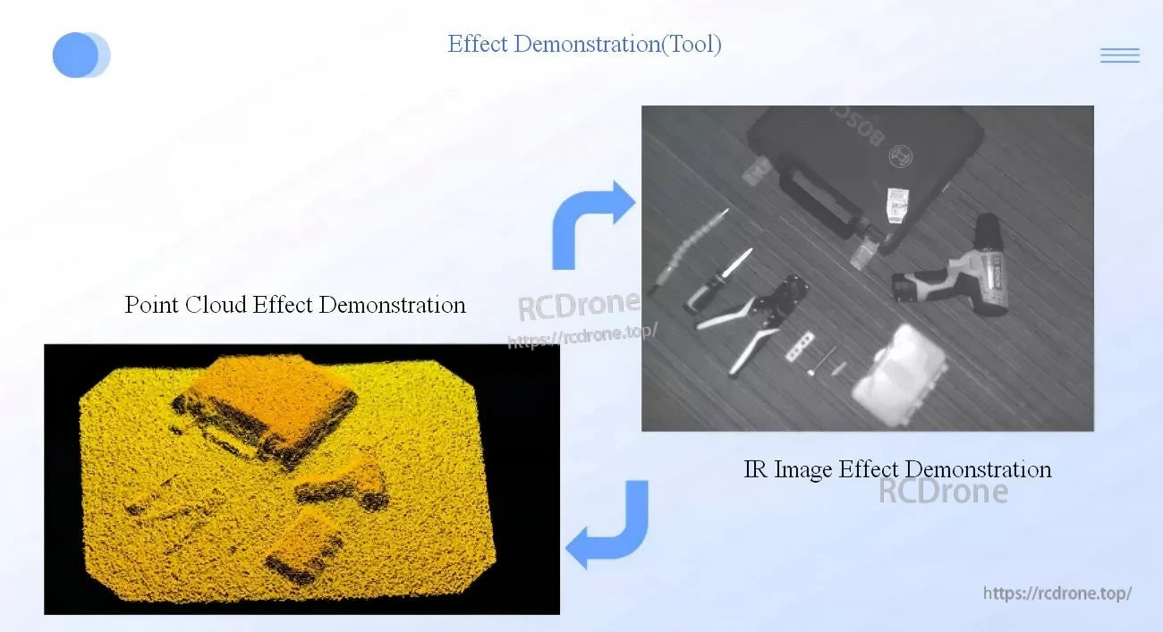

تساعد خرائط العمق والسحب النقطية في تقسيم الأشخاص والأشياء مع تقليل الاعتماد على ظروف الإضاءة المحيطة.
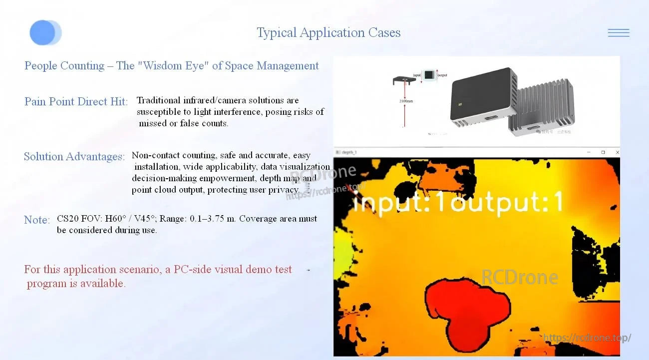
لدقة عد الأشخاص، يدعم CS20 القياس غير التلامسي مع التصوير القائم على العمق لتقليل العد المفقود أو الخاطئ.
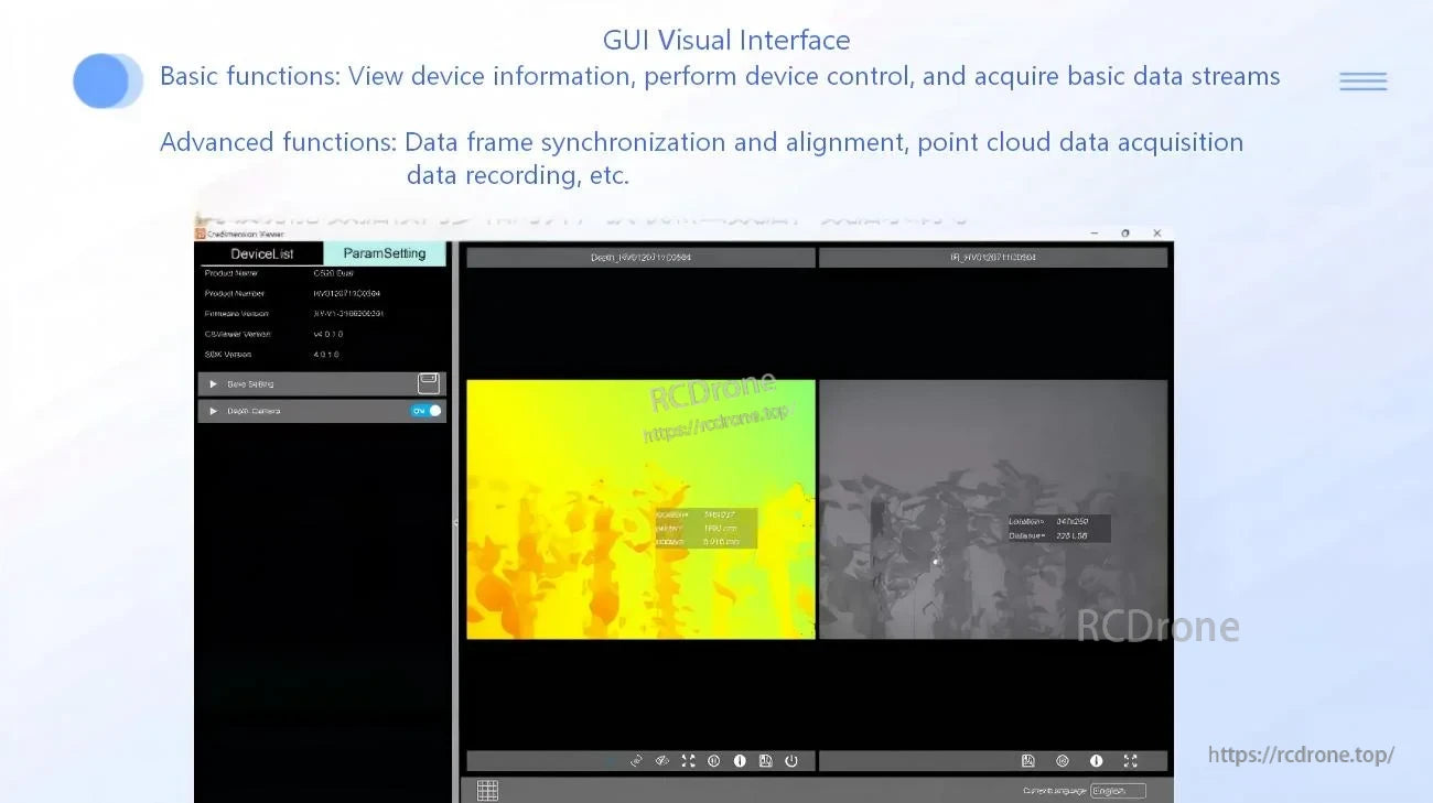
يدعم واجهة المستخدم الرسومية المضمنة التحكم في الجهاز بالإضافة إلى وظائف متقدمة مثل مزامنة/محاذاة الإطارات وتسجيل البيانات للتطوير.


الرسم الميكانيكي والأبعاد الرئيسية (48 × 34 × 12 مم) لتصميم الحاويات والتركيب.