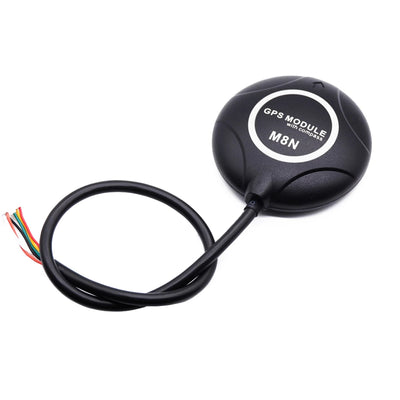
Papan GNSS RTK Kekerapan Penuh Beitian UM980/K902 untuk Navigasi UAV, Modul BDS/GPS Ketepatan Tinggi
Papan GNSS RTK Kekerapan Penuh Beitian UM980/K902 untuk Navigasi UAV, Modul BDS/GPS Ketepatan Tinggi
Beitian
Tidak dapat memuatkan ketersediaan pengambilan


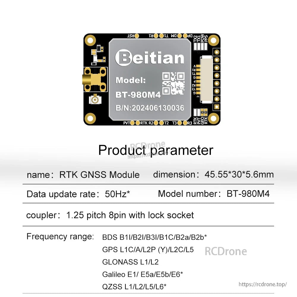
Overview
Beitian UM980/K902 adalah papan RTK GNSS frekuensi penuh untuk navigasi UAV dan aplikasi penentuan kedudukan berketepatan tinggi yang lain. Ia mengintegrasikan modul GNSS (UM980 atau K902, bergantung pada model) dan menyokong penerimaan multi-konstelasi seperti BDS/GPS/GLONASS/Galileo/QZSS untuk penentuan kedudukan RTK tahap sentimeter dan penentuan kedudukan titik tunggal tahap meter.
Ciri Utama
- Pilihan cip GNSS terintegrasi: UM980 atau K902 (bergantung pada model)
- Penentuan kedudukan RTK (RMS):
- Jajaran K902: (Keterlaluan) (8+10-6xD)mm; (Tegak) (15+10-6xD)mm
- Jajaran UM980: Rata: 0.8 cm +1 ppm; Ketinggian: 1.5 cm +1 ppm
- Penentuan kedudukan titik tunggal: Permukaan rata 1.5 m; Ketinggian 2.5 m
- Ketepatan masa: 20 ns
- Masuk ke mod RTK dengan cepat: masa permulaan kurang dari 5 s (nilai tipikal)
- Frekuesi kemas kini:
- Jajaran K902: lalai 5 Hz
- Jajaran UM980: <=50 Hz (Lalai: 1 Hz)
- Pelbagai kaedah sambungan ditunjukkan: kaedah sambungan berwayar dan kaedah sambungan radio (asas/rover)
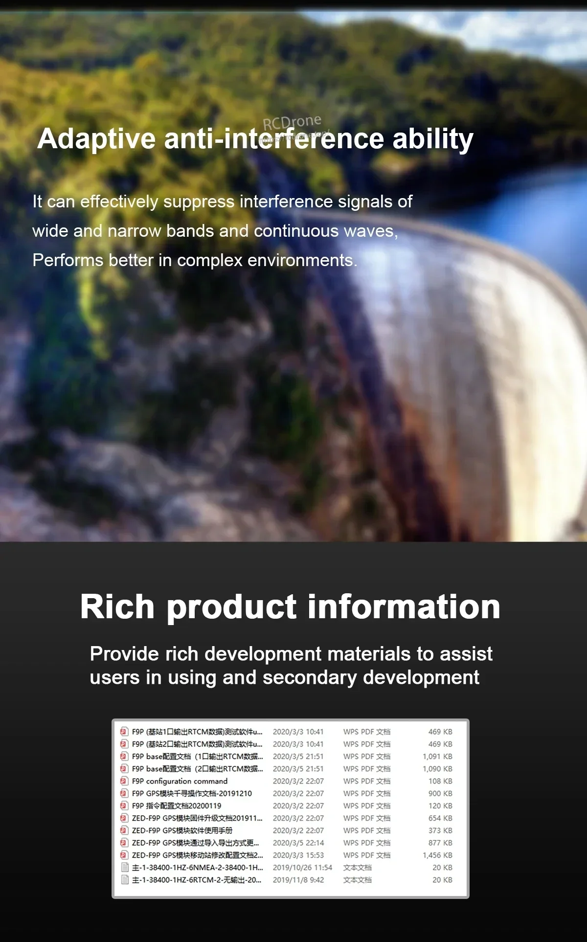
- Keupayaan anti-gangguan adaptif (menekan isyarat gangguan jalur lebar dan sempit serta gelombang berterusan)
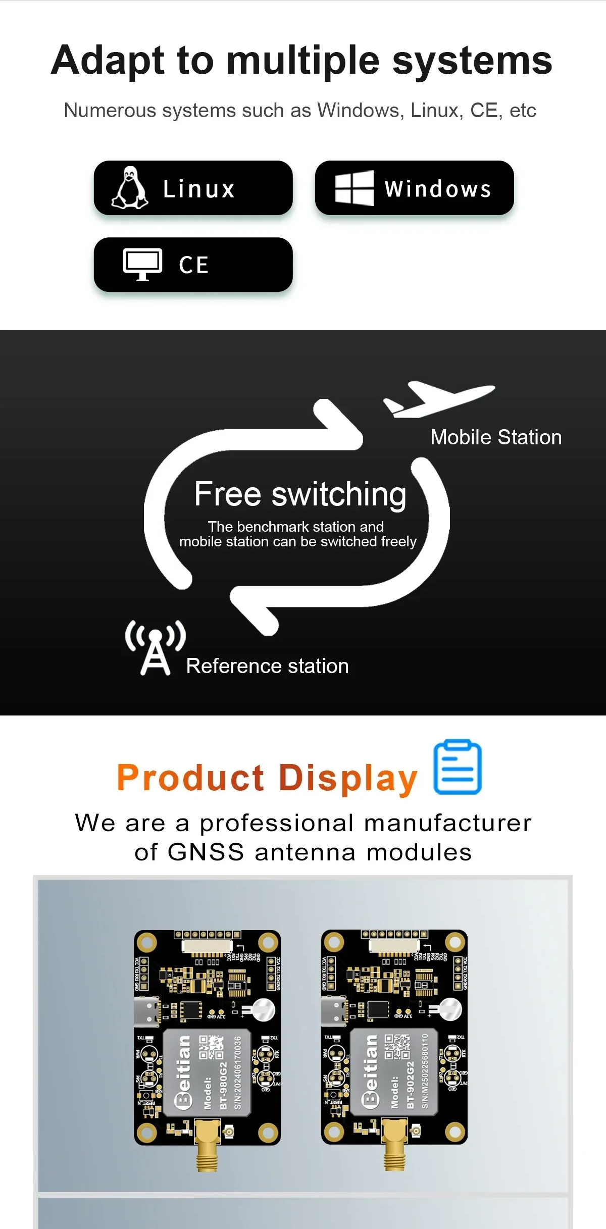
- Menyokong pelbagai sistem seperti yang dinyatakan: Windows, Linux, CE
Pilihan Model
- BT-980G1; BT-980G2; BT-980G3; BT-980G4
- BT-980M1; BT-980M2; BT-980M3; BT-980M4
- BT-902G1; BT-902G2; BT-902G3; BT-902G4
- BT-902M1; BT-902M2; BT-902M3; BT-902M4
Spesifikasi
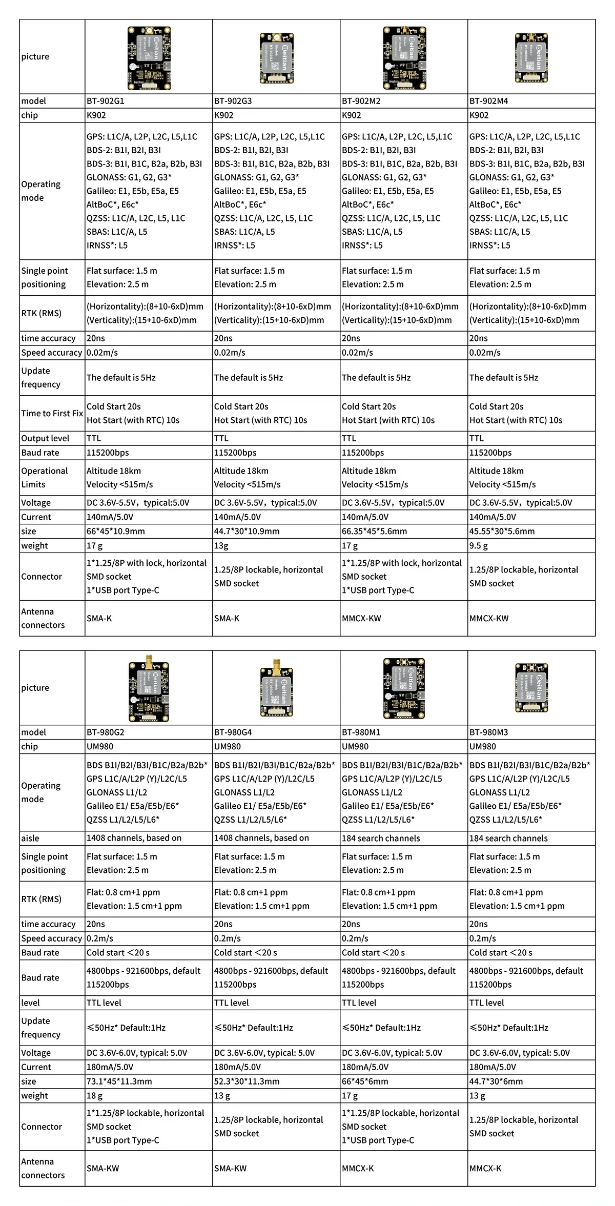
Jajaran K902 (model yang ditunjukkan: BT-902G1 / BT-902G3 / BT-902M2 / BT-902M4)
| Chip | K902 |
| Modus operasi | GPS: L1C/A, L2P, L2C, L5, L1C; BDS-2: B1I, B2I, B3I; BDS-3: B1I, B1C, B2a, B2b, B3I; GLONASS: G1, G2, G3*; Galileo: E1, E5B, E5a, E5, AltBOC*, E6c*; QZSS: L1C/A, L2C, L5, L1C; SBAS: L1C/A, L5; IRNSS*: L5 |
| Pemosisian titik tunggal | Permukaan rata: 1.5 m; Ketinggian: 2.5 m |
| RTK (RMS) | (Horisontaliti): (8+10-6xD)mm; (Vertikaliti): (15+10-6xD)mm |
| Ketepatan masa | 20 ns |
| Ketepatan kelajuan | 0.02 m/s |
| Frekuesi kemas kini | Default adalah 5 Hz |
| Masa untuk Pertama Fix | Cold Start 20 s; Hot Start (dengan RTC) 10 s |
| Tahap output | TTL |
| Kadar baud | 115200 bps |
| Had operasi | Ketinggian 18 km; Kelajuan <515 m/s |
| Voltan | DC 3.6 V-5.5 V, tipikal: 5.0 V |
| Arus | 140 mA/5.0 V |
| Model | Saiz | Berat | Penyambung | Penyambung antena |
|---|---|---|---|---|
| BT-902G1 | 66*45*10.9mm | 17 g | 1*1.25/8P dengan kunci, soket SMD mendatar; 1*port USB Type-C | SMA-K |
| BT-902G3 | 44.7*30*10.9mm | 13 g | 1.25/8P boleh dikunci, soket SMD mendatar | SMA-K |
| BT-902M2 | 66.35*45*5.6mm | 17 g | 1*1.25/8P dengan kunci, soket SMD mendatar; 1*port USB Type-C | MMCX-KW |
| BT-902M4 | 45.55*30*5.6mm | 9.5 g | 1.25/8P kunci, soket SMD mendatar | MMCX-KW |
UM980 Siri (model yang ditunjukkan: BT-980G2 / BT-980G4 / BT-980M1 / BT-980M3)
| Chip | UM980 |
| Mod operasi | BDS B1I/B2I/B3I/B1C/B2a/B2b*; GPS L1C/A/L2P (Y)/L2C/L5; GLONASS L1/L2; Galileo E1/E5a/E5b/E6*; QZSS L1/L2/L5/L6* |
| Saluran | BT-980G2/BT-980G4: 1408 saluran, berdasarkan; BT-980M1/BT-980M3: 184 saluran pencarian |
| Pemosisian titik tunggal | Permukaan rata: 1.5 m; Ketinggian: 2.5 m |
| RTK (RMS) | Rata: 0.8 cm +1 ppm; Ketinggian: 1.5 cm +1 ppm |
| Ketepatan masa | 20 ns |
| Ketepatan kelajuan | 0.2 m/s |
| Masa untuk Penetapan Pertama | Permulaan sejuk <20 s |
| Kadar baud | 4800bps - 921600bps, lalai 115200bps |
| Tahap | Tahap TTL |
| Kekerapan kemas kini | <=50Hz* Lalai:1Hz |
| Voltan | DC 3.6V-6.0V, tipikal: 5.0V |
| Arus | 180mA/5.0V |
| Model | Saiz | Berat | Penyesuai | Penyambung antena |
|---|---|---|---|---|
| BT-980G2 | 73.1*45*11.3mm | 18 g | 1*1.25/8P boleh kunci, soket SMD mendatar; 1*port USB Jenis-C | SMA-KW |
| BT-980G4 | 52.3*30*11.3mm | 13 g | 1.25/8P boleh dikunci, soket SMD mendatar | SMA-KW |
| BT-980M1 | 66*45*6mm | 17 g | 1*1.25/8P boleh dikunci, soket SMD mendatar; 1*port USB Jenis-C | MMCX-K |
| BT-980M3 | 44.7*30*6mm | 13 g | 1.25/8P kunci, soket SMD mendatar | MMCX-K |
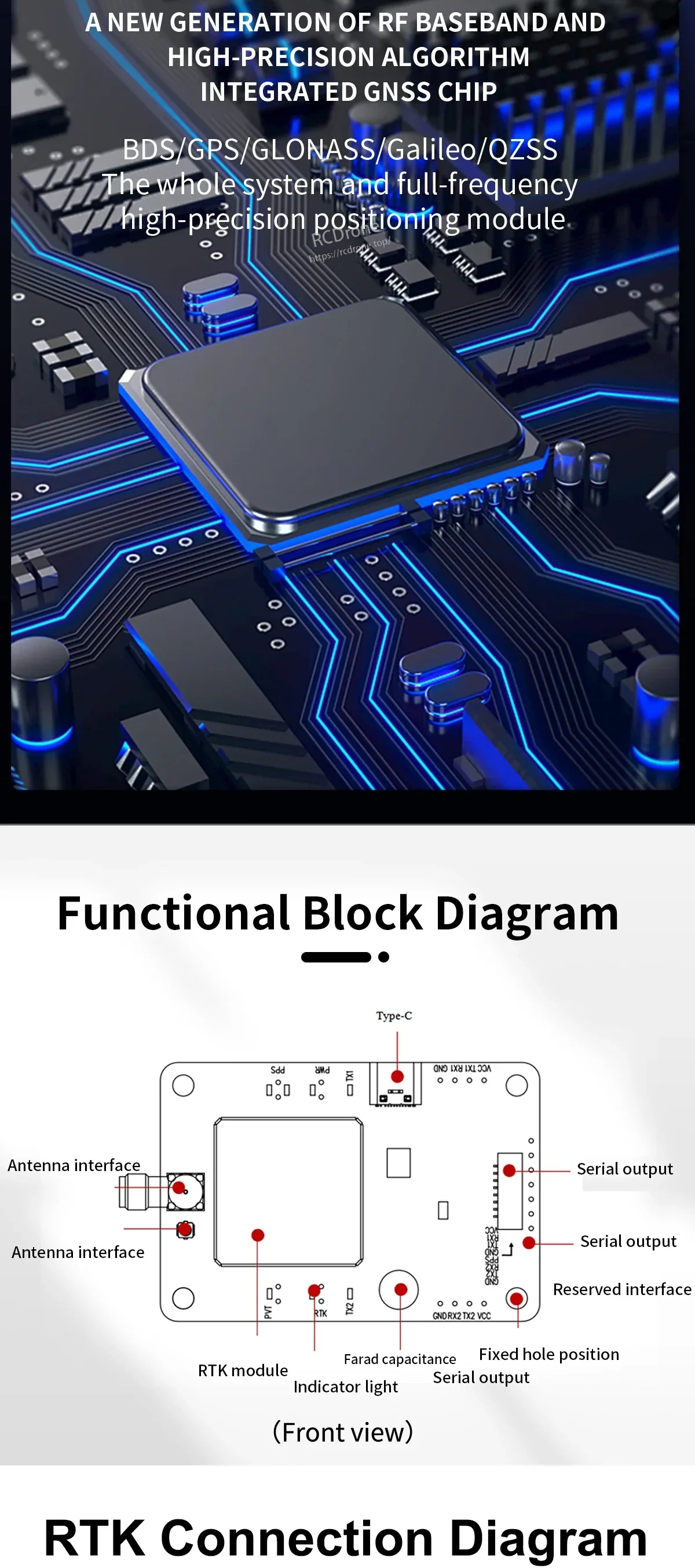
Susun Atur Papan / Antara Muka (seperti yang dilabel)
- Type-C
- Antara muka antena (dilabel dua kali)
- Output serial (dilabel beberapa kali)
- Antara muka yang diperuntukkan
- Lampu penunjuk
- Modul RTK
- Kapasitans Farad
- Posisi lubang tetap
Sambungan RTK (skema ditunjukkan)
- Konstelasi yang ditunjukkan: BDS / GPS / GLONASS / GALILEO
- Mod yang ditunjukkan: Kaedah sambungan radio (stesen radio luaran) dan kaedah sambungan berwayar
- Asas/Rover yang ditunjukkan: Stesen Induk (Asas) dan Stesen Hamba (Rover)
- Bekalan kuasa yang ditunjukkan: 5V > 1A (Sumber)
- Label isyarat yang ditunjukkan: RX1, TX1, GND, VCC, RX2, TX2
Apa yang Termasuk
- Papan/module GNSS (nomenon) x1
- 1.25 8p dengan kabel serial soket kunci x1
- Kabel USB ke TYPE-C x1
Aplikasi
- Dron / navigasi UAV
- Ujian memandu dan latihan pemandu
- Navigasi mesin pertanian
- Robot dan sistem pemanduan pintar yang memerlukan penentuan kedudukan yang tinggi ketepatannya
Untuk sokongan pemilihan model dan bantuan integrasi, hubungi [email protected] or lawati https://rcdrone.top/.
Butiran
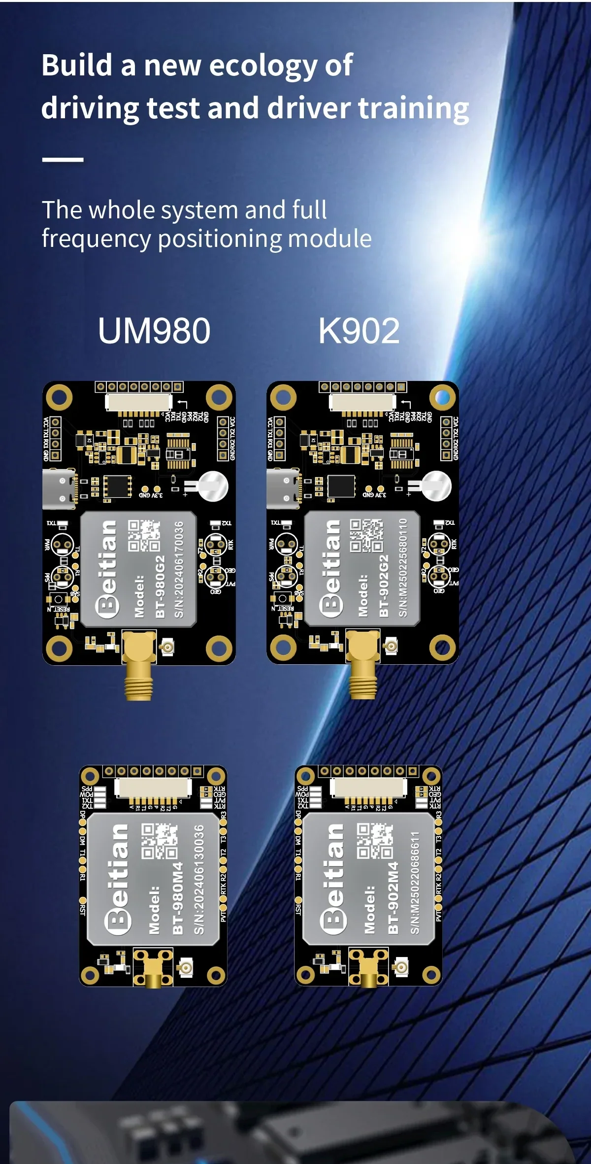
Pilih UM980 atau K902 bergantung kepada keperluan kadar kemas kini anda dan ruang integrasi untuk pembinaan navigasi UAV dan robotik.
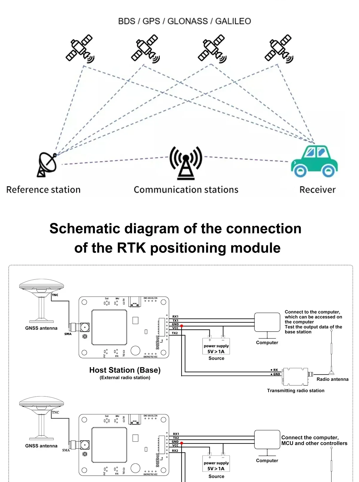
Persediaan RTK menggabungkan stesen asas (rujukan) dengan penerima rover untuk memberikan penentuan kedudukan pada tahap sentimeter apabila pembetulan diterapkan.
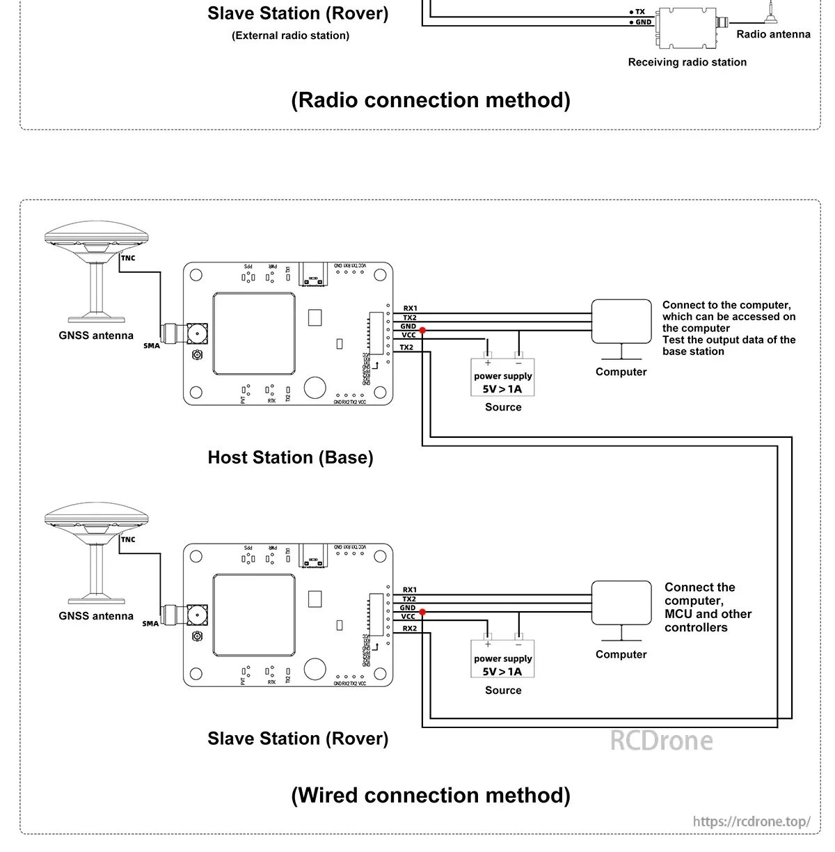
Kedua-dua pautan pembetulan berwayar dan radio disokong, memudahkan untuk menyelaraskan stesen darat dan aliran kerja telemetri anda.
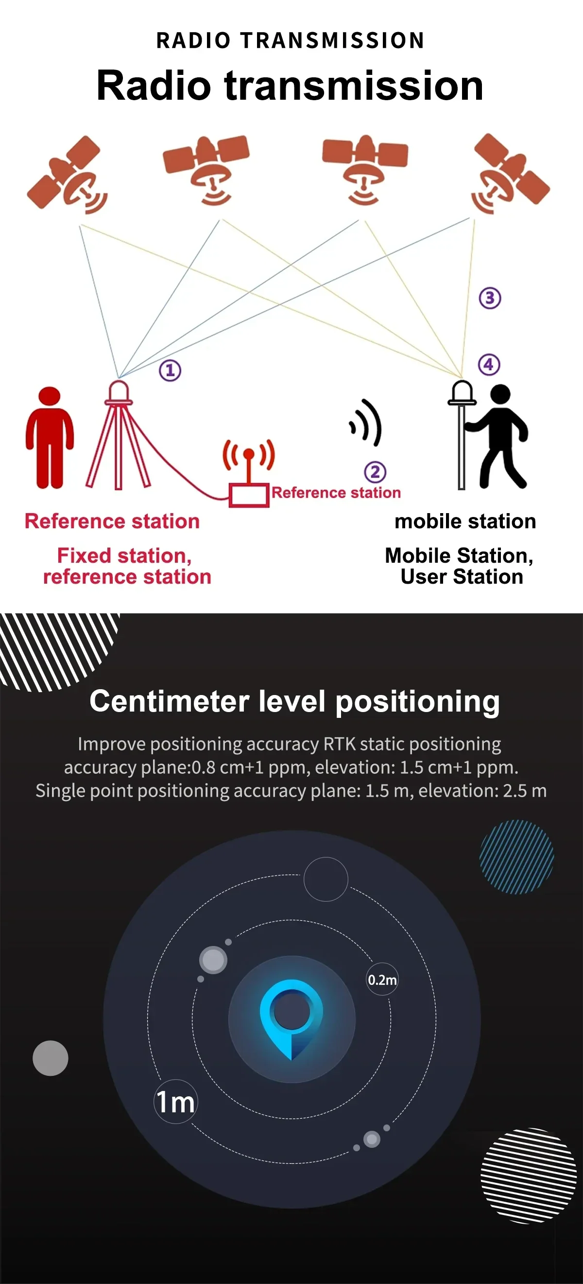
Pemosisian RTK tahap sentimeter meningkatkan ketepatan panduan untuk kenderaan autonomi, dron, dan aliran kerja pengukuran.
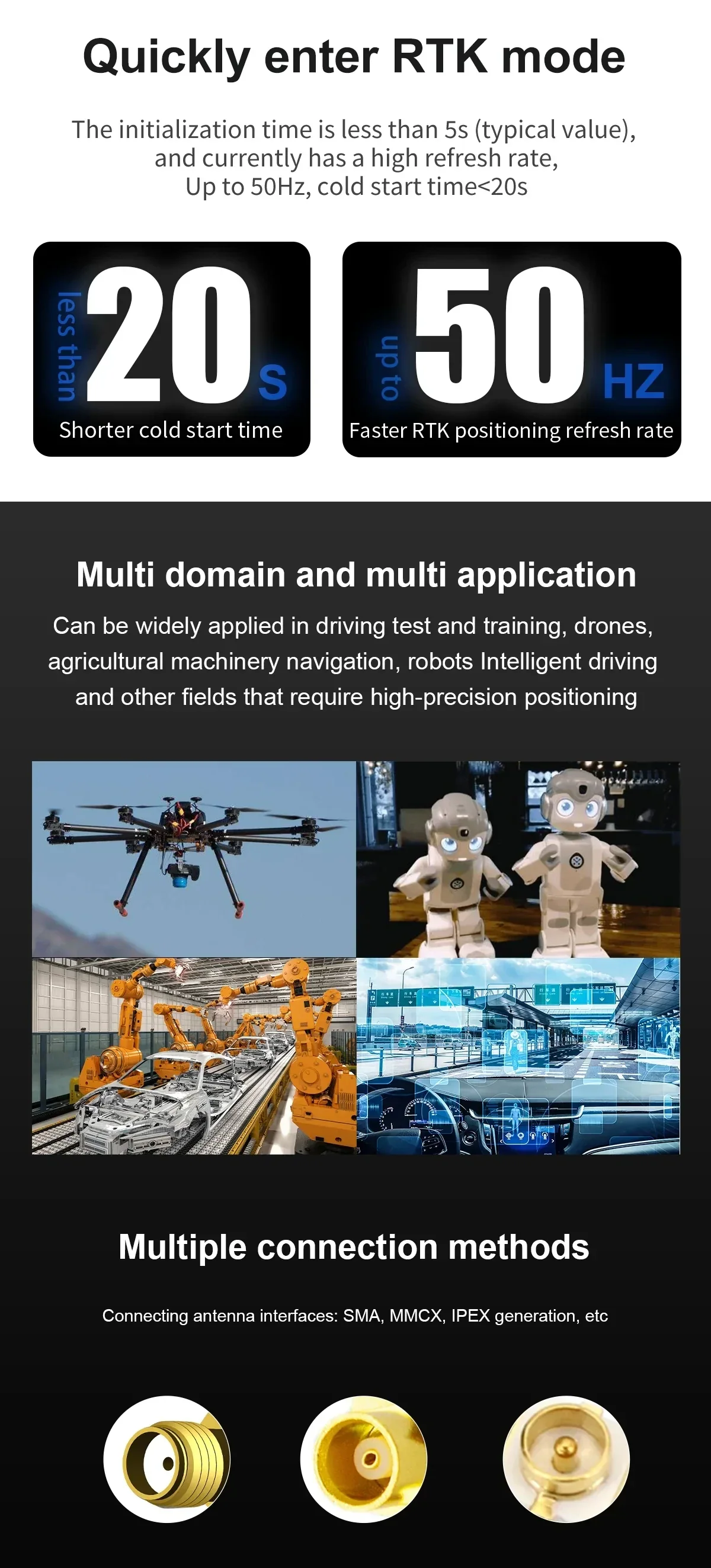
Pemulaan yang cepat dan pilihan penyambung antena yang fleksibel membantu mempercepat pemasangan di seluruh UAV, pertanian, dan platform industri.
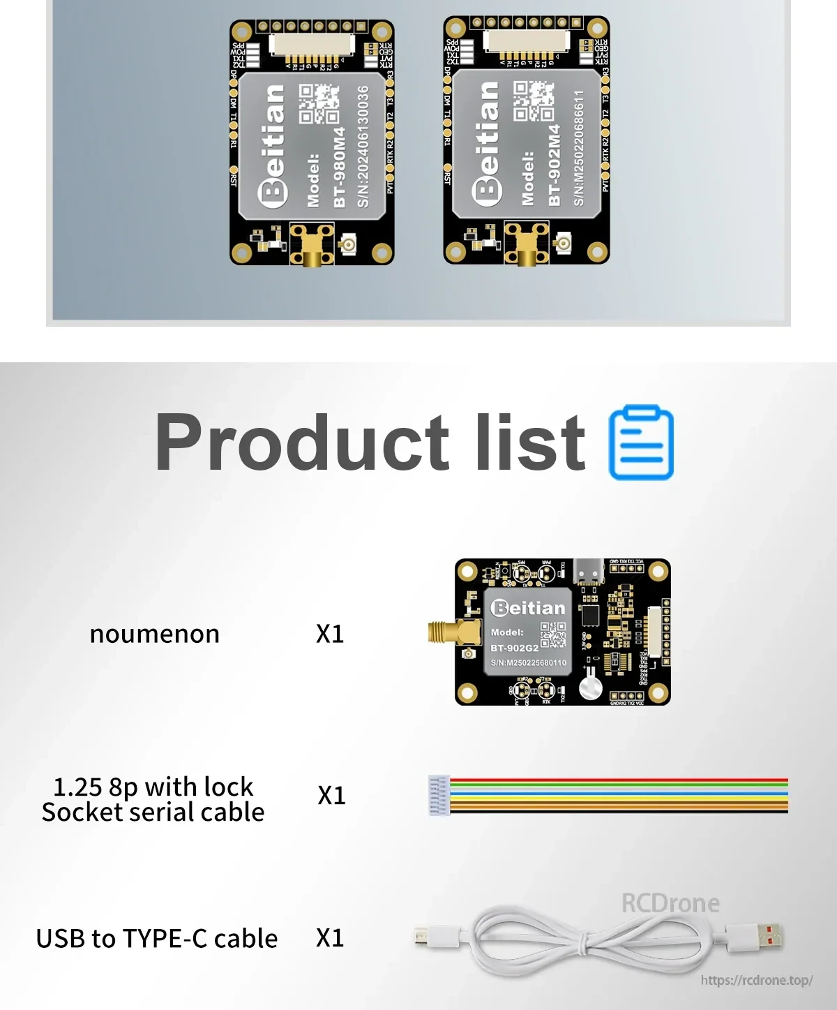
Kabel yang disertakan memudahkan penyediaan bench, konfigurasi, dan komunikasi serial semasa integrasi dan pengujian.