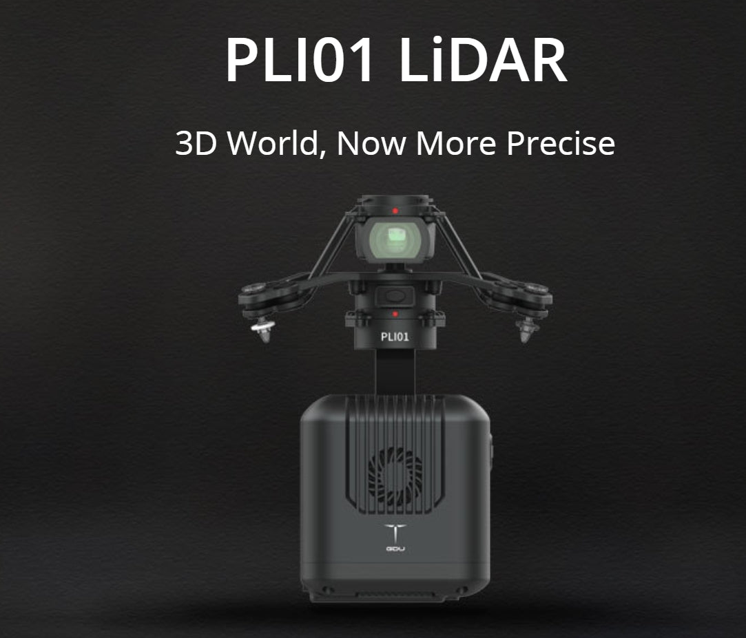
GDU PLI01 LiDAR Drone Gimbal Camera - High-Precision 3D Mapping for Surveying
GDU PLI01 LiDAR
3D World, Now More Precise
The GDU PLI01 LiDAR is a lightweight and highly efficient LiDAR system developed for multi-rotors. It integrates a compact LiDAR system, an inertial navigation system, a control system, and high-resolution mapping cameras, making it the perfect tool for a variety of applications including surveying and mapping, power line inspection, forest preservation, precision agriculture, land planning, disaster relief, and mine safety.
More Drone Gimbal
Triple Echoes For More Under-the-Cover Stories
The PLI01 is capable of capturing and processing up to 720,000 points per second (triple echoes). This high point rate allows the system to penetrate vegetation and reveal more details hidden beneath, providing comprehensive data for better analysis and decision-making.
High-quality Point Clouds
With integrated GNSS and a high-precision IMU, the PLI01 generates point clouds with centimeter-level accuracy. This precision is crucial for tasks such as precise measurement in surveying and mapping, obtaining detail-rich spatial digital representations in urban planning, and reducing risks by identifying unstable terrain or vegetation encroachment.
Efficient Operation
The PLI01 LiDAR Scanner can measure distances up to 450 meters (80% reflectivity) and cover an area spanning 2 square kilometers (494.2 acres) in a single flight. This extensive coverage ensures that large areas can be surveyed quickly and efficiently, saving time and resources.
More Thermal Camera
Software Services One Click Away
The PLI01 is complemented by a series of software solutions designed to simplify operations. With just one click, users can process point clouds, plan automatic flight routes, and identify defects in point cloud data, enhancing productivity and accuracy in their projects.

Technical Specifications
PLI01
| Parameter | Specification |
|---|---|
| Weight | 1065 g ± 5 g |
| Installation mechanism | Camera gimbal all-in-one, detachable |
| Dimensions | 160 mm × 96 mm × 152.5 mm (exclude FV shock-absorbing hanger) |
| Interface | 60-pin interface (includes network port & serial port) |
| IP level | IP54 |
| Work temperature | -20ºC ~ 55ºC |
| Storage | MicroSD (max 256GB), internal storage 64G + 128G SD card |
| Power consumption | 20W |
LiDAR
| Parameter | Specification |
|---|---|
| Detection Range | 190 m @ 10% reflectivity, 280 m @ 20% reflectivity, 450 m @ 80% reflectivity |
| Point Rate | Single return: 240,000 pts/s; Multiple return: 480,000 pts/s; Triple return: 720,000 pts/s |
| Ranging Accuracy | 3 cm @ 100 m |
| Wavelength | 905 nm |
| Scan Modes | Repeat scan |
| Line count | Equivalent to 64 lines |
| FOV | Repeat scan: 70.4º × 4.5º |
Inertial Navigation System
| Parameter | Specification |
|---|---|
| Yaw Accuracy (RMS 1σ) | Post-processing: 0.080º |
| Pitch / Roll Accuracy (RMS 1σ) | Post-processing: 0.025º |
| Positioning accuracy | Horizontal: 0.02 m, elevation: 0.03 m |
| Update Frequency | 200 Hz |
Camera
| Parameter | Specification |
|---|---|
| Resolution | 26 mega pixels |
| FOV | 83º |
| Shooting mode | Fixed time/range |
Point Cloud
| Parameter | Specification |
|---|---|
| Positioning accuracy | Horizontal: 10 cm @ 50 m; Elevation: 5 cm @ 50 m |

Product Highlights
The GDU PLI01 LiDAR is a groundbreaking tool designed for precise 3D mapping and surveying. Its combination of high point rate, centimeter-level accuracy, and efficient operation makes it ideal for a wide range of professional applications. Whether you are involved in urban planning, environmental monitoring, or infrastructure inspection, the PLI01 provides the detailed and accurate data needed to make informed decisions. With easy-to-use software solutions, it streamlines the entire workflow from data capture to analysis, making high-precision 3D mapping more accessible than ever.


