Overview
The Prometheus P450 Scientific Research & Teaching Drone is a comprehensive open-source development platform designed for academic and research applications. Built on the robust F450 frame, this quadrotor drone integrates cutting-edge hardware, including the NVIDIA Jetson Orin NX onboard computer with 100 TOPS computing power, Intel RealSense depth and tracking cameras, 2D LiDAR, and a high-capacity 5000mAh battery. Supporting advanced control modes, real-time visualization, and path planning with SpireCV vision algorithms and EGO-Planner, it offers versatility for indoor and outdoor high-precision applications. Additional features include autonomous obstacle avoidance, QR code tracking, and seamless integration with the Prometheus Ground Station system, making it a powerful tool for AI development, education, and UAV programming.
Key Features
-
Robust Frame
Built on the sturdy F450 quadrotor frame for reliable stability. -
High-Performance Computing
Equipped with NVIDIA Jetson Orin NX delivering 100 TOPS of AI computing power. -
Advanced Sensors
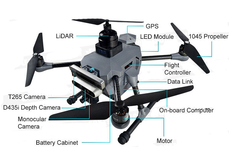
Includes Intel RealSense D435i and T265 cameras, 2D LiDAR, and optical flow modules. -
Precise Positioning
RTK, GPS, and SLAM-enabled Viobot positioning for enhanced accuracy. -
Versatile Control Modes
Supports 8 control modes, including position, speed, and trajectory tracking. -
Open-Source Platform
Based on ROS with extensive secondary development interfaces. -
Integrated Ground Station
Prometheus Ground Station for real-time monitoring, control, and visualization. -
Indoor/Outdoor Applications
Designed for high-precision use in both indoor and outdoor environments. -
Powerful Battery
High-capacity 5000mAh battery for extended operation. -
Expandable and Programmable
Supports MATLAB Simulink and SpireCV SDK for custom algorithm development.
Specifications
Hardware Parameters
Drone Specifications
| Category | Details |
|---|---|
| Drone Type | Quadrotor |
| Takeoff Weight (approx.) | 2.044kg (including battery) |
| Diagonal Wheelbase | 410mm |
| Dimensions | Length: 290mm, Width: 290mm, Height: 240mm |
| Maximum Takeoff Weight | 2.2kg |
| Hover Time | Approx. 10 minutes |
| Hover Accuracy | RTK positioning: Vertical ±0.15m, Horizontal ±0.1m |
| GPS Positioning | Vertical ±0.5m, Horizontal ±0.8m |
| T265 Accuracy | ±0.05m |
| Operating Temperature | 6°C to 40°C |
Onboard Computer - Allspark
| Category | Details |
|---|---|
| Name | Allspark-Orin NX Onboard Computer |
| Model | IA160_V1 |
| Weight | Approx. 188g |
| Dimensions | 102.5mm × 62.5mm × 31mm (including fan) |
| Processor | NVIDIA Jetson Orin NX |
| Memory | 16GB LPDDR5 |
| Compute Power | 100 TOPS |
| GPU | 32 Tensor Cores, 1024-core NVIDIA Ampere architecture GPU |
| CPU | 8-core Arm® Cortex®-A78AE v8.2 64-bit CPU (2MB L2 + 4MB L3 cache) |
| SSD | 128GB (Built-in M.2 interface, expandable) |
| Ethernet | 100Mbps x2 (One independent port, one switch port) |
| WiFi | 2.4GHz |
Onboard Computer - Viobot
| Category | Details |
|---|---|
| Name | Viobot |
| Weight | 94g |
| Dimensions | 82mm × 75mm × 23mm |
| Processor | RK3588 |
| Memory | 4GB |
| Compute Power | Approx. 5 TOPS |
| Storage (eMMC) | 16GB |
| Ethernet | 1000Mbps (adaptive) |
| WiFi | 2.4GHz |
Power Battery
| Category | Details |
|---|---|
| Dimensions | 130mm × 65mm × 40mm |
| Weight | 470g |
| Charging Cutoff Voltage | 16.8V |
| Nominal Voltage | 14.8V |
| Rated Capacity | 5000mAh |
Remote Controller
| Category | Details |
|---|---|
| Model | AMOVLAB QE-2 |
| Operating Voltage | 4.5V - 9V |
| Channels | 8 |
| Transmission Power | <20dBm |
| Weight | 410g |
| Dimensions | 179mm × 81mm × 161mm |
Communication Link
| Category | Details |
|---|---|
| Model | Mini Homer |
| Frequency | Sub 1G band |
| Operating Voltage | 12V |
| Transmission Distance | 1200m |
| Bandwidth | 7MHz |
Charger
| Category | Details |
|---|---|
| Input Voltage | DC 9V - 12V |
| Maximum Output Power | 25W |
| Maximum Output Current | 1500mA |
| Display Precision | ±10mV |
| Dimensions | 81mm × 50mm × 20mm |
| Weight | 76g |
Depth Camera
| Category | Details |
|---|---|
| Model | Intel® RealSense™ Depth Camera D435i |
| Depth Technology | Active Stereo IR |
| Depth Imaging Technology | Global Shutter |
| Depth FOV (HxV) | 86°×57° (±3°) |
| Depth Resolution & FPS | 1280x720, 90 FPS (maximum) |
| RGB Imaging Technology | Rolling Shutter |
| RGB Resolution & FPS | 1920x1080, 30 FPS (maximum) |
| RGB FOV (HxV) | 69°×42° (±1°) |
| Minimum Depth Distance | 0.105m |
| Maximum Range | Approx. 10m |
| Dimensions | Length: 90mm, Width: 25mm, Height: 25mm |
| Weight | 72g |
Stereo Camera
| Category | Details |
|---|---|
| Model | Intel® RealSense™ Tracking Camera T265 |
| Depth Sensor | Dual Cameras (Left & Right) |
| Depth Resolution | 848x800 |
| Depth Range | 0.2m~5m |
| Camera Resolution | 800x848 (per camera) |
| Frame Rate | 30 FPS |
| Image Format | Y8 |
| Data Interface | USB 3.1 Gen 1 Type-C |
| Weight | 55g |
| Dimensions | Length: 108mm, Width: 25mm, Height: 13mm |
Optical Flow Module
| Category | Details |
|---|---|
| Weight | 5.0g |
| Dimensions | 29mm × 16.5mm × 15mm |
| Measurement Range | 0.01m - 8m |
| Horizontal FOV | 6° |
| Vertical FOV | 42° |
| Power | 500mW |
| Operating Voltage | 4.0V - 5.5V |
| Effective Working Distance | >80mm |
| Output Interface | UART |
LiDAR Sensor
| Category | Details |
|---|---|
| Model | S3M1-R2 LiDAR Sensor |
| Application Scenarios | Suitable for indoor and outdoor environments, reliable anti-sunlight capability (≥80Klux) |
| Measurement Range | White objects: 0.05m~40m (70% reflectivity) |
| Black objects: 0.05m~15m (10% reflectivity) | |
| Black objects: 0.05m~5m (2% reflectivity) | |
| Angular Accuracy | 0° ~ 1.5° |
| Sampling Frequency | 32kHz |
| Scanning Frequency | Typical: 10Hz, 10~20Hz |
| Angular Resolution | Typical: 0.1125°, 0.1125°~0.225° |
| Communication Interface | TTL UART |
| Transmission Rate | 1M |
| Range Accuracy | ±30mm |
| Distance Resolution | 10mm |
| Power Supply Voltage | 5V |
| Weight | Approx. 115g |
| Operating Temperature | 10°C ~ 40°C |
Software Parameters
Onboard Computer
| Category | Details |
|---|---|
| Model | Jetson Orin NX |
| Cuda Version | 11.4.315 |
| Operating System | Ubuntu 20.04 |
| Realsense SDK | 2.50.0 |
| Username | amov |
| ROS Version | noetic |
| Password | amov |
| OpenCV Version | 4.7.0 |
| L4T Version | 35.2.1 |
| Realsense ROS Version | 2.3.2 |
| Jetpack Version | 5.1 |
Prometheus Software
| Category | Details |
|---|---|
| Version | v2.0 |
Prometheus Ground Station System
| Category | Details |
|---|---|
| Version | v1.24.01.08 (based on official Wiki records) |
Packing List
| Name | Model | Quantity/Unit |
|---|---|---|
| Frame | MFP_V1 | 1 |
| Flight Controller | Pixhawk 6C | 1 |
| Remote Controller | Amovlab QE-2 | 1 |
| Communication Module | Mini Homer | 2 pairs |
| Power Distribution Board | / | 1 |
| ESC | 4-in-1 ESC | 1 |
| Optical Flow Module | MTF-01 | 1 |
| Motor | 2312 960kv | 4 |
| Propellers | 10-inch | 2 pairs |
| Onboard Computer | Allspark Orin NX | 1 |
| Stereo Depth Camera | Intel D435i | 1 |
| Stereo Depth Camera | Intel T265 | 1 |
| LiDAR | S3M1-R2 | 1 |
| Battery | FB45 4S 5000mAh | 1 |
| GPS Module | M8N GPS | 1 |
| RTK Module | Antenna RTK | 1 |
| GNSS Antenna Cable | GNSS Antenna Cable | 1 |
| Charger | PD60 | 1 |
| Network Cable | 1.5m | 1 |
| Safety Rope | 50m | 1 |
| Data Cable | Type A to Type C | 2 |
| Certificate | / | 1 sheet |
Notes:
We also provide Viobot onboard computer models. For details, please contact customer service.
| Package Name | config 2 | config 3 |
|---|---|---|
| Model Name | P450_Viobot | P450_RTK_Allspark2_T265_S3_D435i |
| Usage Scenarios | Indoor: √ Outdoor: √ | Indoor: √ Outdoor: √ |
| Flight Platform | F450 | F450 |
| Onboard Computer | Viobot: √ Allspark2: × | Viobot: × Allspark2: √ |
| Positioning Methods | RTK: × GPS: √ | RTK: √ GPS: √ |
| Depth Camera | T265: × D435i: × | T265: √ D435i: √ |
| LiDAR | S3M1-R2: × | S3M1-R2: √ |
| Recommended Use | Indoor and outdoor control use | Indoor and outdoor high-precision use |
| Features | UAV control applications | UAV control applications, visual tracking, visual obstacle avoidance, RTAB-Map building, Octomap building, LiDAR obstacle avoidance |
Details
Prometheus 450 Research Drone Development Platform
F450 Frame
- Sturdy and reliable structure with high stability.
Powerful Computing
- Provides up to 100 TOPS of floating-point computational power.
Integrated Image Transmission and Control
- Combines controller signals into an integrated image transmission module, achieving a transmission distance of up to 1 km.
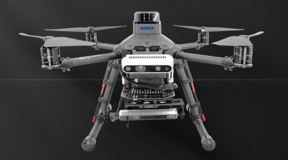
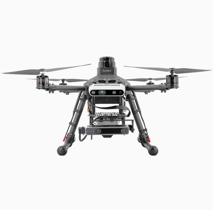
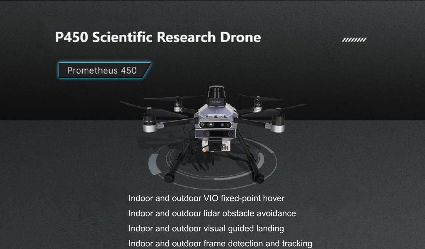
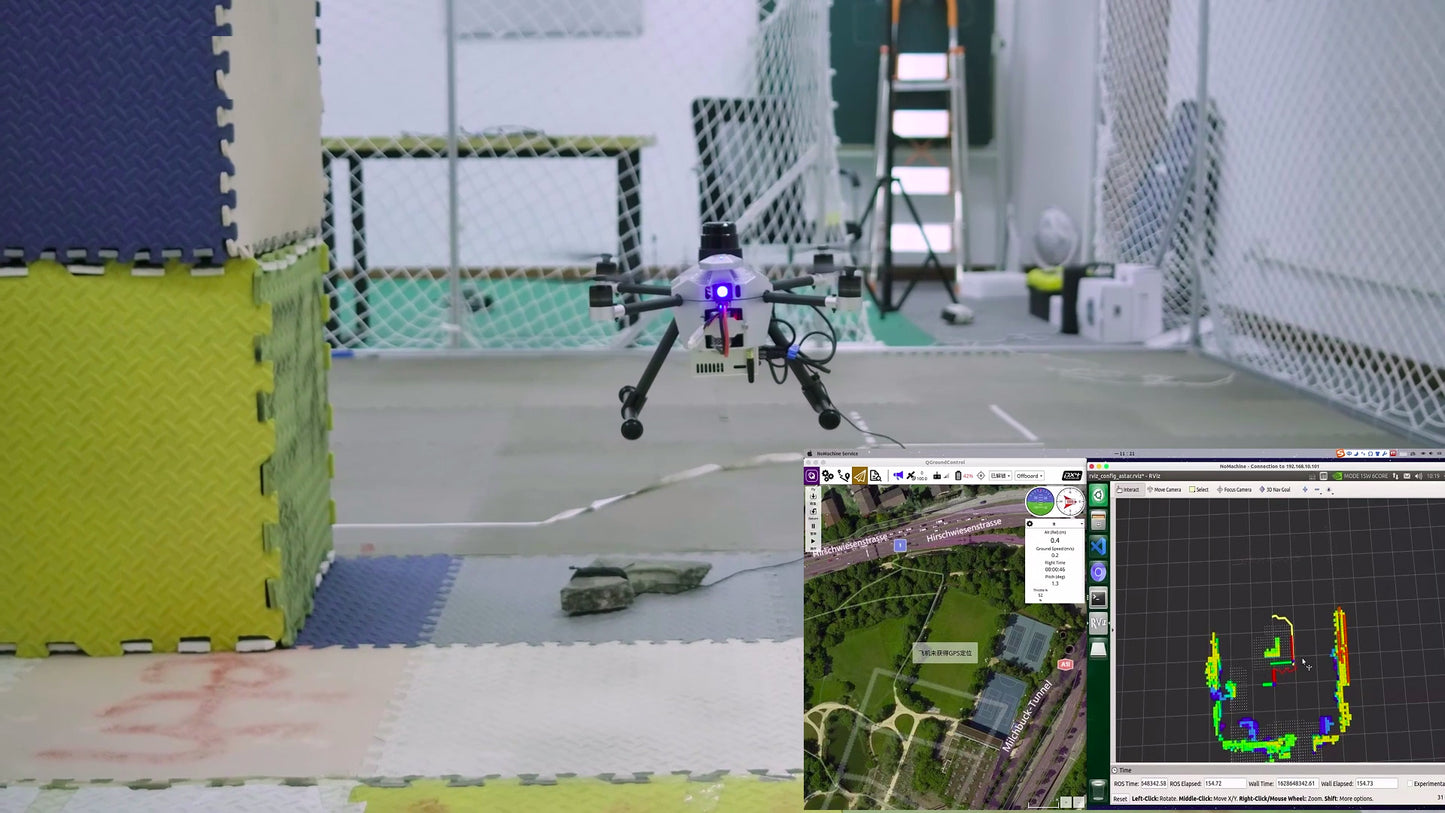
Prometheus 450 (shortened as P450) is a medium-sized quadcopter designed for both indoor and outdoor applications. Based on the F450 platform, it integrates a 2D LiDAR, stereo depth cameras, and other advanced sensors. It comes with SpireCV visual algorithms and the Prometheus autonomous drone system to achieve target tracking and path planning.
With the addition of EGO-Planner route planning and Prometheus’s professional ground station capabilities, it supports real-time visualization, streamlined operations, and rapid deployment.
Drone Control Application
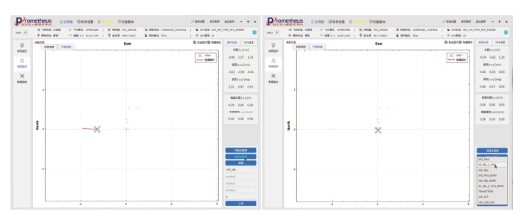
The drone control module acts as a "bridge" between software algorithms and drones, providing initial position hold, waypoint hold, descent, movement, and other control states. It includes six sub-control modes for position, speed, and position-speed hybrid control in an inertial and body frame, along with trajectory tracking and spiral control modes, making up a total of eight control modes.
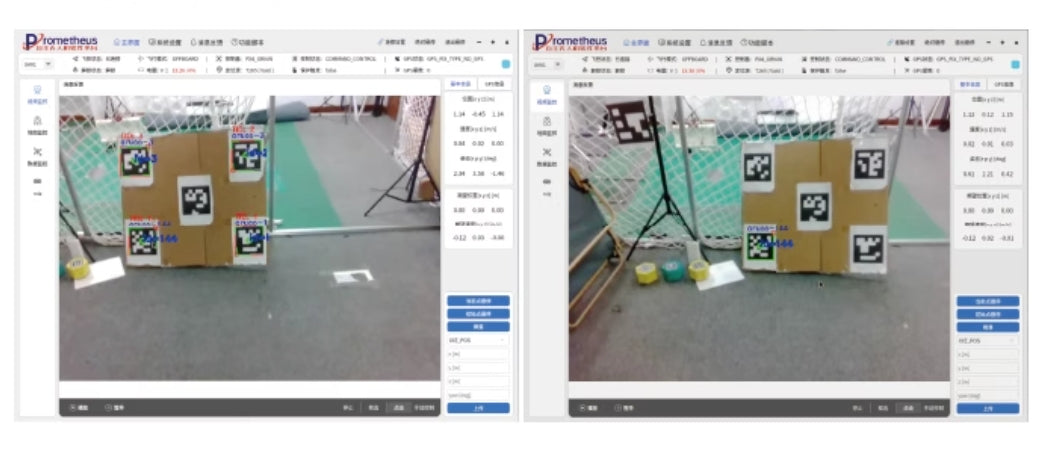
Indoor/Outdoor QR Code Point Tracking (SpireCV Vision Library)
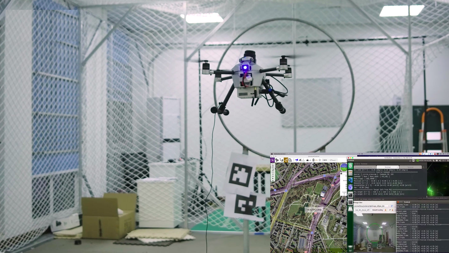
Utilizes the SpireCV vision library for QR code recognition programs and integrates with the Prometheus control interface. Paired with the professional ground station, it achieves indoor and outdoor QR code point tracking functionality.

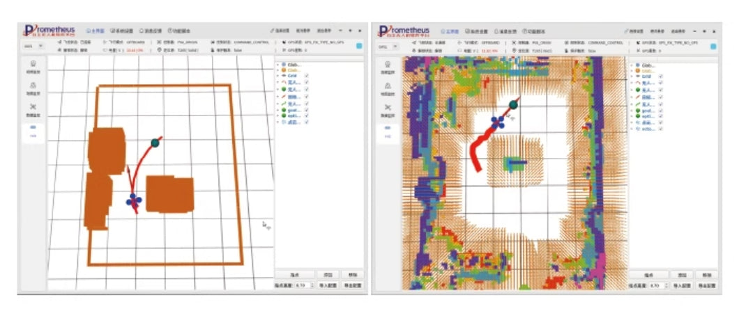
Indoor/Outdoor EGO-Planner
Supports different hardware inputs, such as depth cameras or 2D LiDARs. Integrates the EGO-Planner path planning algorithm to achieve obstacle avoidance and provides the Octomap mapping algorithm. Combined with the professional ground station, it enables autonomous path planning.
Prometheus V2 Software System
The development platform is built on the ROS and Prometheus open-source framework, featuring rich functions and built-in capabilities. It provides abundant secondary development interfaces for efficient development. It supports data inputs like positional information, flight modes, battery status, IMU, and drone state detection sensors, offering data for position, speed, acceleration, and posture control. It also includes examples for secondary development interfaces.
Additionally, the system is equipped with safety features for autonomous descent and obstacle avoidance during emergencies, reducing risks and ensuring safer operations.
SpireCV Vision Library
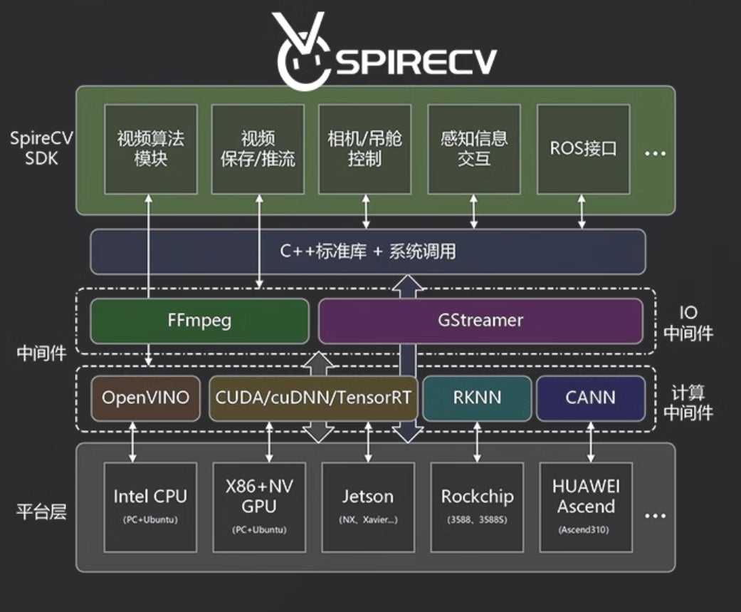
The SpireCV vision library is a specialized SDK designed for intelligent vision systems. Its primary features include drone/camera control, video storage, pushing, target tracking, recognition, and tracking. It provides developers of intelligent drone systems with high efficiency, precision, and seamless interfaces.
This model specifically supports YOLO-based point tracking and obstacle avoidance functionalities.
Prometheus Ground Station System
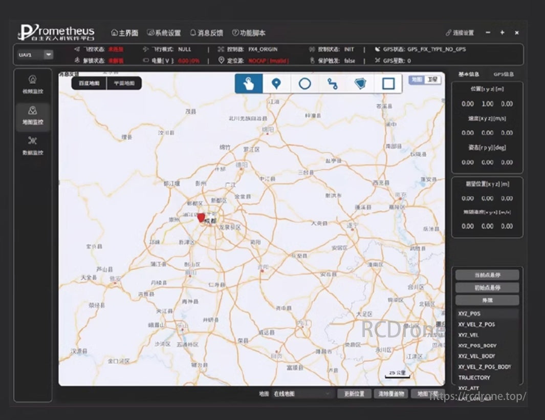
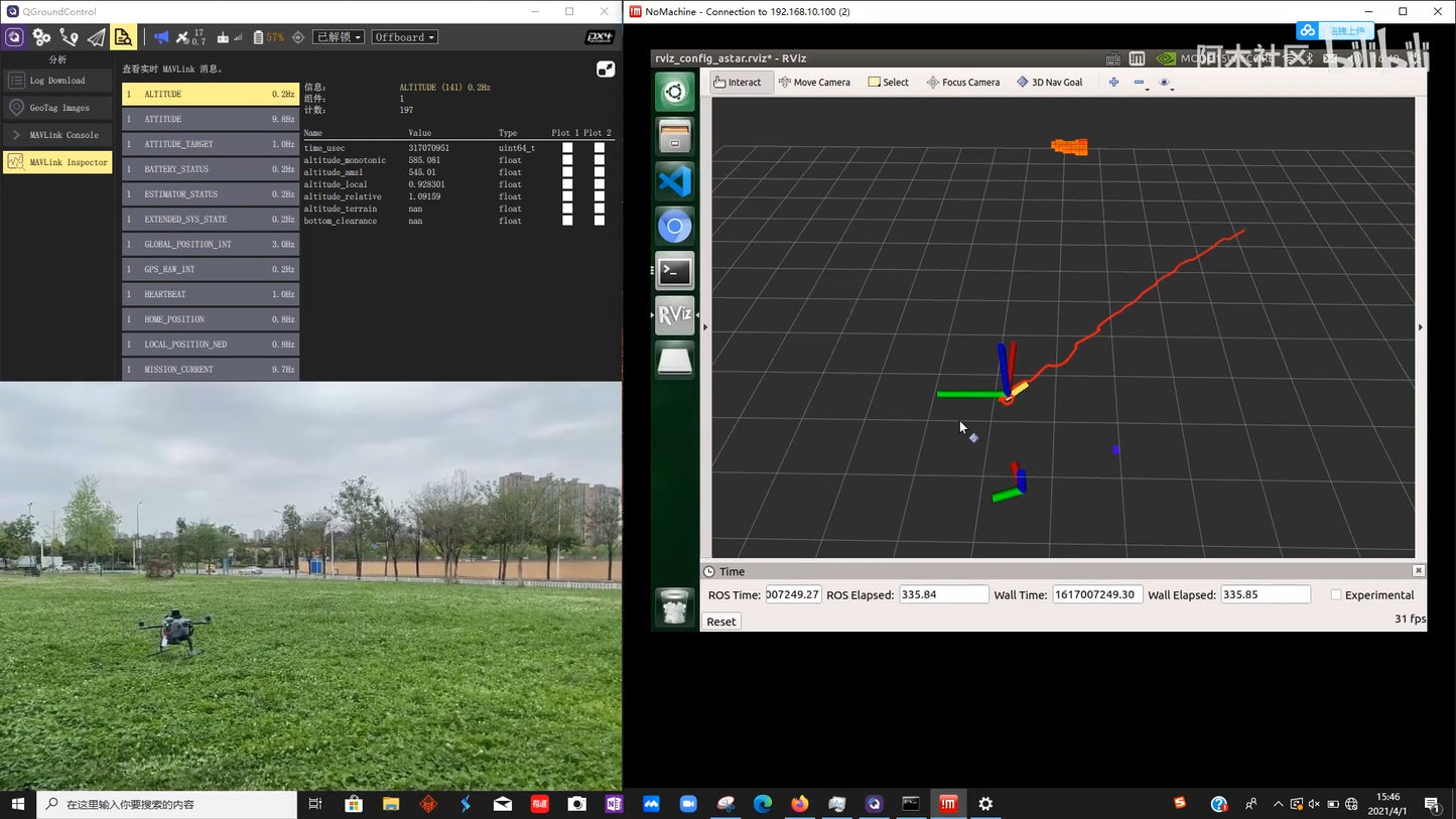
The Prometheus ground station is an interactive interface for drones, developed using Qt and based on the Prometheus system. The ground station uses TCP/UDP communication, avoiding the complex configurations of ROS1 multi-machine communication.
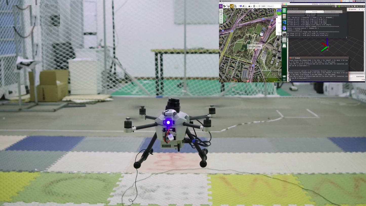
This ground station allows users to quickly replicate various functions of the Prometheus system, enabling real-time monitoring of drone status. It also supports operations such as one-click takeoff, landing, and position control.
Matlab Toolbox (Optional)
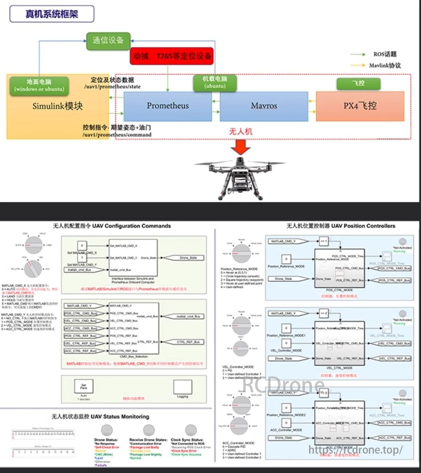
The Matlab toolbox is one of the submodules of the Prometheus project. This module provides multiple example programs for UAV control algorithms using Simulink. Through the Matlab ROS Toolbox, it establishes a communication link between Matlab (Simulink) and ROS.
It is mainly used for the design, testing, and secondary development of UAV control algorithms and swarm control algorithms, as well as controller designs. It supports secondary development using Matlab/Simulink programs and interfaces. It enables real-time simulation and experiments (without needing to download programs to the drone), offering abundant example algorithms.
Viobot Positioning Module
(Applicable to P450 Viobot models)
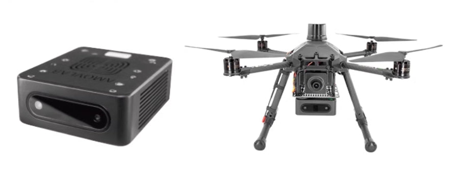
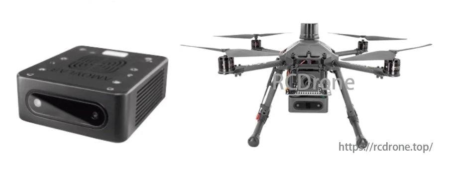
Viobot utilizes the domestic RK3588 chip from Rockchip, equipped with 6 TOPS of computing power and 70% residual performance. Viobot offers higher openness, allowing direct access to its IMU data to run custom SLAM algorithms. Its positioning performance is stable, sufficiently open, and can be considered a good domestic alternative to the T265, meeting the localization needs of customers.
Related Collections
Explore More Drones & Accessories
-

Camera Drone
Our Camera Drone Collection features a wide range of brands including FIMI,...
-
Drone Accessories
Discover a wide range of drone accessories to enhance flight performance, extend...


